[1] Fantasia Painter, Bordering the Nation: Land, Life, and Law at the US-Mexico Border and on O’odham Jeved (Land) (Berkeley, CA: PhD Diss., 2021).
[2] Brenda Norrell, “US Spy Tower Pact Targets Tohono O’odham Sacred Mountain and Spying on Traditional O’odham,” Censored News, September 7, 2015, https://bsnorrell.blogspot.com/search?q=Gu+Vo.
[3] See “Integrated Fixed Towers,” Elbit Systems of America website, https://www.nextgenborder.com/, accessed July 23, 2024.
[5] US Border Patrol, US Customs and Border Protection, US Department of Homeland Security, Draft Environmental Assessment for the Integrated Fixed Towers on the Tohono O’odham Nation in the Ajo and Casa Grande Stations’ Area of Responsibility (March 2016), https://www.cbp.gov/sites/default/files/assets/documents/2016-Apr/IFT%20DRAFT%20EA%20FINAL%2003%2018%20PART%20I.pdf. Ultimately the number of IFTs built was ten, which we will discuss later in the book.
[6] In 1994 Operation Gatekeeper ushered in the “prevention through deterrence strategy” by increasing Border Patrol agents, border checkpoints, and immigrant detentions. By increasing apprehensions in urban areas, it sought to direct migrants to undeveloped landscapes understood as dangerous, primarily the Sonoran Desert. See Joseph Nevins, Operation Gatekeeper: The Rise of the “Illegal Alien” and the Remaking of the US–Mexico Boundary (New York: Routledge, 2001).
[7] Papago was a Spanish word given by Spanish missionaries for the Tohono O’odham. In 1986 the Papago Tribe ratified a new constitution as the Tohono O’odham Nation. Tohono O’odham Tribal Constitution, March 6, 1986. For more on the history of the Tohono O’odham borderlands and the creation of the US-Mexico border, see Painter, Bordering the Nation; Geraldo L. Cadava, “Borderlands of Modernity and Abandonment: The Lines within Ambos Nogales and the Tohono O’odham Nation,” Journal of American History 98, no. 2 (September 2011): 362–383; Jeffrey Schulze, Are We Not Foreigners Here? Indigenous Nationalism in the US-Mexico Borderlands (Chapel Hill: University of North Carolina Press, 2018); Andrae Marak and Laura Tuennerman, At the Border of Empires: Tohono O’odham, Gender, and Assimilation, 1880–1934 (Tucson: University of Arizona Press, 2016); Erik Meeks, Border Citizens: The Making of Indians, Mexicans, and Anglos in Arizona (Austin, TX: University of Texas Press, 2007 [2020]).
[8] Geraldo Cadava describes how the first fencing on the Sells Reservation was to keep cattle from crossing to Mexico and to keep out Mexican revolutionaries. As Ophelia recalls, O’odham did in fact aid Pancho Villa. See Cadava, “Borderlands of Modernity and Abandonment,” 366.
[9] Joseph Nevins, Operation Gatekeeper: The Rise of the “Illegal Alien” and the Remaking of the US–Mexico Boundary (New York: Routledge, 2001).
[10] On the colonial mindset of deserts as empty landscapes, see Samia Henni, ed., Deserts Are Not Empty (New York: Columbia University Press, 2022).
[14] US Border Patrol, US Customs and Border Protection, Department of Homeland Security, Final Environmental Assessment for the Integrated Fixed Towers on the Tohono O’odham Nation, 11.
[18] This is a rough estimate based on statistics of agents employed in the CBP Tucson sector, their distribution across stations within the sector, and the on-reservation population of the Tohono O’odham Nation made in 2023.
[19] In 2012 Amnesty International published a report on human rights violations caused by immigration enforcement in the Southwest, including a section on the rights of Indigenous peoples. It documents abuses, including abuses to O’odham, such as tribal members being harassed and even deported to Mexico at the border. See Amnesty International, In Hostile Terrain: Human Rights Violations in Immigration Enforcement in the US Southwest (New York: Amnesty International, 2012).
[22] J. Kēhaulani Kauanui, “‘A Structure, Not an Event’: Settler Colonialism and Enduring Indigeneity,” Lateral 5, no. 1 (2016).
[23] Audra Simpson, Mohawk Interruptus: Political Life Across Settler States (Durham, NC: Duke University Press, 2016), 11. Italics in the original.
[24] Molly Hennessy-Fiske, “Arizona Tribe Refuses Trump’s Wall, but Agrees to Let Border Patrol Build Virtual Barrier,” Los Angeles Times, May 9, 2019.
Borderlands: Indigenous Cartographies of a Militarized Land
Ophelia Rivas, Caitlin Blanchfield, and Nina Kolowratnik
Who We Are and What Significant Impact Is
The broad slope and rounded crest of O’ks Tak’am Do’ak outline the profile of a woman sitting and facing the west. Her name is O’ks Ta’kam. She is part the O’odham origin story, passed down through oral history. She sits there vigilant, a warrior protecting, and will warn the people when a catastrophic event will occur. When this event comes, she will stand and gather the smallest creatures in her skirt to protect them.
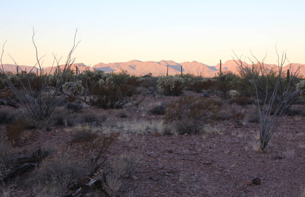
The mountain forms part of the Tak’Va’Vak range which cuts through Tohono O’odham land, joining peaks like Han’a-mek and Ma’mke-mad. These mountains are known as a place to gather sweet fruits from the chu-chues (organ pipe cactus). They are home to caves, springs, and seasonal water holes. Each year ceremonies and hunts take place all across the Tak’Va’Vak, and trails lead through the mountain passes, connecting the springs at A’al Va’pai (Quitobaqito) to O’odham villages in Sonora, and leading all the way to the salty Ge-Ka-ch’k (Sea of Cortez). The mountains hold deer, mountain rams, javalina. They hold burial places. Medicines grow there. In the evening they are especially beautiful, bathed in crimson.
The Tak’Va’Vak range also forms one border of the Tohono O’odham Nation. The boundary runs along the ridge line and separates the reservation from the Organ Pipe Cactus National Monument, a United States national park to the west. The border with the National Monument is one of three that divide Tohono O’odham Nation from the United States; the reservation’s southern border is with Mexico. It is this border that dominates the others—both in its real effects and in media representations—and with good reason, especially in the last decades, and acutely in the present moment. It separates the Tohono O’odham in Sonora from those in Arizona, dividing the people; and its securitization has brought violence and destruction to O’odham lands on both sides in different ways. Yet these two borders—one between nation states and one between reservation and national park—work together: they are part of the same process of colonialism and dispossession that have been constricting O’odham life for hundreds of years. The construction of the US-Mexico border is intertwined with the expropriation of Indigenous land and the subsequent creation of Native American reservations as much as it is with United States expansionism and policies of exclusion. More than that, the US-Mexico border, and the many weapons, technologies of surveillance, and Border Patrol officers that comprise it, is an extension of the United States’ ongoing, violent, and racialized campaign to contain and assimilate Indigenous peoples—it is a settler colonial border. But as Salt River Pima-Maricopa scholar Fantasia Painter reminds us, the borderlands are not yet settled, and they are unsettled: this is because of the refusal of Tohono O’odham and other Indigenous peoples to see and accept their lands as not their own.¹
In opposition to a proposal from the United States Department of Homeland Security and United States Customs and Border Protection (CBP) to build Integrated Fixed Surveillance Towers (IFTs) on their lands, the Tohono O’odham Nation’s Gu Vo District issued a statement, one that tied their political rights as Indigenous peoples and as communities to the protection of their mountains:
The Gu-Vo District opposes these proposed tower sites to protect cultural sites on the holy mountain now called the Ajo Mountain Range [Tak’Va’Vak]. The Mountain holds human remains of our people and also places our cultural practices (medicine bundles) and is home of the ceremonial deer and bighorn sheep and mountain tortoises that are protected under the endangered species act … The Gu-Vo District communities’ landscape have already been greatly impacted by numerous unauthorized roads and destruction of our mountains and hills of great significance to the O’odham way of life. Our future generations will face more restriction to live on our original lands as our rights as original Indigenous peoples continue to deteriorate. These US proposed towers are not on the border but in our communities and on the border of the Tohono O’odham Nation, reiterating discrimination and deliberate attack on the O’odham.²
Ten of these towers were ultimately built, and the sentiment behind the Gu Vo District statement in many ways motivates this book. Significant Impact argues against the construction of the IFTs and related border infrastructure and for the protection of O’odham je’ved (land). The book assesses the impact that border technologies and infrastructures are having on Tohono O’odham people and on the Tohono O’odham Nation from the perspective of O’odham je’ved. It does this by mapping and documenting the effects of the IFT system—the most recent border infrastructure to be installed on the Tohono O’odham Nation—on O’odham communities, daily lives, ceremonies and ceremonial cycles, animals, plants, and him’dag (way of life). And while this book shows in precise detail the footprint of these towers, the surveillance equipment that they are made of, and their reach across the landscape, it also presents them as connected to a long history of border militarization in the United States and to the ever-thickening, networked border condition that extends far beyond the international boundary line. In thoroughly examining how these towers, and the systems they are connected to, disrupt a rich and interconnected Tohono O’odham relationship with the landscape, the seasons, ceremonies, and history, this book offers a view of O’odham je’ved that is much more powerful than the colonial ideas of an empty, dangerous desert that needs to be controlled. This is a relationship with the land that O’odham have cultivated for thousands of years and that will outlast any border wall or tower.
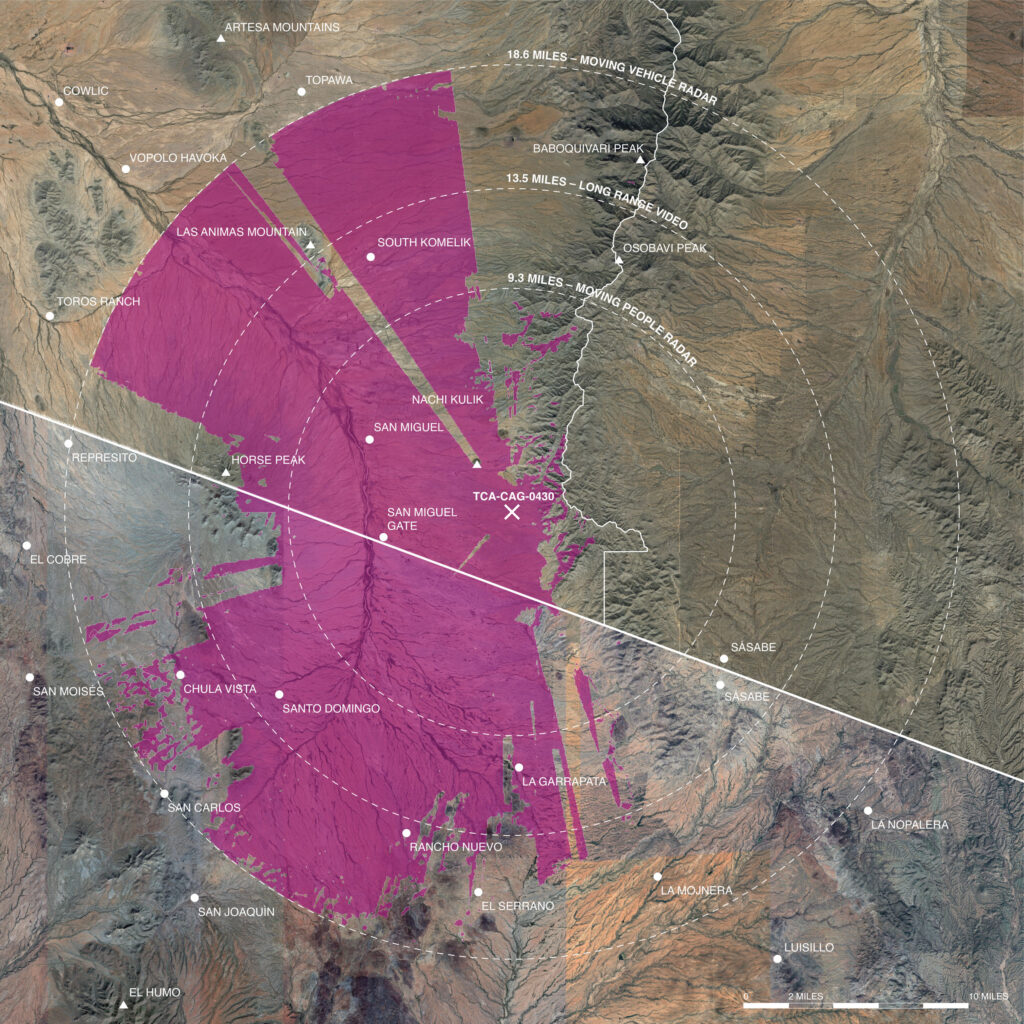
Map showing surveillance equipment radii and reach of TCA-CAG-0430 in Chutkut Kuk District, the first IFT erected on the Tohono O’odham Nation. Surveillance equipment represented in the map: radio-frequency radars for tracking moving people (9.3 mile radius) and moving vehicles (18.6 mile radius) as well as long-range video cameras (13.5 mile radius). The 40-mile radius of the microwave communication receivers exceeds the boundaries of this map and is not shown. While type of surveillance equipment to be installed and surveillance equipment companies to be contracted or subcontracted have been made public, the exact equipment models to be used have not. The map was drawn based on the most advanced surveillance equipment available in 2017 from companies expected to be contracted or subcontracted as stated in the environmental assessment.
Significant Impact is a collaboration between Caitlin Blanchfield, Nina Kolowratnik, and Ophelia Rivas. Caitlin is a historian of landscape and the built environment from Coast Miwok lands in California. Her research and writing examines how architecture and planning are used as tools of settler colonialism, and how Indigenous and environmental resistance movements work through landscape and building practices. Nina Kolowratnik is a human rights scholar and architect from Austria, Europe, whose research looks at the representation, acceptance, and agency of Indigenous truths in Western legal proceedings. Ophelia Rivas is a Tohono O’odham Tribal Elder and activist. Ophelia, born in her mother’s village and with her father’s village just miles away on the southern O’odham lands adjacent to the US-Mexico international border, is a grandmother and original O’odham seed gardener. Ophelia became an O’odham human rights educator and defender to protect the people and the land.
This book is the result of nearly ten years of working together to document the effects of and to advocate against the IFTs on the Tohono O’odham Nation, and builds on Ophelia’s decades of activism against border militarization on O’odham lands. As an opening to our work, this chapter situates the IFT project within a longer history and networked geography of intertwined border militarization and settler colonial violence on O’odham je’ved. It points to the ways in which environmental review processes, such as those conducted prior to approving the IFTs, have been used to enable development and how they reproduce colonial power relations and definitions of environment. Contestation, as the title of this book identifies, means contesting not only the result of environmental review, but how it is done, and the very premise of environmental protection behind it. We find these contestations in the insistence of Tohono O’odham to care for their land and people in spite of the border and its destructive impacts, and in preparing for a future when border infrastructure comes down.
Borders and Land
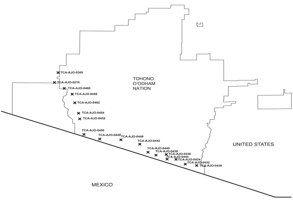
In March 2014, CBP awarded Elbit Systems of America a contract to design, construct, and deploy IFTs in a string of unspecified sites along the southwestern border of the United States. Elbit’s responsibilities extended beyond construction to include on-the-ground testing of continuous monitoring, ensuring customer satisfaction with their product’s ability “to detect, track, identify, and classify movement on the border.”³ While the location and number of such sites remained obscure, the objective of the towers was made clear: they were to be integral nodes in an increasingly fortified system of border surveillance. This was militarized infrastructure, configured to give CBP command over the mountainous terrain of the Sonoran Desert and designed to control the populations that lived in and moved through it. The environmental assessment for the IFTs stated this directly: the project was meant to increase “long-range, persistent” surveillance, as well as interdiction, and to enhance the deployment of resources, such as officers, vehicles, and drones, to the region.⁴ When the draft environmental assessment, conducted to determine the impact the towers would have on the surrounding cultural and biological landscape, was published in 2016 it also revealed the location of the proposed towers: ten running the span of the Tohono O’odham Nation’s border with Mexico in the Chukut Kuk and Gu Vo districts; and five in Gu Vo District, along its western border with the Organ Pipe Cactus National Monument and linking to existing towers in the National Monument and at the USBP Ajo Station.⁵ The towers reinforced borders on two sides of the Tohono O’odham Nation and took advantage of policies that had seen O’odham lands as inhospitable and dangerous, and then funneled migrants through them.⁶
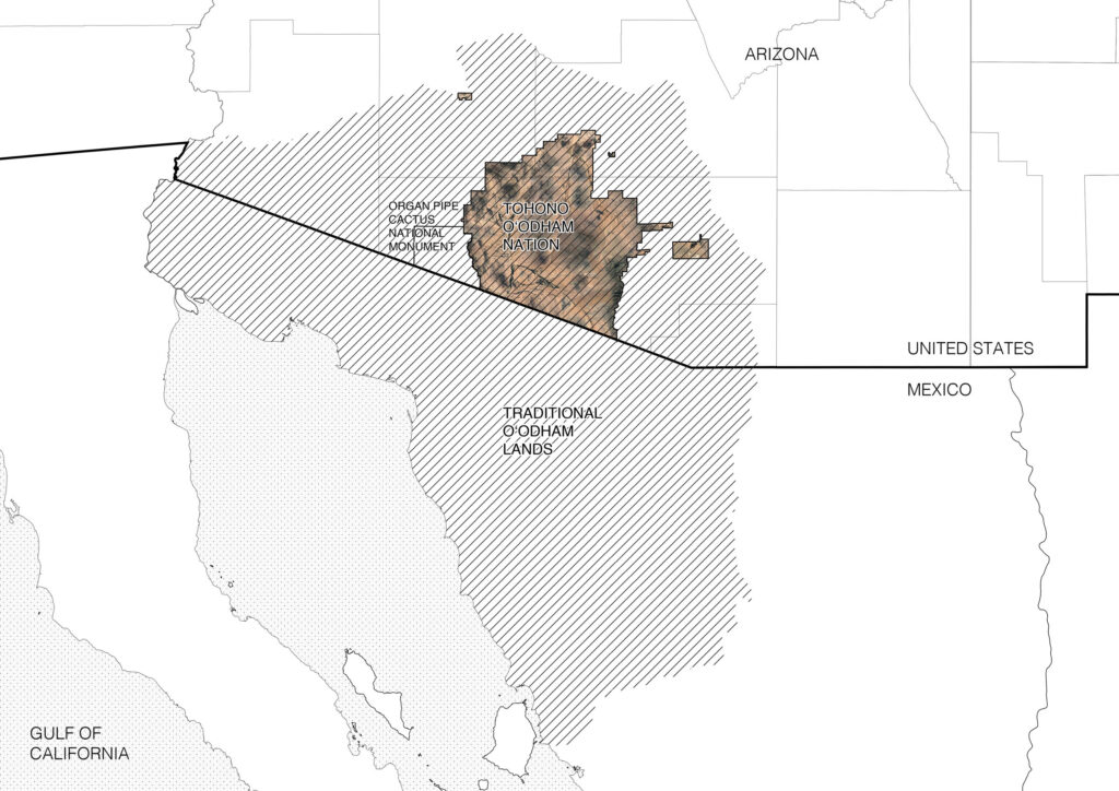
Map of the proposed fifteen IFTs on the Tohono O’odham Nation, and two in the Organ Pipe Cactus National Monument. Map of O’odham lands and current boundaries of the Tohono O’odham Nation.
Tohono O’odham je’ved extends from the San Pedro River in the east to Bech’um (Hermosillo) in the south to Akimel O’odham territory (Gila River) in the north to Ge-Ka-ch’k (Sea of Cortez) in the west. The Tohono O’odham Nation today is a fraction of that ancestral territory. From the late seventeenth century this region was occupied by Jesuit missionaries, who called it part of New Spain. After Mexican independence from Spain in 1821 these lands became Sonora, Mexico. The Gadsden Purchase of 1854 annexed 30,000 miles of Sonora to the United States—including O’odham territory; in the decades following, the US government established two O’odham reservations in San Xavier and Gila Bend, signaling the start of US government interest in developing O’odham land for transcontinental infrastructure and permanently settling O’odham families that moved across the now-borderlands into confined communities. The Dawes Act was passed in 1887, which allowed the federal government to break up land on reservations held in common and divvy it into individual parcels (allotments) granted to tribal members listed on official rolls. Remaining lands were open to settlers. While this did not happen on all reservations, Tohono O’odham lands in San Xavier were opened to allotment in 1888. In 1916, in response to O’odham outcry at the ranchers and prospectors increasingly taking their lands, the government created the Sells Reservation, now called the Tohono O’odham Nation, formally the Papago Tribe, and built the first US-Mexico border fence on it.⁷
The anxiety behind the border fence stemmed from political upheavals in Mexico, exemplified in Pancho Villa’s threats of cross border raids.⁸ But implicit was the need to imprint American identity onto people who did not see themselves as such, enforce the international boundary onto a nation whose lands exceeded it, and bring O’odham into the capitalist economy of a growing Tucson and surrounding region. This is a short history of the beginnings of federal incursions onto O’odham je’ved in the name of defining and securing national property. Though the internal affairs of the Tohono O’odham Nation are governed by a tribal legislative council, title to Native American reservation land is held in trust by the federal government, making it easy for the state to claim eminent domain and expropriate land for federal projects, or waive certain laws that apply to public and trust lands, as has been done extensively to build the border. Sketching this brief timeline of bordering on O’odham je’ved shows how “the border” has been drawn along different coordinates at different times by different colonial governments and how that bordering has been experienced, from unimportant to a force that separates people and disrupts their way of life.
Traversing the desert was, and is, an integral part of O’odham time-keeping, connected to harvesting and hunting and to religious ceremonies. Mountains, valleys, and washes are known deeply, and the stories attached to them tell O’odham history; walking and running to sacred sites are spiritual acts and territorial practices; migration patterns determine hunting cycles. This unbounded mobility did not seem, in the eyes of the colonial government, aligned with the forms of settled farming and private property on which the United States is based. Historically and today, federal agencies like CBP and Border Patrol have viewed the desert as a hot, inhospitable expanse—a natural barrier too harsh and depopulated for many migrants to travel. From the 1990s onward, the Department of Homeland Security’s Operation Gatekeeper used the perceived unknowability and danger of this terrain to funnel border crossing towards urban areas, or toward the eastern segment of the Rio Grande where surveillance infrastructure was more robust.⁹ The topography and climate of mountainous desert was used to channel the flows of migrants. Yet, as fears of drug trafficking increased during the Obama administration, and anti-immigrant rhetoric accelerated to fever pitch under Trump, the Sonoran Desert transformed from an “empty” terrain of deterrence into one of apprehension and fortification with an accompanied increase in migrants, cartel violence, and Border Patrol violence. The same colonial mentality that caused government agencies and officials to see the Sonoran Desert as empty, unproductive, and difficult to live in shaped policies that pushed migrants there. This mentality also makes law enforcement agencies ignorant to the ways this vital landscape is impacted by their construction equipment, their trailers, their trucks, their surveillance towers, and their very presence.¹⁰
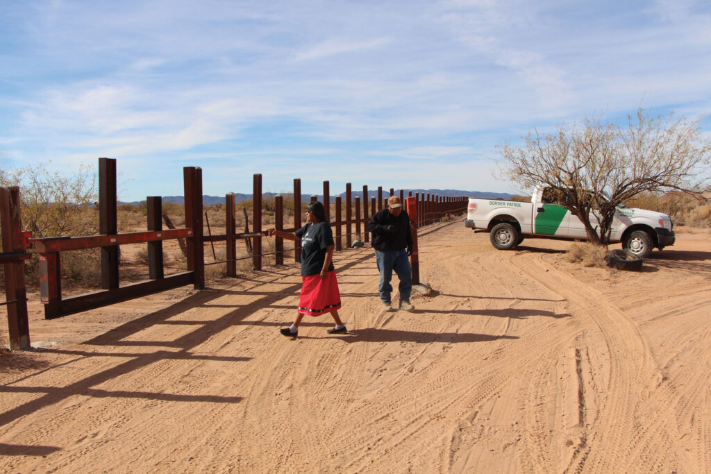
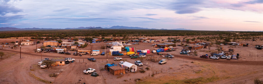
Border gate to Cu:Wi I-Gesk in 2016.
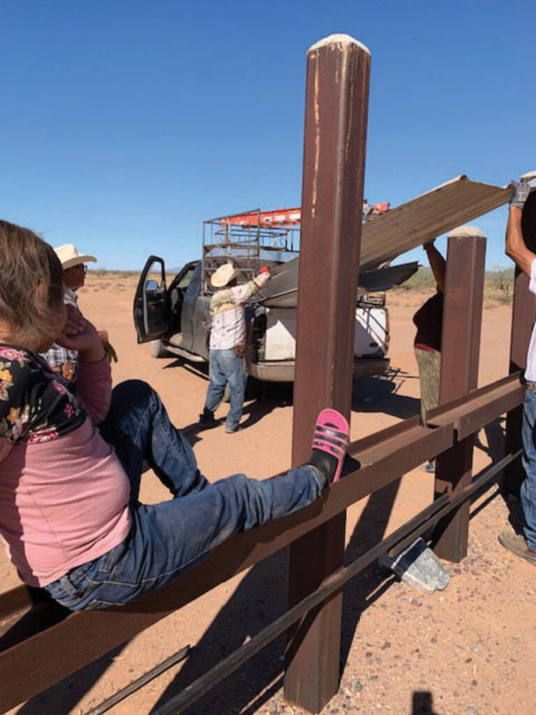
With the Patriot Act in 2001, crossing the US-Mexico border along the Tohono O’odham Nation was restricted to three “tribal gates.” Under the Bush administration CBP closed the gates and installed a vehicle barrier along the border. These are routes to communities and ceremonial places used from ancient times until present day, and were put under the control of Border Patrol. Now they are inaccessible: the gate to ceremony and to the communities in Mexico is closed and padlocked. In Woo’san (San Miguel), south of the capital Sells, a simple dirt road through the ha’shan (saguaro cactus) and creosote now is also gated by the land owner on the Mexican side, making it essentially impossible to travel through with a vehicle.¹¹ The area is heavily used by drug cartels, also funneled there by border policies in urban regions. Their presence has displaced many O’odham living in Mexico. A CBP law enforcement center was built down the road, and ground sensors summon siren-flashing Border Patrol trucks when anyone approaches. At these gates, checkpoints are managed by Border Patrol and sufficient documentation, such as a passport or tribal ID, which many O’odham in Mexico do not have, is needed to cross. The transformation of tribal routes into checkpoints turned regular pathways through O’odham territory into sites of encounter with law enforcement, where CBP has to be notified ahead of time to come check documents of O’odham tribal members. This not only adds layers of federal bureaucracy to routine movement, but also discourages the act of border crossing and criminalizes it for those who do not conform to the new laws. O’odham in Mexico are often unaware of these laws and can end up being apprehended, deported, and told they may no longer cross into their lands within what is now the United States. The results are not only devastating for family members and for people who maintain homes on both sides of the border—they have also cut off O’odham in Mexico from essential services and grocery stores.¹² After 9/11 and throughout the presidency of George Bush, border fortification and the rhetoric of border securitization increased dramatically, with consequences for the daily life of O’odham in the US and in Mexico. This securitization has not lessened and has seen renewed intensity under both administrations of President Donald Trump and President Joe Biden. Crossing the border has gotten only more difficult for tribal members, with crossings sometimes closed and already far distances turned into a full day’s journey to get to villages only tens of miles away.¹³ Border infrastructure criminalizes Indigenous land use and rights to movement for residents on both sides of the international boundary and connects remote places to an ever-expanding system of command and control.
Delivering materials to Cu:Wi I-Gesk over the border fence.
Ophelia After 9/11, I had an old minivan. As soon as I would drive out of the fence [around my home] and get on the road, they’d follow me to an isolated area and pull me over and look in my car and ask me where I was going. And if I took people with me they would ask them for their tribal IDs. It was every single time I moved the vehicle. It was constant. Not just me, everyone in the village. At that time they would just come into your house. This fear, it was a military fear tactic that they used on us—and it’s long lasting for the people.
In 2011, the Department of Homeland Security implemented the Arizona Border Technology Plan, which planned for the deployment of tower-mounted radar, cameras, and communication equipment—both mobile and fixed—as well as ground sensors along the US-Mexican border in Arizona to assist Border Patrol with monitoring and apprehension. In 2014, the Southwest Border Technology Plan expanded the intensification of border surveillance to the rest of the southwest border. These border technology plans exacerbated the constricted mobility already in place as the result of border checkpoints and stops. IFTs and the equipment they carry constitute a more pervasive form of monitoring and control—what CBP refers to as “persistent surveillance.”¹⁴ The towers reinforce the restrictions on mobility and access already established by checkpoints and the vehicle barrier, they widen the border’s reach. The United Nations Declaration of the Rights of Indigenous Peoples (UNDRIP) states that Indigenous peoples have the right to self-determination, and by virtue of that right they are free to determine their political status and free to pursue their economic, social, and cultural development. UNDRIP also enshrines Indigenous peoples’ right to practice traditions and customs and to access cultural sites in privacy. By preventing O’odham from crossing the border and heavily surveilling the entirety of the Tohono O’odham Nation as well as lands in Mexico, the US government is violating the rights of O’odham who live on both sides of the border.¹⁵
It’s no coincidence that the proposed construction of towers coincides with the addition of detention facilities for people apprehended crossing the border. It also requires little stretch of the imagination to understand that the infrastructure apparently needed to support the construction and maintenance of towers (the truck paths latticing the desert, the movement of Border Patrol officers to nearby stations, the tracts of housing and trailers of mobile offices) are also quite useful in the pursuit of what the environmental assessment terms “items of interest”—be they local residents, US citizens, or migrants entering the country legally or illegally. They are also part of a sustained harassment of the permanent population in the borderlands, facilitated through the establishment of the 100-mile border zone, adopted by the US Department of Justice in 1953. While the Fourth Amendment of the US Constitution protects Americans from random and arbitrary stops, it does not fully apply to the 100-mile zone, where regulations allow for border agents to conduct what courts have called a “routine search without a warrant or even suspicion.”¹⁶
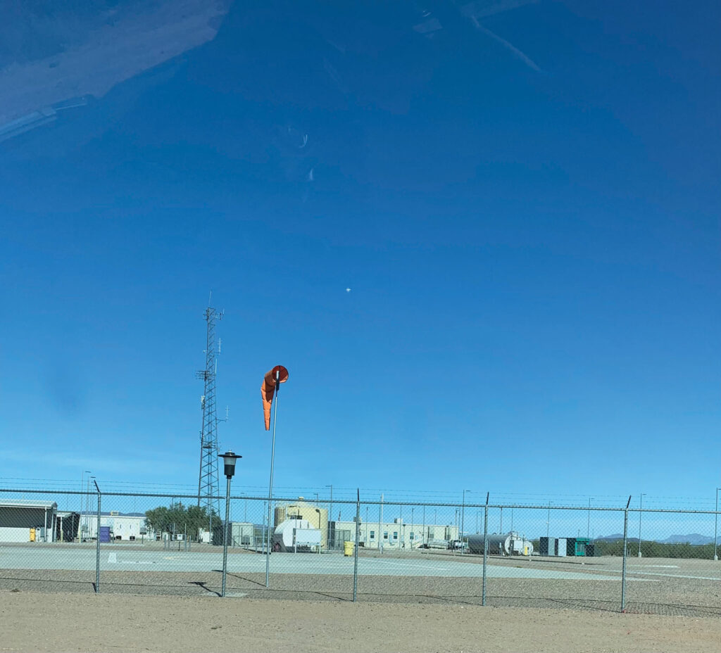
CBP sub station near Cu:Wi I-gesk gate, Chukut Kuk District, Tohono O’odham Nation.
Harassment on the Tohono O’odham Nation is exercised at increasing scales, sometimes erupting into lethal violence. In addition to the CBP-regulated gates on the border itself, officers at checkpoints at the reservation’s borders with Arizona stop O’odham systematically. CBP pull people over at random who are driving on the reservation, raid their homes to see if they are suspected of helping migrants, and even draw guns on children running outside. They have also on multiple occasions run over community members with patrol vehicles.¹⁷ With something close to one CBP agent employed in the area for every ten tribal members living on the Tohono O’odham Nation, the land feels occupied, saturated with CBP agents and equipment.¹⁸ Both land and people are treated with hostility. This “persistent surveillance” and its pattern of harassment creates an infrastructure of state violence in which border militarization and policing of Indigenous populations reinforce one another. Harassment comes from criminalizing help: anyone who aids a migrant trying to make their way through the desert is breaking the law. This overrides O’odham sovereignty, as US law supersedes policies that would be decided by the Tohono O’odham Legislative Council when it comes to non-O’odham, and it interferes with the ability of tribal members to treat those passing through the Tohono O’odham Nation humanely, in accordance with their beliefs.
Nina Were there many instances in which O’odham people practicing traditional harvesting were mistaken by CBP for migrants crossing from the south?
Ophelia The lady that lives over here, they don’t have a vehicle so they walked over to harvest on that side [of Ali Jegk village]. The Border Patrol followed them and watched them the whole time, sitting on the top of their truck, and then followed them coming back and right when they were about to enter the gate to their house they stopped them and asked for their tribal ID. And this lady that lives next door, she and her partner, they have a little truck, and they were on the other side of the mountain harvesting saguaro fruit and the Border Patrol would stop them and ask if they have tribal ID. And the partner, he’s Hopi and Tewa, I think, and they would ask him for his tribal ID and interrogate him: “This is O’odham land, what are you doing here?” And it’s not one story there are lots of stories. In Pisinemo District, which is next door, when they were doing their ceremonial hunt, the Border Patrol surrounded them and made them sit and tied their hands behind their back and took their weapons. They made them sit there until someone came and determined they were doing a ceremony hunt. And that affects everyone. It affects the hunters, it affects the women who are praying for them and praying for the deer and that everything will go well. It disturbs everything. For six years we didn’t get a deer because the Border Patrol was disrupting them… We are criminalized for having brown skin and dark hair when we never regarded any human as being illegal. The people crossing the O’odham lands were always treated as human and not as trespassers.¹⁹
When O’odham have called Border Patrol for help, it has ended in lethal violence. Raymond Mattia and his family have lived in Ali Jegk for generations. Ray was a ceremony person, a hunter, and a much respected figure in the community. He also accompanied us on one of our research trips to find the IFT locations. On the night of May 18, 2023 he called Border Patrol after strangers passing through the village had come to his house demanding to use his phone. Assisting Tohono O’odham police in investigating a different report from that night, nearby Border Patrol agents saw Ray standing outside his home (presumably thinking they were responding to his call). They treated him with hostility and aggression, demanding he drop what he was holding and remove his hands from his pockets; as he did so, three Border Patrol agents shot and killed him.²⁰ He was unarmed and had called for help. Prior to his murder he had been harassed by a non-O’odham officer in the Tohono O’odham Police Department who was there that night. The Department of Justice refused to prosecute the agents who killed Ray, even though his death was ruled a homicide, leaving his family to continue to fight for justice and for information about what happened. There is no justice for them under US law. This follows a pattern—the DOJ regularly fails to prosecute CBP agents for deadly use-of-force, and the US Border Patrol’s Tucson sector has the highest rate of use-of-force in the country.²¹ This violence has widespread impact that reverberates for generations: residents of Ali Jegk are now even more fearful of going out in their community, and the loss of a ceremonial person and hunter means the loss of traditional knowledge that is already threatened. IFTs are part of a system of border militarization that brings death and destruction to O’odham land.
Walls
This book rejects the “finding of no significant impact.” It rejects the process of environmental review that gave a green light to the construction of massive surveillance towers across O’odham je’ved, despite strong voices of community members and tribal government in the Gu Vo District speaking against them. We offer, instead, a counterenvironmental assessment focusing on the “Cultural, Historical, and Archeological Resources” impacted by IFTs. An environmental assessment’s “finding of no significant impact” means that no further review needs to be done, and therefore no environmental impact statement made. We disagree. Our counter assessment documents the impacts that CBP’s assessment did not, but more than that it offers a model for another way of conducting environmental review: one that is collaborative, that respects and foregrounds Indigenous knowledge and relationship with land, and one that prioritizes protection of land, plants, animals, and people over development. It does this by addressing the format of the environmental assessment, instead using oral history, interviews, testimony, and narrative cartography. At the same time, we acknowledge the limitations of the environmental review process, who it has served, and whose voices it has valued. What’s needed is not improvements to the system but instead a reimagining and evaluation of how to understand environment, how to protect the land, and who should be making decisions about how built projects impact Indigenous lands.
Cu:Wi I-gesk during a community celebration, photograph by Jason Jaacks.
The impacts of surveillance infrastructure are far reaching when considered through an O’odham understanding of the land and its meaning. Unlike the Western scientific framework of environmental assessment, which separates human life from plants, animals, and cultural artifacts, from the O’odham perspective it is impossible to separate the cultural, ecological, and social effects of this infrastructure. Sacred sites, migration routes, seasonal cycles, genealogy, and sovereignty are interconnected.
Ophelia The European way of looking at things dilutes our way of thinking and what we treasure here as O’odham. It’s difficult to start separating our beliefs into categories and subcategories when our way of thinking is more what we call him’dag. And it’s everything here in O’odham land—it’s everything our Elder Brother defined as our lands and our homes. So it’s the mountains, it’s the plants, it’s the animals, it’s all the special places we hold, burial places, old ceremony places, old villages. We’re all connected to that.
Caitlin Do you think that with the Border Patrol, this been communicated to them and they don’t understand? Are there things you don’t want them to know about?
Ophelia I think that land has always been defined by Europeans as property so they have a different perspective on land, and from that perspective it’s very difficult to understand. And I’m saying that just from seeing the Border Patrol and how they react when we talk about our land and how we’re connected to it. It just seems to not make a difference to them that it’s of great concern to us. It’s very difficult for them to understand and therefore they just continue to disrespect all the things we’ve been telling them not to disturb, like our caves on the mountain. They removed pottery that has human remains or ceremony items, they removed them from the mountains. And it’s very disturbing to us, people who have continued to follow our way of life and live our ceremony life. It affects us, but it also affects people who don’t follow that tradition.
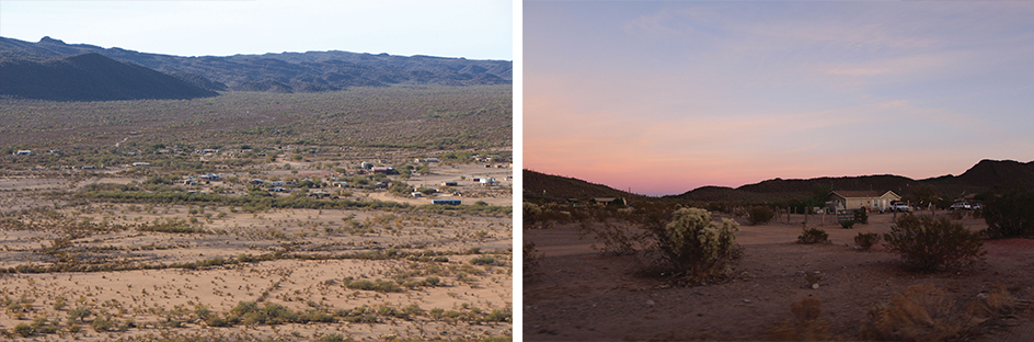
Left: Village of Ali Jegk from Vej’u-pan hill. Ali Jegk is impacted by IFT TCA-AJO-0450 and TCA-AJO-0448. Right: Ali Jegk community in Gu Vo District, impacted by IFT TCA-AJO-450 and towers in Organ Pipe Cactus National Monument.
Opposition to the IFTs refuses the imposition of federal control over Indigenous lands and an assertion of the right of Indigenous peoples to regulate movement within their lands on their own terms. It is also an indictment against the broader system in which the towers operate—a securitizing infrastructure that includes policing and surveillance already installed on the Nation (checkpoints, new roadways, increased officers on the ground, detention centers, sensors, and more) and that is connected to a long history of federal attempts to expropriate and exploit Indigenous land in this region.
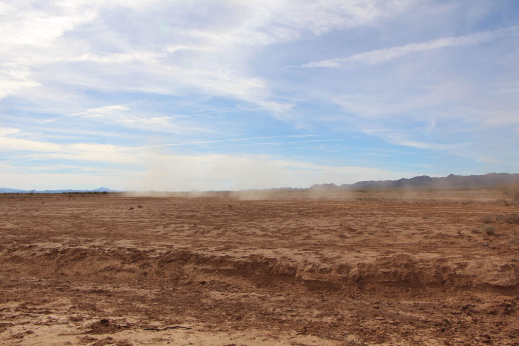
Impacts to the Shad’gum area include new roads and Border Patrol driving at high speeds.
Reflecting on anthropologist Patrick Wolfe’s well known definition of settler colonialism as a structure, not an event—as something that is ongoing because of systems like the border and its enforcement—Kanaka Maoli scholar J. Kēhaulani Kauanui describes “enduring indigeneity,” a term of dual implications: “that indigenous peoples exist, resist, and persist; and second, that settler colonialism is a structure that endures indigeneity, as it holds out against it.”²² It is this form of endurance that Tohono O’odham Elders, activists, and community members practice every day. And they can endure against the towers; these towers can be brought down. It is in the face of this double-sided endurance that Tohono O’odham Elders and activists have fought against and still oppose IFTs and the militarization of their lands more broadly. With these everyday forms of endurance in mind, we can also understand how their refusal to accept the terms by which the Department of Homeland Security defines ideas like “environment” and “impact” in relationship to land, living things, and culture is an act of sovereignty. “Refusal,” writes Mohawk anthropologist Audra Simpson, “comes with the requirement of having one’s political sovereignty acknowledged and upheld, and raises the question of legitimacy for those usually in the position of recognizing.”²³ Indigenous sovereignty challenges the authority of the military and administrative power of the United States. The ways of knowing and being with land—which is to say the cultural and political forms of land use—that the O’odham exercise regardless of the international boundary, confront Western, capitalist notions of property and nation. They unsettle the United States of America. It is these forms of interconnectivity that the Department of Homeland Security aims to undermine through technological, informational infrastructure.
Refusing these towers is complicated though. The Tohono O’odham Nation is dependent on the federal government for funding, which compromises their position of opposition. In 2019, when the Tohono O’odham Legislative Council approved ten of the proposed fifteen towers, sacred sites in the Organ Pipe Cactus National Monument were dynamited as Trump’s wall barreled through the park. Vice Chairman Verlon Jose, who had said the wall would be built over his dead body, told a reporter the towers were a compromise with DHS to prevent the wall.²⁴ Furthermore, CBP’s informational meetings provided little information, excluding precise locations and technologies used, instead alluding to enhanced connectivity and roadwork. Lack of information and suggestion of improvements exacerbated diverging opinions and divisions in the districts where the towers were to be built. However, the number of towers was ultimately reduced from fifteen to ten, with only two in Gu Vo, indicating that opposition does have a tangible effect. Continued opposition and vigilance is important not only to push back against militarization in the present, but to dismantle it in the future. For this reason it is important to document, to organize, and to imagine new ways to know and protect the environment. As Ophelia first wrote when United States Customs and Border Protection broke ground to build its border in her village of Ali Jegk, “When our world comes under attack the warriors only need a signal. They are there willing to stand firm. Here I stand.”²⁵
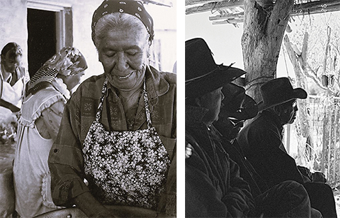
Elders of Cu:Wi I-gesk and Va’c.
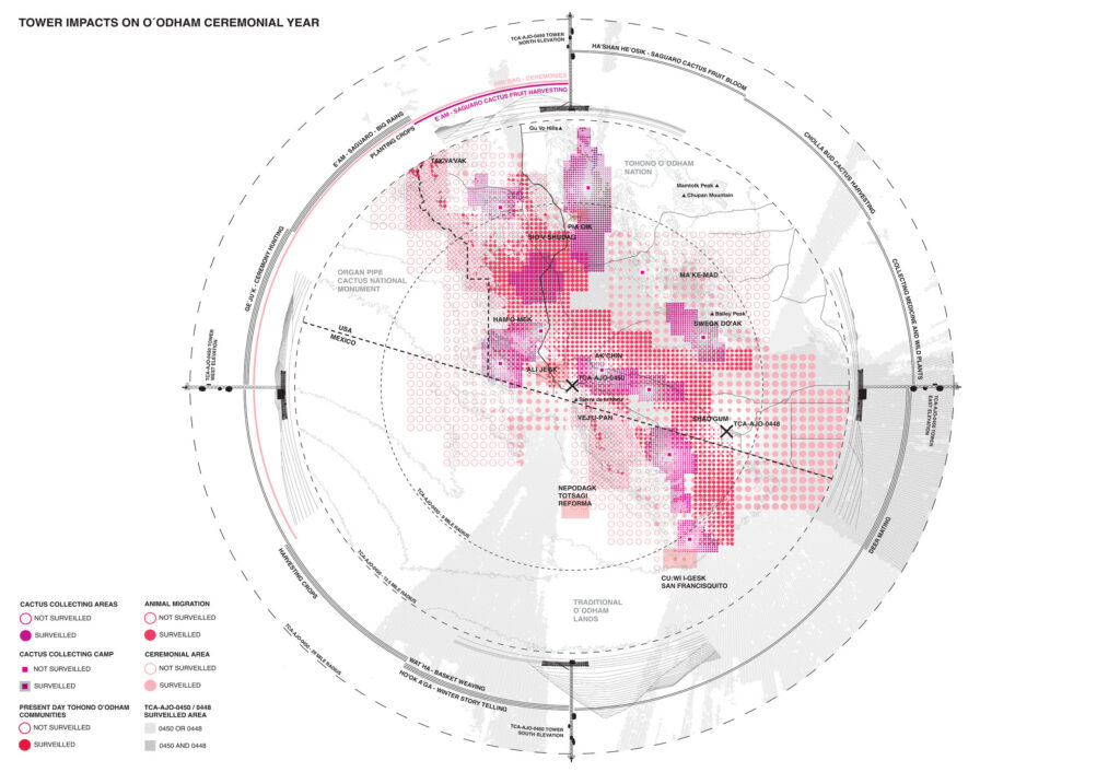
Integrated Fixed Tower Impacts on the O’odham Him’dag
This chapter presents a narrative cartography, created in close collaboration by the three authors, that shows the impact of the IFT surveillance towers on Tohono O’odham je’ved and the living beings it sustains. Focusing on the range of two towers near the community of Ali Jegk and the area for cultural events at Shad’gum, the drawing traces the precise surveillance imprint on the land—the zones continuously monitored by cameras, the intentional overlap of their ranges, and the visual presence of the towers as experienced by someone walking the terrain. Based on the Traditional Knowledge Ophelia shared during our work, the cartography also shows areas essential to community life and continuity—sites of ceremonial significance, animal migration routes, O’odham villages, and cactus harvesting grounds, as well as the camps used during family and community harvesting, described by Ophelia in the previous chapter. Each of these practices is interconnected through the O’odham year, represented in the drawing’s circular frame. Particular care was taken to respect the sensitivity of this knowledge: areas are shown with varying detail and circle sizes, balancing geographic precision with the need for discretion. The more sensitive an area, the larger the circle and the less distinct, more blurred its outlines, corresponding to greater cultural sensitivity and protection. In the drawing, color and filled circles signify surveillance: the more layers of traditional practices and surveillance that overlap, the more intense the colors become, visually indicating areas that are deeply significant to the O’odham and heavily monitored.
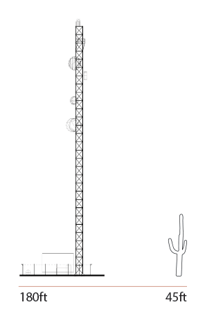
Comparison of scale between a surveillance tower and a cactus.
As part of the counter environmental assessment, this narrative cartography conveys the deep interconnectedness of animals, plants, mountains, the spiritual world, and people within the ecosystem safeguarded by the Tohono O’odham. It renders visible how surveillance infrastructures transform these places and practices in ways that textual description alone cannot capture—balancing the need to document impact with respect for cultural protocols, while also offering a visual space that contrasts surveillance data with Indigenous practices, relationships, and beings. By presenting them together on one plane, the drawing reveals both tensions and points of overlap, allowing outsiders to better grasp the complexities involved. By carefully bringing together technical data—such as surveillance radii and territorial boundaries—with Indigenous knowledge, practices, and stories, the cartography transforms into a storytelling device that challenges colonial assumptions embedded in conventional mapping. It offers instead a relational understanding of place, foregrounding O’odham ways and lived experience as a counterpoint to militarized perspectives on the border landscape.