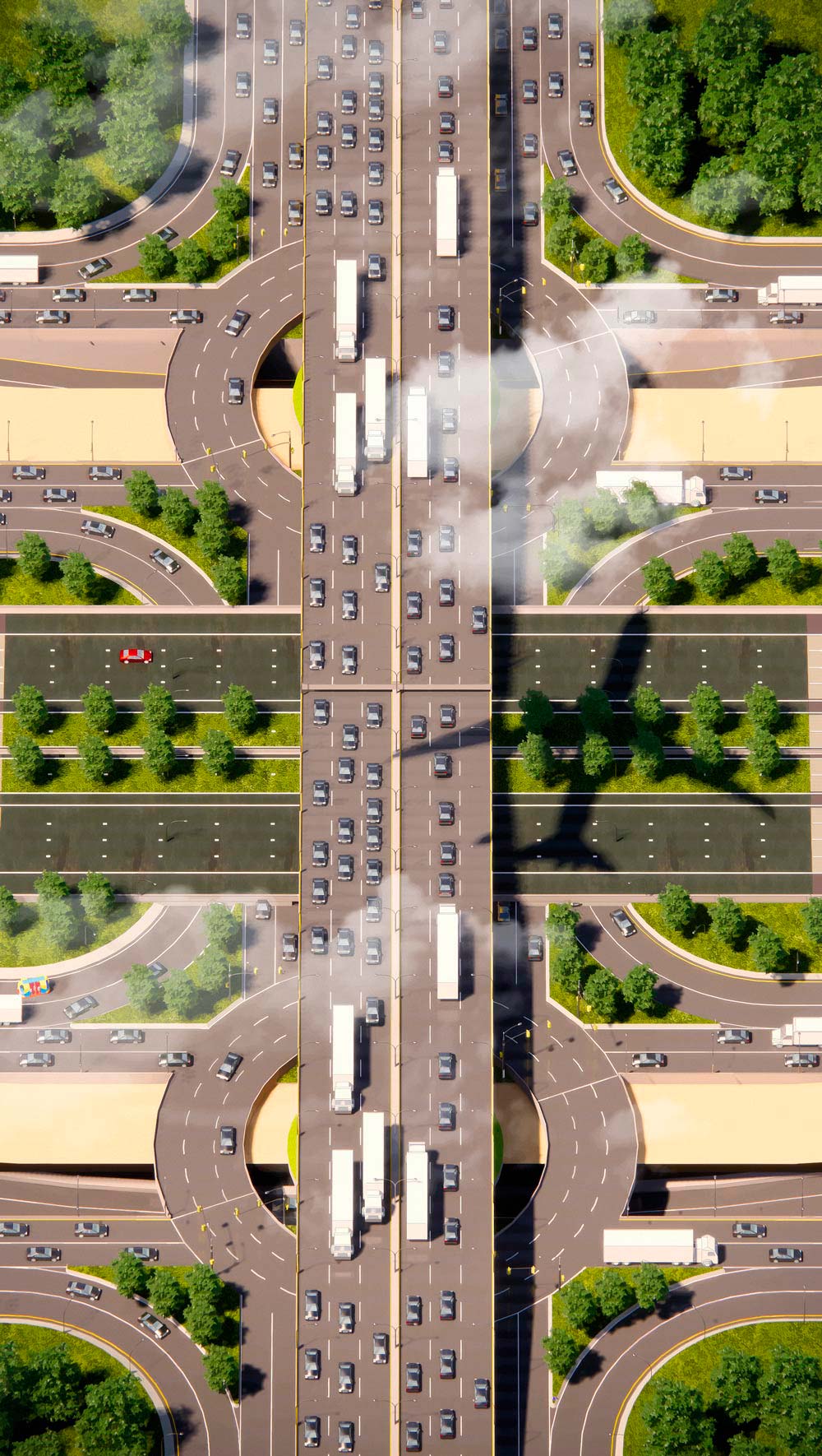
There might not be much “weather” to speak of in Los Angeles, but there is traffic. It’s the de facto small talk upon arrival at meetings or cocktail parties, comparing journeys through the proverbial storm. And in certain ways, traffic does resemble the daily expressions of climate. It follows diurnal and seasonal patterns; it shapes, and is shaped, by local conditions. There are unexpected downpours: accidents, parades, sports events, concerts. Once upon a time, if you were really savvy, you could steer around the thunderheads—that is, evade congestion almost entirely.
My dad used to have a version of this shamanistic power. He knew that to bypass the 405 at its most wretched hours on the way to UCLA from the Valley, he could slip through Bel Air estates, twisting down Woodcliff, Roscomare, and Bellagio roads. To skip the hellish backlog of the 101 heading downtown, he’d slide down Riverside Drive to San Fernando Road, and ride it to the heart of the city. He refined these traffic workarounds over decades of commuting in L.A., and through careful study of the worn street atlas he kept in his car. He was flexing his sense of agency in a world of gridlock. And, the way other parents might with a cherished record collection or piece of jewelry, my father passed down his hard-learned dodges to my brother and me when we started to drive. This was a useful inheritance for a handful of driving years. Now its value has plummeted, for the era of Waze is here.
Waze, a socially-networked navigation app, launched in 2009 by a startup based in suburban Tel Aviv, started life with the aspiration to save drivers five minutes on every trip by outsmarting traffic jams. Ten years later, its current motto is to “eliminate traffic”—to untie the knots of urban congestion once and for all. Like Google Maps, Apple Maps, Inrix, and other smartphone-based navigation tools, it integrates user location data with other sources of traffic data into a routing algorithm, which identifies the fastest routes available at any given moment, while also offering real-time updates about conditions on nearby roads. Waze, which has 90 million global users, gets its famous competitive edge by actively crowdsourcing road reports from a dedicated core “community.” Towards the noble cause of smoother drives for all, millions of volunteer “Wazers” flag speed traps, collisions, and road closures worldwide. Waze tallies and posts these submissions on the map, which refreshes every few minutes, and factors them into its routing algorithm.
I probably don’t need to tell you this, though. A 2015 Pew survey found that 90 percent of Americans who own smartphones get their driving directions from them, at least some of the time. So you’ve probably used Waze, or gotten directions from its parent company Google, or ridden in an Uber or Lyft whose drivers steer by these softwares to get you from place to place. Waze is known as the system-gamer’s choice, though the company often describes itself in terms of the social goods it promotes. It likes to highlight the dedication of its active participants, who pay it forward to less-informed drivers behind them, as well as the company’s willingness to share incident reports with city governments so that, for example, traffic engineers can rejigger stop lights or crack down on double parking. “Over the last ten years, we’ve operated from a sense of civic responsibility within our means,” wrote Waze’s CEO and founder Noam Bardin in April, 2018.
But Waze is a business, not a government agency. The goal is to be an indispensable service for its customers, and to profit from that. It isn’t clear that those objectives align with a solution for urban congestion as a whole. This gets to the heart of the problem with any navigation app—or, for that matter, any traffic fix that prioritizes the needs of independent drivers over what’s best for the broader system. When it comes to managing traffic, the ideal approach for society isn’t one where drivers are moving independently. Roads and traffic laws require drivers to work together. Apps invite us to tap into our selfish desires.
Everyone wants to feel in control. In L.A., nothing concerns locals more than traffic—not personal safety, the cost of living, or even the housing market—according to a 2016 poll by The Los Angeles Times. Drivers there spend an average of 80 hours in gridlock every year, according to a report by Texas A&M University. That’s a full three-and-a-half days.
So virtually everyone on the road is following a routing app, in L.A. and beyond. Our troubled psyches are soothed by the constant movement the apps encourage us to be in. By isolating the source of jams in closures and crashes, the apps teach us why congestion even exists, a question that can be as aggravating as the thing itself. “Why is traffic slow? How can I get around it? Waze tells me,” the columnist Gary Richards wrote in the Mercury News in 2016. Brian Roberts, a writer and producer who authored a book about L.A. street shortcuts in the 1980s, declared in a 2015 L.A. Times op-ed that Waze feels like a “a quantum leap forward for those of us who want to keep our blood pressure down during the daily commute.”
Our minds really do get a break when we map by phone. There is a reason why London taxi drivers that study to memorize thousands of streets actually build gray matter in the process; navigating takes a certain level of spatial processing in the brain. GPS aids reprieve us from the proprioceptive computations once required by even familiar journeys home.
From the perspective of the driver, navigation apps look like the next generation of the old GPS units you’d pick up at a rental car counter. From the app-maker’s perspective, they are the bedrock of a burgeoning market estimated to be worth $16 billion by 2021. Google bought Waze in 2013 for about $1 billion, likely to cement the California company’s status as the planet’s dominant mapping service. But as mobile phones integrate more deeply into our daily lives, where we are, how we got there, and why— “location intelligence” in industry terms—becomes of utmost value to the telecommunication and technology industry. Sifted together with other types of consumer information, location data informs market research and advertising; it’s also become a hot investment for traders keen on predicting stock prices. And data is the priority: apps will, on occasion, direct drivers on longer or slower routes than they’d necessarily choose for themselves, unbeknownst to them, as the anthropologist Alex Rosenblat recently documented in her book Uberland: How Algorithms Are Rewriting the Rules of Work. They do this for the purpose of gathering richer information about roads and traffic. She writes: “An unwitting consumer is thus to gather data that will benefit the system as a whole, but a route that benefits the system may not be optimal for the individual user.” As we use the apps, the apps use us.
Even with that aside, most drivers don’t seem to be too bothered about their movements being tracked for purposes of monetization, or about the possible loss of brain-power. But what if people knew that the shortcuts highlighted by Waze and other apps had systemic consequences? What if they knew they were actually making traffic worse?
Researchers have known for decades that driver-first traffic “fixes,” even with the best of intentions, have deleterious effects on transportation networks overall. The principle of “induced demand” is one expression of this. When engineers widen roads in order to accommodate growing traffic volumes, the outcome in the long run will rarely be a faster journey for drivers. That’s because “the traffic we see does not represent the full demand for peak travel at the prevailing cost, since congestion itself causes many potential rush-hour trips to be canceled, diverted, or rescheduled,” the urban economists Richard Arnott and Kenneth Small wrote in a 1994 issue of American Scientist. Like liquid, traffic expands to the space available.
Another expression of the counterintuitive relationship between person and society is a theory developed by John Nash, the famed mathematician best known from the 2001 film A Beautiful Mind. The “Nash equilibrium” describes a situation where, in a system of decision-making actors, nobody is motivated to make a different decision than the one they are making, because a different decision would leave that individual worse off, even if it would improve overall group welfare. In other words, it’s when a bunch of individual self-interests work against the good of all. Road traffic is a great example: absent other incentives, I’m always going to choose the fastest route home that is available to me, even though taking a longer, more circuitous route would help spread out traffic and ease congestion for other drivers across my city. Traffic engineers have long assumed that the Nash equilibrium describes real-world rush hours pretty well.
In fact, mathematical studies and behavioral experiments dating back to the 1960s have shown that the collective delay is almost always worse in the Nash equilibrium, a.k.a. “user-optimized” driving scenario, compared to a world where drivers worked as a team for smoother traffic overall. Imagine a centralized transportation planner who assigned commuters their routes based on what was going to most benefit everybody. That god-like figure could impel some drivers to protract their journeys in order to improve the overall flow and decrease the cumulative time spent in traffic. In this “system-optimized” equilibrium, our trips would be less harried on average: one widely cited 2001 paper by computer scientists at Cornell found that a network of “user-optimized” drivers can experience travel times equivalent to what a network of “system-optimized” drivers would experience with twice as many cars. Transport engineers call the difference between selfish and social equilibria the “price of anarchy.”
By and large, current GPS routing systems help drivers double down on our selfish tendencies. In some cases, the price of anarchy may be growing as a result. It’s true that Waze and other systems divert drivers to emptier pockets of road space, which may improve travel times across the network. But Alexandre Bayen, the director of UC Berkeley’s Institute of Transportation Studies whose current research is focused on modeling the effects of mapping apps, believes there is a limit to that systemic benefit as the share of us plugged into apps grows. In his 2017 talk at the Cal Future Forum, Bayen walked through a computer simulation that showed how drivers reacted to a car crash on the highway with and without the help of a navigation system. His model demonstrated that when just 20 percent of drivers were using apps, the total time drivers were spending in traffic actually increased. Prompted by their smartphones to use “faster routes” on surface streets, the simulated drivers clogged exit ramps as they veered off the crash-afflicted highway. The back-up they created sent ripples into the travel lanes behind them, creating delays for highway drivers. Meanwhile, they added vehicles on neighborhood roads that weren’t designed to handle the through-traffic.
There hasn’t been enough research or available data to say for sure, but with adoption rates as high as they are, Bayen believes that navigation apps are creating more problems than they’re solving in many crowded cities. “If these companies were ever subpoenaed by public agencies, we strongly believe their data would clearly reveal that,” Bayen told me. Other researchers agree that it’s possible, though not certain, that these tools are making traffic worse, not better. Drivers have always made self-serving choices, of course—but often with imperfect information. Ioannis Paschalidis, a traffic engineering scholar at Boston University, explained his reasoning in this light. “The selfish decisions that people are making without an app might not actually be accurate estimates of congestion; therefore, their independent selections might not always be minimizing their actual travel time,” he told me. “So it is plausible that congestion gets worse with apps, because it means more users are using accurate information.” The more we know, in other words, the more we might be dooming the system.
Waze insists otherwise. “With more and more drivers on the road every day, Waze works to spread congestion evenly across public roads to make the driving and commuting experience better for everyone,” a spokesperson stated in response to questions about the app’s possible negative impacts. She also pointed to Waze’s efforts to share data with city governments through its “Connected Citizens Program,” in which it passes along accident reports and road closures to traffic officials.
In unusual circumstances—including hurricanes, fires, and other emergencies—this data has proven invaluable to public agencies. But from the perspective of “eliminating traffic,” the researchers told me, it’s not the most salient. As long as officials and academics are unable to measure the volume of app-reliant drivers passing through city streets at a given time, it’s hard to say for sure whether apps are “defeating” jams or exacerbating them.
Clearly, residential neighborhoods are bearing a heavier traffic burden. Sherman Oaks, a wealthy residential neighborhood in L.A.’s San Fernando Valley, is a good example of this collateral damage. The enclave is less than a mile to the northeast of I-405, one of the busiest commuter arteries in the county, which pulls drivers up and over the Sepulveda Pass to West L.A.’s many commuter destinations. As such, the narrow, windy, unstriped streets have become popular alternate routes, and the city’s own studies have found that traffic has become measurably worse in recent years, in part due to the apps. I happen to have grown up there, and I’ve seen it myself: On weekdays by 8 AM the roads are clotted, noisy, lurching with the penetrative anxious movements of drivers in a rush. Further up in the hills, where the streets tighten and curl up more, some homeowners take to leaving the tails of their vehicles prodding out of the driveway so that they can join the flow in the morning.
City officials have responded by installing signs to slow speeds and restrict turns, but these have been difficult to enforce. Sherman Oaks homeowners are not alone in demanding a more meaningful response. In the Bay Area, homeowners have taken to reporting false car crashes and even physically walking in the street with the app running on their phones in hopes of screwing with the algorithm. In the suburbs of Washington, D.C., Boston, Toronto, Paris, and London, homeowners are slapping up DIY detour signs and staging protests. Some resistors would like to see their neighborhood taken off the map entirely, as in Leonia, New Jersey, a favorite shortcut for New York City-bound travelers thanks to its proximity to the George Washington Bridge. Cut-through traffic aggressed locals so much that in December 2017, Mayor Judah Zeigler and the Leonia city council ordained to restrict traffic on key municipal streets during peak commute hours. Only travelers who can demonstrate to law enforcement a need to access a destination in town are allowed passage. Such provisions may be illegal—and are certainly unenforceable—but nevertheless signal an encroachment on the public realm.
Would all communities get away with such hijinx? The Waze backlash raises the question of who gets to politicize traffic, and to what end. After all, routing apps don’t exist in a vacuum. They disrupt a system that has long funneled traffic, noise, emissions, and fatalities into poorer neighborhoods of color, with serious consequences. In the US, blacks and Latinos are disproportionately killed in car crashes compared to whites, in part because they are more likely to live near high-speed, high-capacity roads. Living near highways is associated with higher rates of asthma, cancer, and heart disease. “The poor disproportionately bear the costs of automobility,” wrote the historian of technology Paul Josephson in his 2017 book Traffic.
Bear in mind, too, that as new interstate highways plowed through dense urban centers while under construction in the 1960s, some “15,000 families and 1,500 business [were] being displaced each year,” as President John F. Kennedy stated in a 1962 address to Congress. This pattern frequently played out in lower-income black neighborhoods. During that era, in many cities, highway protests led by white, wealthy activists got their way more often than those led by activist of color. Today, poorer neighborhoods of color tend to have less political power to demand design improvements such as sidewalks, bike lanes, crosswalks, stop signs, and speed bumps. Perhaps algorithm adjustments could be included in that list too.
Yet traffic apps have transformed the politics of traffic in addition, perhaps, to its physics. They have created new constituencies of people outraged by what cars are doing to their neighborhoods. Perhaps their anti-app energy could be channeled into a solution that produces smoother traffic flows for everybody.
After all, there are known and viable solutions to congestion. Economists and urban planners insist that tolling the use of city streets, with prices rising at peak travel times, is the only meaningful way to reduce congestion. The results of “congestion pricing” policies in the cities that have implemented them, from London to Stockholm to Singapore, are promising. And there may be real societal gains to be had from the apps themselves. With adoption rates as high as they are, most of us have already bought into the idea of following an omniscient traffic planner; now it might just be a matter of working towards “system-optimized equilibrium” instead of one designed around selfishness. Paschalidis, the Boston University traffic expert, has also imagined a system where app companies adjust their algorithms to factor in the cost of increased congestion and send users on routes that cut down on system-wide travel times. (As Rosenblat found, they are already adjusting the algorithms for more expansive purposes than we realize.) Bayen envisions something similar, but accompanied by financial incentives—drivers could be rewarded with a couple of dollars every time they opt for a slightly longer route.
Such a scheme sounds like the most perfect of all navigation-app worlds. But it’s antithetical to their business models for companies like Google or Waze to even fathom giving away their most meaningful data, the lifeblood of their products, and it’s hard to imagine that drivers would accept slower routes, at least knowingly. What’s more, even in cities where congestion pricing exists, the utopian vision of fast-flowing streams of traffic does not. Tolls help mitigate delays, but traffic eventually expands to meet the financial and physical space that’s available to it. It’s a byproduct of a healthy economy, after all.
Maybe it’s worth asking what exactly we want traffic to look like. Clearly, the era of highway engineers nudging drivers onto the straight wide roads they wanted us on is over. It isn’t clear that cities like L.A. are preparing themselves for what should come next, let alone fully addressing what’s happening now. What kinds of vehicles should be prioritized? What kinds of neighborhoods? Given that bad traffic affects non-drivers, too, what kinds of people?
Perhaps the best approach to the future of traffic starts with redefining the problem we’re trying to solve. For most of the 20th century, the principal concern of transportation economists was to reduce travel time across a given distance. But getting as many people as possible to and from work, school, and shopping—period—might be the more important task. If we reframe the goal as increasing access, rather than increasing speed, then the answer involves more than traffic apps and vehicle transponders. It’s about rethinking land use patterns and improving housing affordability so that people can live closer to the destinations they care about. It’s about letting people walk as much as they want to, and expanding support for other modes of transportation, including bikes, scooters, buses, and trains. And it’s about folding autonomous vehicles into the mix with care so we’re not doubling down on congestion, emissions, and other externalities of human-driven cars. Longer travel times might be less of a bother once we’re free to work, snooze, and screw while a robot does the driving. That could incentivize sprawling land patterns. Or it could be useful for the coordinated vehicle-routing that Bayen, Paschalidis, and other researchers envision.
The apps aren’t going away any time soon. Their data is too precious, and we’re too seduced by their aura of authority. It’s easy to believe we’re being guided on the smartest routes when we’re using them, even when the streets are as familiar to us as the scuffed leather of the steering wheel. Even my dad, 66-year-old veteran of the Southland grid, likes to turn on the in-vehicle GPS system when he’s navigating home. He just likes to compare routes, he tells me. We trust the maps and their idea of what’s best, even if that works against us.
No single app is going to “solve” congestion, despite the claims of tech companies. Nor are autonomous cars, new highways, or any one policy. While we’re dreaming, perhaps the best political outcome of the Waze resistance would be for a savvy leader to channel the outrage of aggrieved suburban residents into support for a future of transportation that’s less about making way for traffic and more about mobility. Instead of censoring apps and blockading public roads, we could change the map itself. Would we have to set aside the delicious human satisfaction of outsmarting the system in place? If we’re all riding in autonomous vehicles, certainly. Otherwise, I’d say not. Grab your bike—I know a good shortcut.
