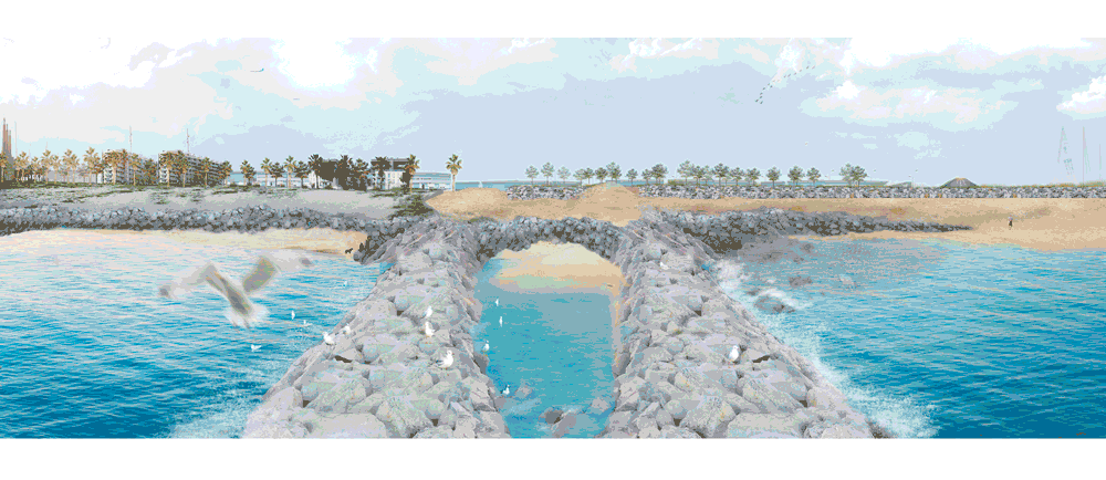
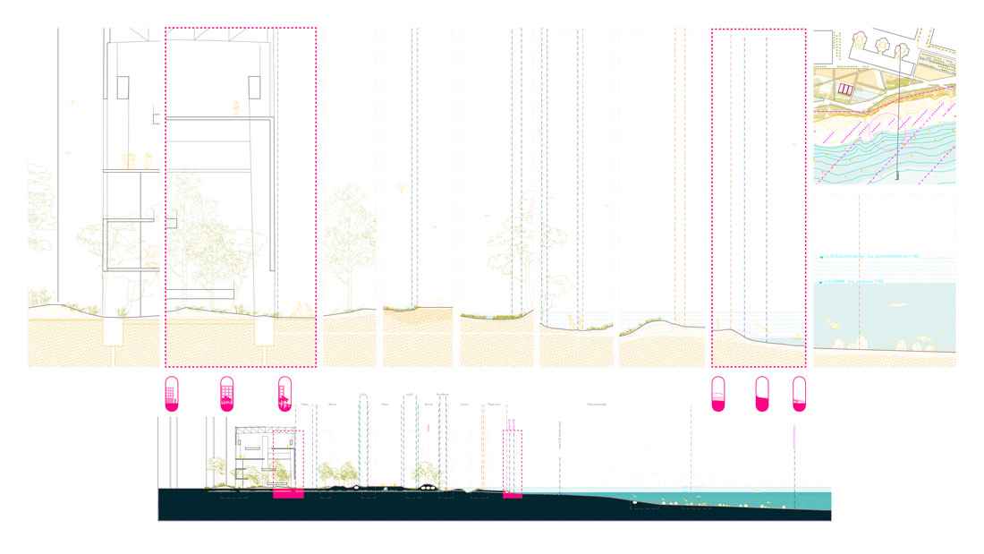
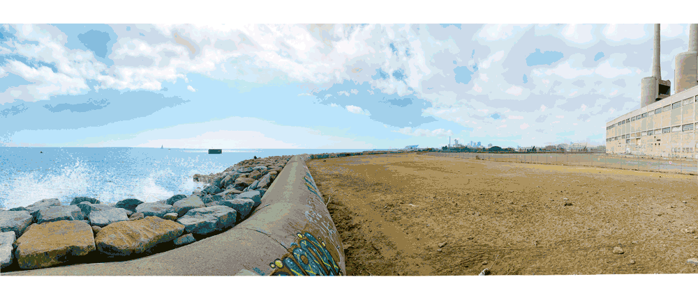
The project is carried out in the area between the mouth of the Besòs River and the port of Badalona, an area with a coastal length of 1.5 km. The Three Chimneys and the turbine hall remained as symbolic elements for the city of Sant Adrià de Besòs after production closed down in 2011.

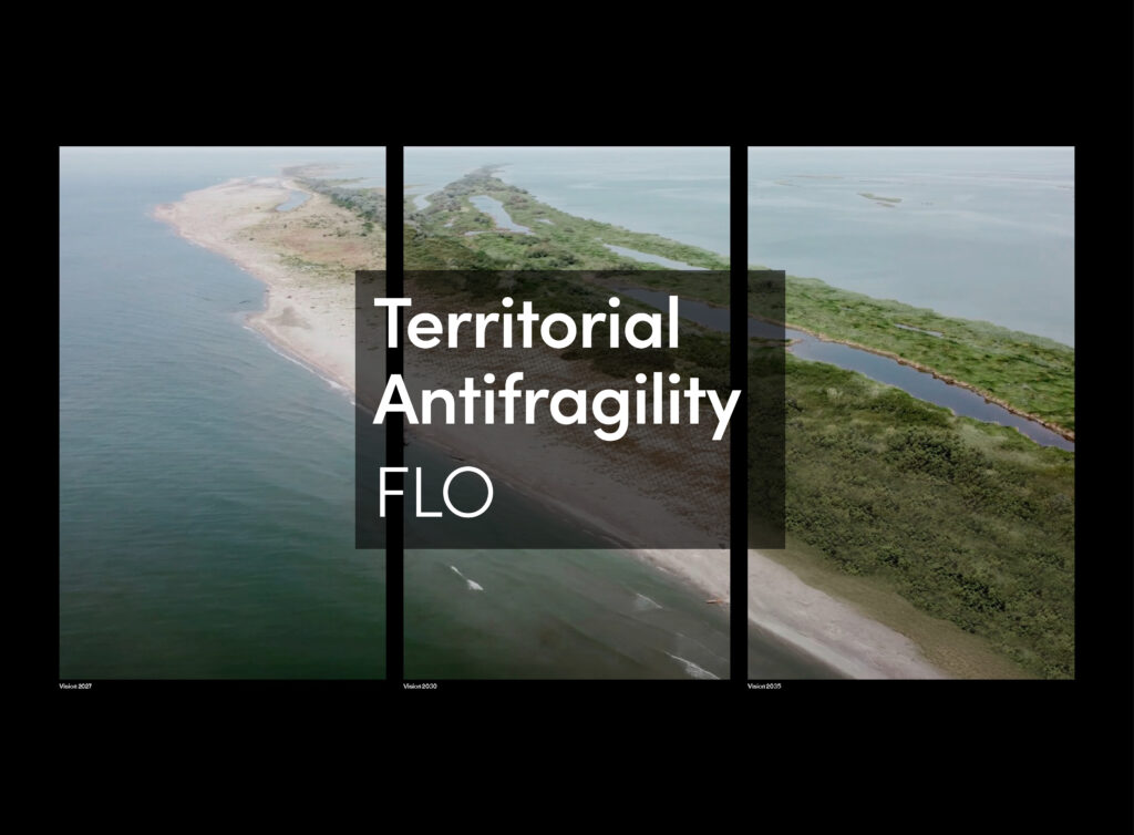
In the coming decades, temperatures are expected to rise and precipitation drop, and predictions indicate that the flow regime of the Besòs river will suffer a reduction and modification. The coast system will face gradual sea level rise and will be the first zone affected by storm events. This combination of factors, together with the fact that beaches are artificial, will increase the loss of beach area, resulting in the re-orientation of the coast and damages to infrastructures.

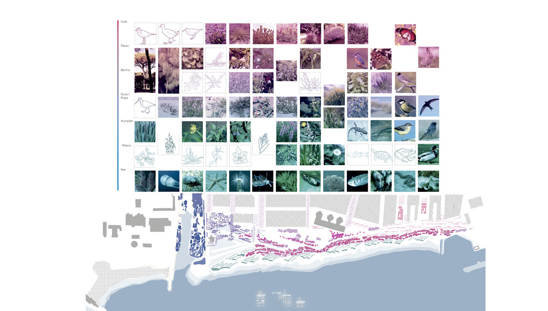
This coastal area was once characterized by a rich natural wealth, with landscapes of wetlands, coastal dunes, lagoons and forests that were frequently flooded by the river. This memory serves as a context, but also a trigger for the potential transformations and processes involved in a renewed urban model. Although it is no longer possible to recover the gradient of habitats typical of a delta, the proposal promotes greater ecological diversity. Pioneer species are used to catalyze processes for restoring vegetation and fauna, while reinforcing the nature-based measures used in the project.
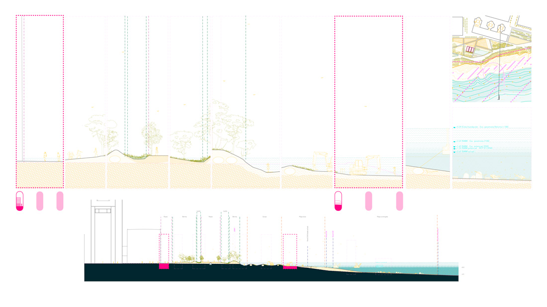
The proposal is based on building a ‘resilient profile’ that can respond actively to transformations as the morphology of the beach changes according to dynamics such as waves, sea level rise and storms. The entire system will necessarily undergo a transformation on all its scales. The aim is to facilitate changes to occur at small and manageable scales. This resilient profile is intended as a series of subsequent levels of infiltration and adaptation, starting with geotubes and artificial reefs that adjust the profile of the beach while reducing erosion. Moving inland, dunes are able to counter the more direct dynamics of the sea; the new berm rising in between the maritime promenade and the dune system can infiltrate the excess water from extreme storm events and serve as a protection of the promenade itself. The infiltration material of the promenade provides additional permeability, and the further interconnected spaces to accommodate water can change in use in time, for water storage or recreational uses.

Regarding accessibility, the current perception is of a barrier between the urban environment and the sea, mainly generated by the presence of the railway. A series of transversal connections are proposed to create a mesh of pedestrian and bicycle routes to make the space permeable and to generate the necessary modularity to promote resilience. The promenade parallel to the shore maintains a height defined by the flood levels from the worst-case scenario, offering a safe route even during storm events.
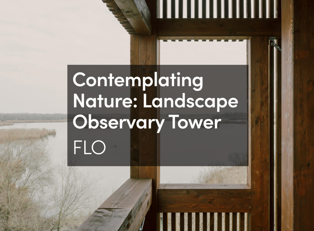
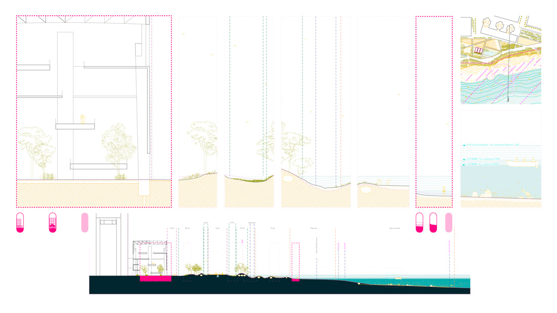 In order to create a resilient ecological and social infrastructure, it is necessary to define a mosaic that supports the diversity of activities demanded by the inhabitants. The approach to the natural environments is not only to allow residents to make use of and care for the area, but also to help them coexist with natural processes as part of a resilient ecosystem. The proposal incorporates wetlands and marshes that are outfitted with observatories or educational itineraries; recreational and sports uses coexist, such as skate parks, community gardens or children’s play areas, which in turn function as floodplain spaces.
 Infrastructures and spaces will evolve and be modified by climatic variables; uses will adapt to new conditions. In the early years it will be possible to enjoy the beaches or to find wetlands working to regulate water in the environment. Over time, however, these situations will adapt to phenomena like sea level rise and increasing dry seasons. Although beaches will no longer exist, the platform generated will permit diving or marine life research activities; as for the wetlands, if they cannot be filled in, they can be turned into spaces for productive gardens or recreational use.