One potential climate tipping point is the response of sea levels to changes in the Greenland and Antarctic ice sheets. Melting of the ice sheets adds liquid water to the oceans and raises global sea levels. Although researchers are working to develop numerical models that will narrow down exactly how fast and how much the ice will melt, development of these models may take more than a decade.

Sea Level Rise is Real
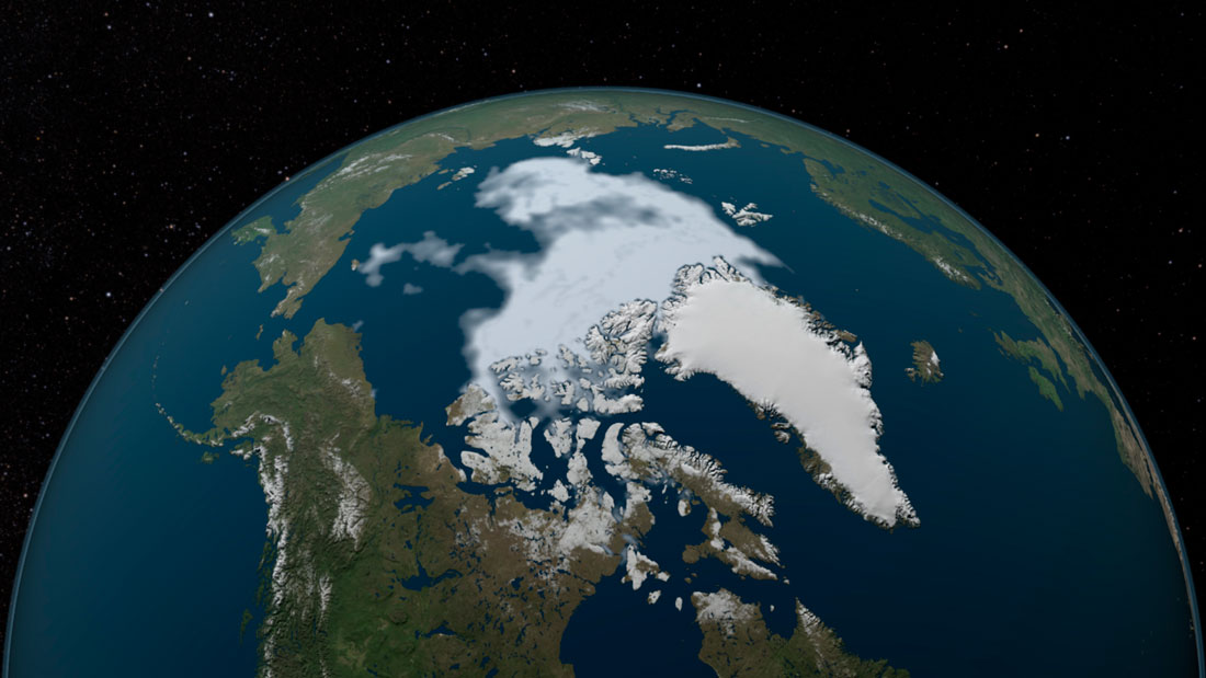
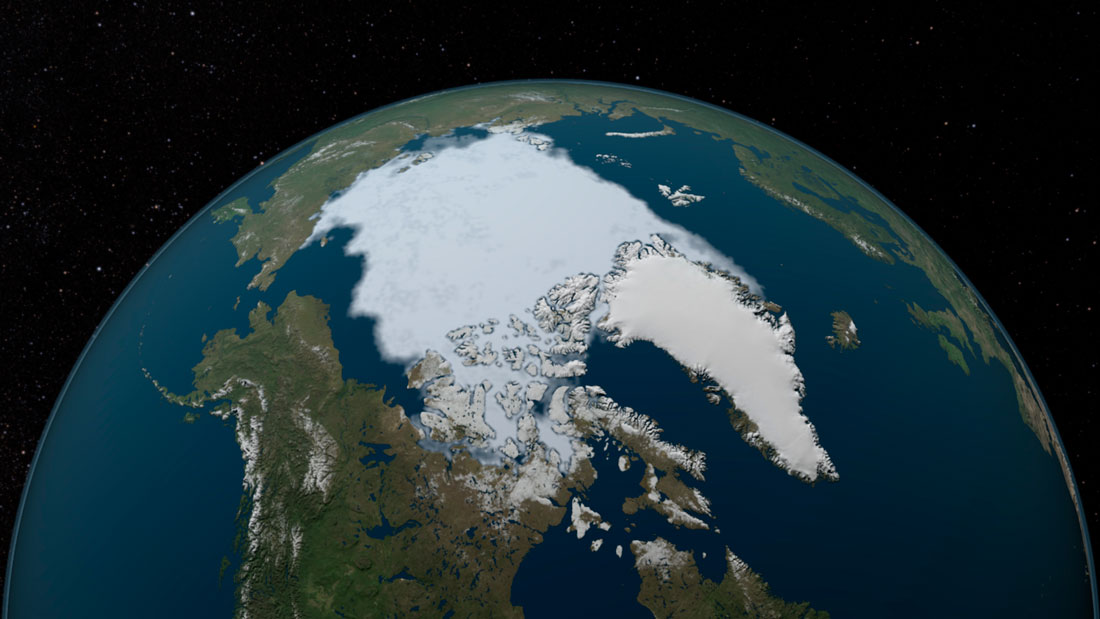
Arctic sea-ice coverage hits record low (1984-2012)
The lowest ice cover in the Arctic Ocean is in September. The ice shrinks during summer and increases during winter. However, in comparison with minimum ice coverage in 1984, which was roughly equal to the average minimum for the period 1979-2000, in 2012 the minimum was about half. The minimum rate in 2016 was the second-lowest record at the rate of decline. NASA scientist Joey Comiso said, “It’s very likely that the Arctic’s summer sea ice will completely disappear within this century.”
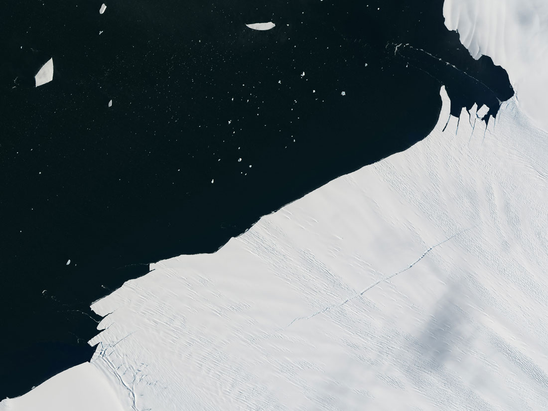
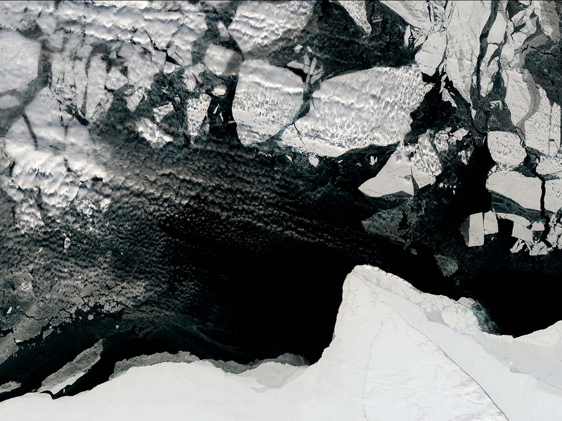
Antarctica’s Pine Island Glacier calves iceberg (January 24, 2017-January 26, 2017)
A block of ice roughly one to two km long has broken off Antarctica’s Pine Island Glacier. The glacier is estimated to deliver around 79 cubic km of ice into the adjacent bay. This ice will move from the West Antarctic to the ocean, contributing to sea level rise.
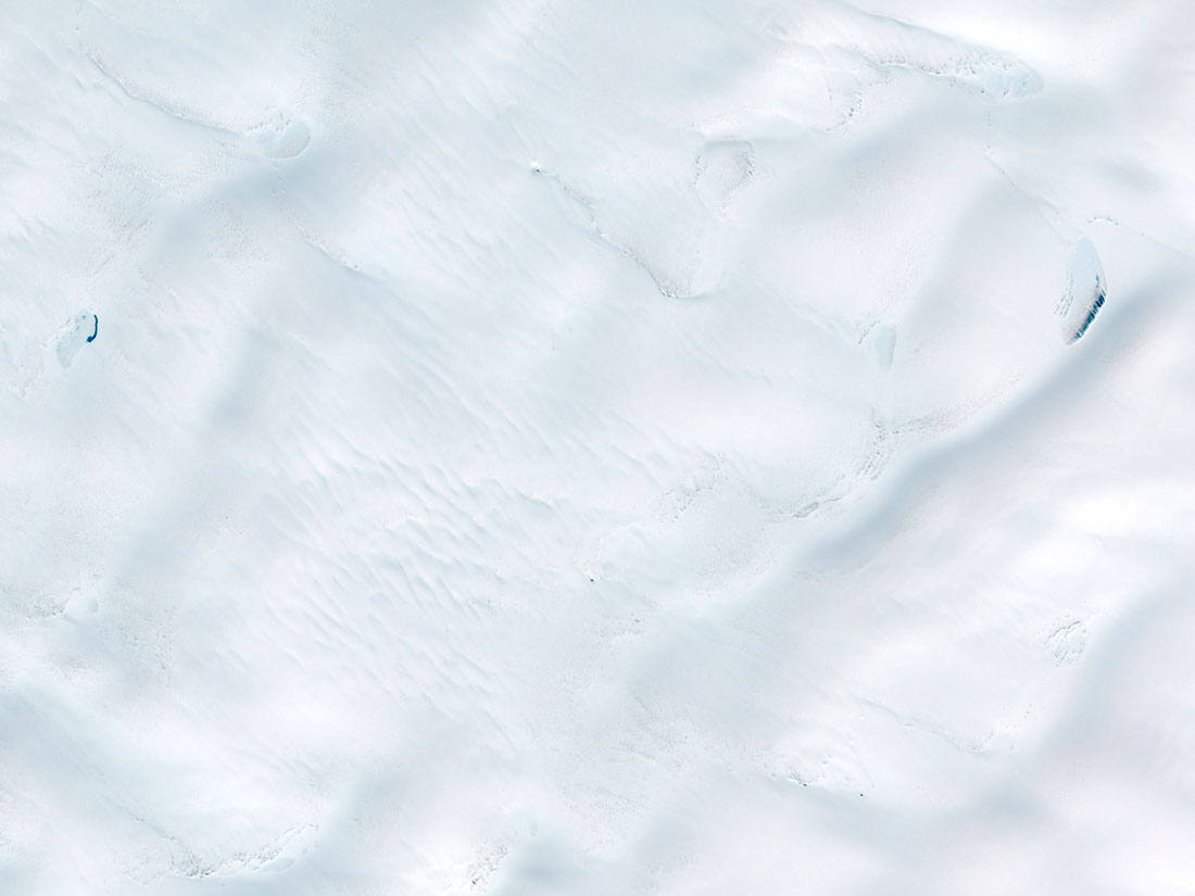
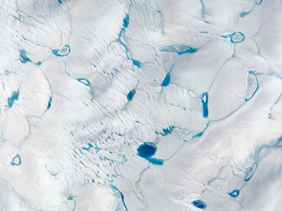
Exceptionally early ice melt, Greenland (June 10, 2014-June 15, 2016)
Melting of Greenland ice sheet began exceptionally early in 2016. Melting causes further melting when ponds of meltwater form because they darken the surface and absorb more sunlight than ice. When water runs into the ocean it flows through crevasses, which helps in speeding up the ice flow and contributes to sea level rise.
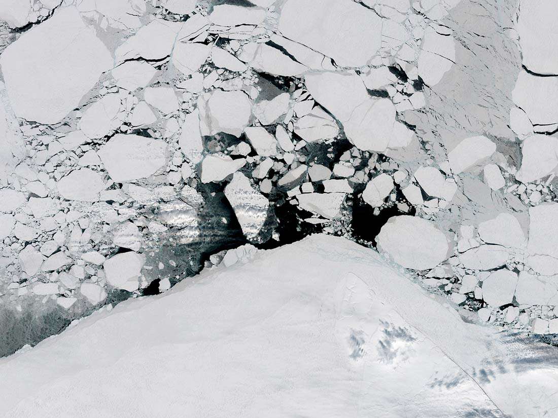
Early sea ice breakup in Beaufort Sea, Arctic (April 13, 2015-April 15, 2016)
In mid April 2016, the sea ice in Beaufor Sea suffered signficant breakup and fracturing, earlier than it usually happens. This change is attributed to the unusally warm air temperatures during the first months of the year, which caused strong winds from the high pressure system over the area.
Extreme Flood Scenarios
The cities most exposed to critical flooding
Figure (1) shows how climate change is likely to impact port cities subject to coastal flooding by the 2070s. Around 38% of the largest port cities are located in Asia, and 27% of them are found in deltaic settings. Deltaic cities have a higher percentage of coastal flood risk since they are located at lower elevations and experience natural and anthropogenic land subsidence. The study analyzes the exposure of population and assets to a 100-year surge-induced flood event, assuming that there are no defenses. Analyzing the risks in this manner is more secure since, if protection strategies were considered, it can give misleading results. Also, flood protection does not necessarily eliminate the risk, as protection measures can fail and it is crucial to consider the implications of residual risk.
Figure (1) Global mean sea level and thermal expansion.
Data source: Ranking of The World’s Cities Most Exposed to Coastal Flooding Today Executive Summary page 5.
These analyses show that a large number of people are exposed to coastal flooding in many large port cities. Taking into consideration all the cities, it is expected that 40 million people are exposed to 100-year coastal flood events. The analysis showed the top 10 cities exposed in terms of population are Mumbai in India, Guangzhou and Shanghai in China, Miami in the United States, Ho Chi Minh City in Vietnam, Kolkata in India, New York in the United States, Osaka-Kobe in Japan, Alexandria in Egypt and New Orleans in the United States. These cities are almost evenly split between developed countries and countries under development. However, when assets are considered as losses, the distribution becomes more concentrated in the developed countries, since the wealth of the cities . Assets here refer to the economic assets in cities such as buildings, transportation and utility infrastructures and other long-lived assets. The total exposed assets estimated for the year 2005 totalled US$3,000 billion, which was around 5% of the global GDP in 2005. The top 10 cities ranked the highest in the exposed assets are Miami, New York, New Orleans, all in the United States, Osaka-Kobe and Tokyo in Japan, Amsterdam and Rotterdam in the Netherlands, Nagoya in Japan, Tampa-St. Petersburg and Virginia Beach in the United States. 60% of the total exposure of assets are in three wealthy countries: USA, Japan, and the Netherlands.
Figure (2) Top exposed cities to coastal flooding.
Data source: Arc GIS
By the 2070s, the exposed population and assets are expected to grow more than threefold to reach around 150 million people, with US$35,000 billion in assets. This loss, which accounts for 9% of the annual GDP, is attributable to the combined effects of climate change, including sea level rise, storm surges, land subsidence, population growth and coastal urbanisation.
