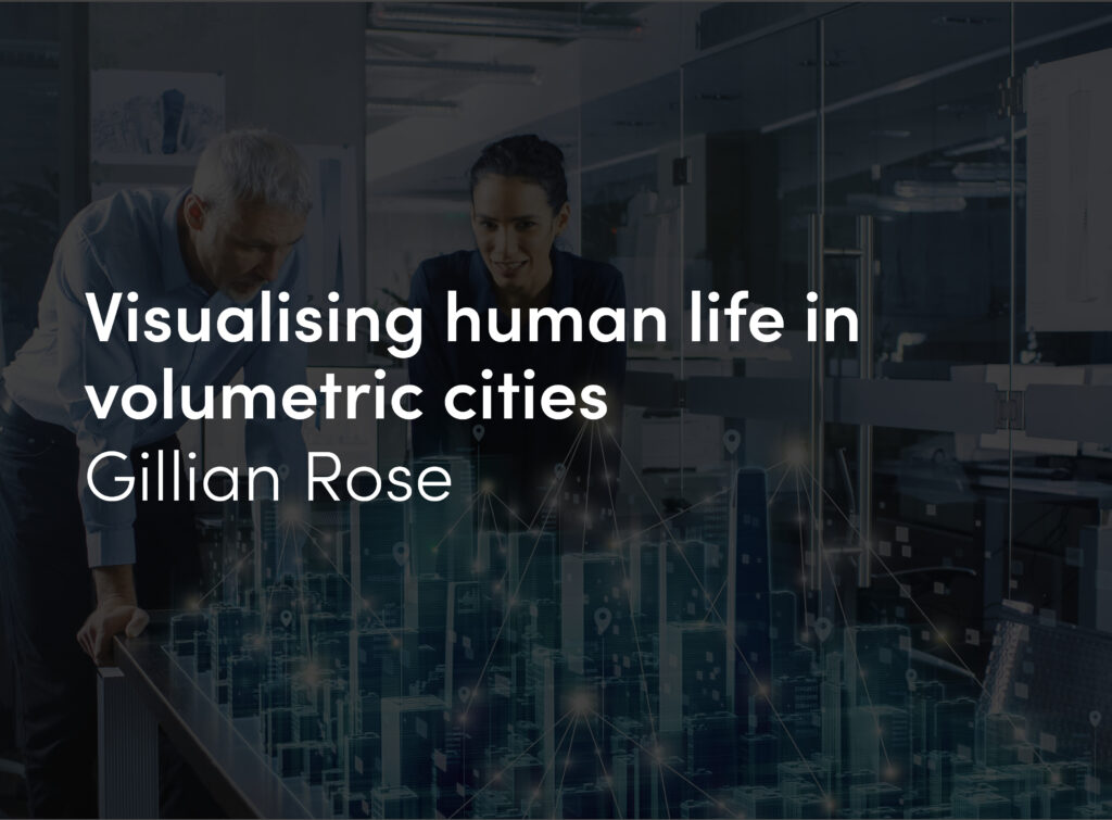
First approach to a 10.000.000 inhabitants community.
Are the world’s great metropolises more efficient than medium- sized cities? How can the constant expansion of large urban agglomerations and their interaction with the surrounding natural environment be managed?
Metropolises are the product of urban development throughout the 20th century. Large areas of the territory occupied by a continuous, amorphous, magma. They follow one another, like unconnected pieces, spaces built with different densities and functions, infrastructures and natural spaces, and in order to recognize them you have to go back to a geographical scale, to where the foundational settlements originated.
At the beginning of the 21st century, the urbanization of the world is suffering from a period of perplexity. Never before in the history of humanity have cities been so well understood, yet they have never before been built in such a vulgar way. Cities in developing countries are growing rapidly to house the people who are migrating from the country to the city. Associated with “progress” in their economies, they systematically repeat the errors that Western cities committed in their high-speed growth process. Chinese cities are the paradigmatic example. Extreme zonification (separation of areas dedicated to business, residences and leisure) simplifies the process of urbanizing the territory. It allows for rapid construction of dozens of neighborhoods, at the expense of an enormous consumption of energy resources. Neighborhoods with thirty-story semi-detached housing buildings, which house the workers for hundreds of industrial centers that supply the whole world, managed from huge districts full off office buildings.
The economic logic persists beyond the limits of reason.
The other great superpower of tomorrow, India, seems to be heading in the same direction. As a result, a kind of urban organisms are emerging in Asia that have never before existed in the history of humanity. Organisms where cities of more than 25 million people will have to coexist in coming years and (barring any catastrophe) in the coming centuries, in keeping with new functional principles in the history of cities. In Europe, a district is made up of 10,000 people, a mid-sized city by 1,000,000, and a metropolis between 1,000,000 and 5,000,000, though the largest urban agglomerations in Europe, such as Paris and London, have population of between eight and nearly ten million people. When we are faced with metropolitan areas of 25,000,000 people, it represents a jump in scale that Western societies have never had to manage.
The Dis-dense City
On the other hand, in Latin America, the 20th century has created megalopolises of millions of inhabitants where more than 50% of the built surface corresponds to areas of self-building. They are areas where the inhabitants, given the inexistence of consistent economic structures and administrative organizations capable of taking on the housing problem comprehensively, acted in accordance with the basic principle of survival. With as much dignity as possible.
In Mexico City, or in Sao Paulo, one of the most relevant questions in terms of urban issues has to do with the renovation of self-built structures, involving inhabitants in the process of urban transformation. In Medellín, the mayor, Sergio Fajardo, and his team began a process of urban transformation. As opposed to tearing down self-built areas, they connected them with public transportation, improved the quality of public space and built public facilities like libraries and schools. Those are relevant architectural projects, with the aim of promoting the transformation of the city from within, accepting the existence of that built territory as part of the economic and social history of the city.
Every city in transformation has had slums within its limits. In the nineteen thirties, New York also undertook a process to transform its self-built areas. Barcelona absorbed its last remaining self-built areas with the urbanization of the Avinguda Diagonal. Bombay and other Indian cities are facing urban transformation processed in which self-built areas, developed with very low construction quality, are disappearing. In Latin America, the quality of these self-built neighborhoods is higher. In many cases the buildings, built with concrete blocks or bricks and between acceptably sized streets, allow for developing the city based on the existing structures.
We worked for the Empresa de Renovación Urbana with Willy Müller and Carlos Hernández in Bogotá. With the participation of the sociologist Guillermo Solarte, we studied the transformation of the city centers and other areas of the city. Since I only had two days on my first trip there, we asked if we could see the exterior limits of the city in order to study its center. In no time, they had offered us a traffic helicopter.
It was a fantastic experience because we were able to spend two hours getting to know the different neighborhoods in the city. Bogotá, for example, doesn’t have large industrial areas because families carry out a large part of production in their own homes. It is a city that is undergoing significant economic progress, and is promoting the connection between the airport and the city based on shopping centers and the tertiary sector. There are areas of severe degradation in the center of the city, and a process of “controlled demolition” has been initiated, along with the creation of parks in the center of the city and new areas to promote local commerce. On the city limits, mountainous areas are interspersed with rich neighborhoods and developing neighborhoods. The river, located to the south, is contaminated because there is no waste water treatment plant.
As we were saying before, there are different urban clocks within the same city. That makes it very difficult to manage the need for mandatory urban mobility. Millions of people work in places that are very far away from their home and, as such, they are forced to cross the city twice a day for their livelihood.
Every metropolitan area in the world is faced with resolving specific challenges using the potential of technology and the cultural and economic conditions that spring forth from globalization.
Development in the Middle East
The Middle East is undergoing an urbanization process similar to the finest hours experienced in Western countries.
What some scientists have described as the zenith of the oil economy has allowed for many Middle Eastern countries to begin the urbanization process at breakneck speed. Their aim is to create new economic structures which will prevent those countries from having to depend on oil for their subsistence in the future.
The development models for Dubai, Abu Dhabi, or Qatar are different, but they respond, once more, to the relationships between territory, economy and government. In 2010, I went to Dubai. It was a few weeks after the opening of the tallest building in the world, the Burj Khalifa, and the sheik Mohamed Al Maktoum’s favorite “city,” Meydan City, with its operational center in the new hippodrome.
Dubai is an example of this polycentric magma. There is an unheard-of accumulation of projects with colossal dimensions set up discontinuously in the territory, like a collage of terrestrial islands. With projects like The Palm or the Burj Al Arab Hotel, Meydan City could be the equivalent of the Bilbao Guggenheim. It is capable of leading a transformation in a built city, which acts as a magnet for the development of a desert territory, which, by default, is empty. There is only desert.
In Qatar, however, the capital Doha is developing around the Corniche, where tribes of fishermen (and pearl hunters) used to ply their trade. A compact city can be clearly seen, which grew up based on concentric rings, like so many Western cities. However, on one of its extremes, we find the financial district, which houses a series of towers (sometimes with spectacular architecture) in a “non-existent” urban space. The concept of public space doesn’t exist here. The street is just unbuilt space, as opposed to a place where people can relate with one another, more characteristic of the new Chinese cities.
In Abu Dhabi, the original growth is also based on the Corniche, where fifty years ago there were only a few small turrets. They were used as a control system by the Bedouin tribes in the desert that operated in the territory. In Abu Dhabi, the capital of the United Arab Emirates, the urban development has taken place on the new islands of Saadiyat, Al Ream and Yas. They are home to a concentration of branches of the most important museums in the world, along with housing and businesses, with a European-like urban design. Adjacent, there is the new city of Masdar, with its Formula 1 racetrack, alongside the Ferrari theme park.
These countries are doing what every country has done when its economy has experienced growth: they have undertaken physical developments to create infrastructures and new resources to fuel their economies. Even though the climatic conditions are not ideal for human life. Today, Dubai could be like New York in the nineteen twenties, during a moment of great expansion, when the tallest buildings in the world were being built all at the same time (Rockefeller Center, the Chrysler Building and the Empire State Building). That period ended with the crash of ‘29 and the Great Depression.
However, building in the Gulf region is the result of a decision that extends beyond the environmental logic of inhabitant a territory in a self-sufficient manner. In the region, people must live with average temperatures of 35 ºC and an average annual rainfall of 107mm. Those atmospheric conditions can only be dealt with at the expense of a significant energy consumption fueled by one resource: oil. They produce it themselves, although one day it will be exhausted on a global scale.
In fact, oil and the wealth derived from it are the reason behind the shape of cities. The presence of multiple relevant projects in Dubai, in many different places, reveals that there is no centralized power that controls the economy and the city, since Dubai does not have large oil reserves. As is the case in Qatar or in Abu Dhabi, the sheiks who own the land are also owners of the oil that can be found underground. Qatar and Abu Dhabi respond to an urban planning that moves beyond the special effects that are characteristic of the accumulation of emblematic projects, which we have seen in Western cities, but Dubai has only expanded at the rhythm of large, pompous gestures.
Urban Nuclei
The first metropolis is the one in the film “Symphony of a Great City”, made in the nineteen twenties. It shows a Berlin that is just waking up, with the activity of its regional trains and its city buses. A city-machine that works like a productive mechanism where the distances between home and workplace are resolved using a system of mechanized transportation. Metropolises are based on the aggregation of historic nuclei, with one center that heads up the growth. Looking at an aerial photograph of any metropolis, the first thing you see are the geographic elements that dictated the original settlement, which served as the foundation for the city’s growth. The island of Manhattan in New York, by the Hudson River, the Seine in Paris, the bay of Bombay or the coastline and the Collserola mountains in Barcelona, define the structure of the territory where the metropolis came into being. And in many cases, the attempt to recognize the limits of the habitable territory reveals natural systems engulfed by the city, which are now part of its ur- ban plan. Some of them are almost natural; others have artificially recreated that nature. The Bois de Boulogne in Paris (846 hectares), or the Pardo in Madrid (15,821 hectares) have the dimensions of ur- ban parks engulfed by the city. Other city have a large-scale natural reference, on or around which the city has grown, but which it has not been able to occupy. At best, the city’s growth has been limited. The Alborz Mountains in Tehran, or the Guadalupe and Monserrate mountains in Bogotá are two good examples.
Natural Connectors
We developed a project in Tehran, in collaboration with the architect Mohammad Majidi, in an area located on the limit between the cities and the Alborz Mountains.
The Alborz is an impressive mountain range that separates the plain between Qazvin and Tehran from the Caspian Sea and determines the direction of the silk road. In Tehran, like in many other cities in the world, questions have been asked about the relationship between the city, which has grown from three million inhabitants to thirteen million in recent years, and nature—in this case a mountain range between 2,500 and 4,000 meters high. For our project, we suggested that the red line that separates the permitted from the forbidden should be substituted by the idea of doors: The Seven Doors to Alborz. Seven cultural facilities could be located along this virtual limit, organizing the relationship between the city and the empty expanse of mountains that protects it from the northern winds. Using those seven door, we developed and enclave, defined by a part and a bridge-building, which will house a center for cultural and recreational activities. An element, in fact, that defines natural space as a place to learn about the city. All cities have drawn red lines to define the limit between what is “urban” and what is “nature”. Systematically, these lines have been pushed back in favor of the urban areas. Up until the present, human activities, and their habitat, have tended toward growth.
If “nature” is understood as the opposite of “urban”, as a useless emptiness, its destiny is clear. However, if nature is understood and used as a setting for leisure, relaxation, rest or knowledge, it will serve as one more habitable space.
The limits on growth and on speculation involving land use have led to the creation of self-protection mechanisms. Both the city and what is not the city are defended. But those mechanisms have proven to be ineffective. Urban design, as a discipline separate from the management of the natural environment, seems to have lost its meaning. It attempts to apply techniques for organizing the territory with the main objective of protecting it from us, so that we will value the excellence, inventiveness and innovation in the use and management of the territory.
In fact, the design of nature, or landscape architecture, as Pep Mascaró, the technical director of Collserola park, has reminded us, was not part of modern architecture during the 20th century. There were no studies of landscape architecture in the Bauhaus21 school, although they designed everything “from the spoon to the city”. For modern architecture, nature was an amorphous space, associated with an abstract kind of leisure, on which isolated housing blocks were constructed, as can be observed in the images by the masters, such as Le Corbusier and Mies van der Rohe. Perhaps the first major modern landscape architect was Roberto Burle Max, a contemporary of Lucio Costa and Oscar Niemeyer, who knew how to integrate nature into the design of cities and buildings. In fact, the strategic question, in the definition of inhabitable territory and its immediate surroundings, has to do with the interaction between city and nature. And the assessment of which of the two influences the other. It is obvious that, for two thousand years, cities have systematically occupied first the arable land, and then the surrounding woodland. Barcelona, Valencia and many other Mediterranean cities have grown over a very fertile territory, where past generations used to grow the food they ate each day.
In American cities, there has always been a much broader relationship between urban areas and farmland. The dimensions have always been bigger, and the interchanges between cities or “interregional exportations” have been in place from the time the territories were colonized.
At a moment when cities have grown upward and downward, both far and near their habitable nuclei, looking back toward the essential elements of the territory and reevaluating them is fundamental to determining their future development. Especially when it comes to promoting the local production of resources. Recovering watercourses, rivers, the natural systems that cross the territory, or agriculture, can allow for improving the quality of life, increasing the environmental quality, and reducing speed in the operation of nearby systems.
The Opportunity for Renaturalizing the City
The Barcelona metropolis is shaped, like few cities in the world, by the natural elements that defined its territorial structure.
The Collserola park is the geographic center of its territorial area. The historical centers of Madrid, Paris or Berlin serve as their metropolitan geographic centers, from which they have grown outward in concentric rings. But Barcelona and its metropolitan urban nuclei have grown up around a number of historical settlements which eventually joined together. Highways and train lines have made daily physical interaction easier between the nuclei that make up the metropolitan area. As such, orography has been a determining factor in defining the expansion of inhabited nuclei. There are now nearly five million inhabitants in the metropolitan area of Barcelona. At this scale, there are infrastructures for water treatment, passenger transportation, logistics, waste management, etc. On the metropolitan scale, we find that the center of Barcelona is occupied by a large natural space, the Collserola park. We see that it is surrounded by urban nuclei and an important system of highways, which trace the limits of the park defined by the Besòs and Llobregat rivers.
Collserola has just been declared a natural park. At the end of the 19th century, when the Eixample was being built, Collserola was a natural place for Barcelona to expand, with projects related to second homes and leisure activities. The Tibidabo amusement park was built on one of its peaks, which was successful due to the installation of the funicular, which allowed city-dwellers to ride up the mountain. A similar movement happened in places like Montmartre in Paris or the Getty Center in Los Angeles.
The Gran Casino de l’Arrabassada was also built in that period, in conjunction with the urban development of Vallvidrera. Two other urban design projects were also part of that movement toward the top of the mountain, though they had two very different endings. What is known today as Park Güell was a real-estate project developed by the Count of Güell, for which Gaudí carried out the urban design. The project included the construction of individual housing units, only one of which was finally built. Within the gated enclosure, the residents would travel using private transportation. On the northeastern slopes of Collserola, an open project consisting of single-family homes was developed around the Avinguda del Tibidabo. It was served by a public streetcar, and was commercially successful very quickly. Barcelona may feel lucky today that the Count of Güell’s project was not a success, due to the collapse of his personal economy and the failure of the development model he chose.
It serves as a magnificent example of the contrast between open projects (like open code communities) and closed projects (proprietary code), which face great difficulties in resisting any changes in the surrounding conditions. Open, hybrid, systems are better adapted to the evolution of the systems that support them than closed systems are.
Years later, the construction in Collserola began to grow. Although it was no longer the wealthy bourgeoisie, but rather the least well-to-do classes. At the time, the bourgeoisie had begun moving northward, toward the Costa Brava or Cerdanya.
In the nineteen eighties, Collserola was marked off as a protected area, with the creation of the first plan based on the idea of transforming the park into public space, cutting off nearly any kind of development beyond preservation.
At the beginning of the 21st century, the park, stretching over more than 8,000 hectares in nine different municipalities, is managed by a consortium directed by a biologist, Marià Martí. It is surrounded by urban nuclei, with an agglomeration of more than three million inhabitants and there are no physical connections with the nearby mountain ranges or the rivers that run beside it.
There are two options in this situation: either the park has the ability to contaminate the surrounding cities, recovering part of the preexisting natural networks, or the cities contaminate the park functionally.
In 2003, a study called HyperCatalonia, promoted by Antoni Vives who was secretary to the Generalitat de Catalunya at the time, took the opportunity to reflect on the future of cities. At the time, in the throes of urban development in Catalonia and Spain, we studies the rate of acceleration of urbanization in the territory in order to determine when Catalonia would be entirely built up. According to those calculations, all of Catalonia would be urbanized by 2375. As such, it was a good idea to develop a process that could reverse the traditional growth of urbanization in the territory. We proposed the “renaturalization of the territory”, a process by virtue of which nature would grow up over cities, engulfing some of the growth from recent years, like residential developments or autonomous industrial areas, creating a new hybrid natural-artificial condition that would serve to structure cities.
After thousands of years of expansion of artificial environments over natural ones, the basic elements of the territory (its geology, topography, botany, climate, etc.) are now the active material capable of action toward creating development in the opposite direction. Those elements can transform historically constructed artificial ecosystems (cities and networks), or create new emergent hybrid constitutions, in keeping with a natural logic.
Collserola’s relationship with Barcelona and its metropolitan area proffers this exact same argument. Collserola doesn’t need to preserve its natural values; it needs to contaminate the surrounding cities. It needs to recover the structural axes of the natural systems, which are especially visible in the former watercourses in gullies and ravines, and other topographical formations.
In New York the ecologist Eric Sanders carried out a study called Manhattan: A Natural History of New York City in which he represented New York before the city was build, with its natural systems and its original fauna. A provocation for rethinking what process cities might undertake in the process toward renaturalization.
The “High Line” in New York is one of the paradigmatic urban spaces in a new kind of landscape architecture, based on visualizing the natural cycles within cities, as opposed to negating them: more in meadows than in flowers. It is a park, managed by a non-profit association, built on an old elevated train line. A park where nature emerges in a wide variety of plants and trees that are characteristic of the meadows in the areas surrounding the city. This renaturalization creates a balance between the medium that houses it and the physical and environmental surroundings.
In order for there to be more nature in cities, there needs to be less use of public space for private mobility.
More nature in cities, opposite building, means lower temperatures in the surroundings and a reduced need for cooling systems in buildings during hot weather.
A city with water in its streets, which recovers old water courses, offers better environmental quality and a more human scale for the city.
Natural Metropolitan Connectors
Can the natural networks that have been destroyed by urbanization in cities be connected with the surrounding infrastructures?
After decades of building infrastructures for mobility, logistics and the urbanization of flat land near rivers, we need to give back to nature part of what urbanization has destroyed. In order for an urban space to be natural, the networks that nature needs to house have to be designed and structured technologically.
As a metropolitan project, another of the fundamental strategies to be developed in Barcelona has to do with connecting the Collserola Park, currently a green island, with the surrounding natural systems. Especially with the coastal range to the north and the Garraf to the south. To that effect, there is a proposal for the possibility of creating natural bridges to allow for pedestrians, bicycles or horses to circulate through those natural spaces.
This would also allow for fauna to move among the different mountainous systems.
The right to travel on foot and the right to a slow pace.
On the other hand, Collserola is also part of an urban system.
It is a natural park in the middle of a city and it currently receives more than two million visitors each year. Therefore, as opposed to supposing that visitors will organize themselves, the proper infrastructures need to be created to organize, promote or limit, accordingly, the activities and mobility in the park.
In fact, what we know as forest today, was a very important agricultural space but a hundred years ago. Collserola, like nearly all of the territory, was a space dedicated to the production of food, and wood and energy for the city. Collserola was planted with large expanses of grape vines that were killed off by phylloxera, which destroyed most of the wine grapes in Europe. The territory was structured and managed on the basis of large estates grouped around a number of traditional farmhouses that still exist today. Valldaura, located in the municipality of Cerdanyola, is one of them, founded by the Cistercian religious order in 1150.
Nature and Self-sufficiency
The IAAC set up a research center on that estate, involved with the self-sufficient habitat, with the aim of learning about how nature works, by coexisting with it. Nature is naturally self-sufficient.
It is made up of a series of living elements that take their resources from the environment in which they are established. It can function as a part of a connected whole, as part of an ecosystem. That is what cities should be like.
Up until the 20th century, Man has always interacted with nature through the extraction of resources. While preserving nature at the same time, however, so that those resources were recurrent.
The challenge, today, lies in proposing systems and solutions that allow for the conservation and management of nature, that will be useful in our current context, with the technologies and systems at our disposal.
Cities need to be designed as systems made up of closed cycles for the exchange of energy and information.
During the presentation of the project, we displayed the outline of the project we intend to develop, which is summed up in the idea of “learning from nature through experience”. Whereas university education, from the Middle Ages up to the present, has always been based on advanced training in a specific discipline (medicine, engineering, architecture, law, etc.), times of structural change in the world are moments when new disciplines should be invented. They often arise from the hybridization of a number of existing disciplines. One example is biotechnology, the fusion between biology and computation.
We propose taking on multi-scalar education. Centered on human beings and their ability to interact with their immediate surroundings, the objectives would include the local production of resources (food, energy and goods) and the ability to interact globally and share knowledge through information networks.
We need to educate human beings as people and in their capacity to produce the resources they need to live locally and sharing globally the knowledge they accumulate: people, surroundings, planet. Valldaura will be a multi-disciplinary environment. In 2009, we invited Meg Lowman to Valldaura to teach a workshop; she is the inventor of Canopy Biology, a discipline that studies life in the upper habitat zone in forests, which, in most cases, implies the need for lightweight structures or aerostats to provide access. With Lowman, we undertook a number of studies of the forests and their biodiversity. Valldaura will also be the location for the implementation of the first Energrid network, and where different energy production sources and consumers of energy will be managed using an intelligent network. Energy will be produced there using wind power systems, photovoltaic systems, biogas, biomass and hydroelectric systems.
There is an interesting phenomenon associated with energy because we know what it is, but we don’t know how to measure it.

Everyone knows the length of a meter, the weight of a kilo, how fast 10km/h is, how many kilobytes are in an image, but not how much heat a kilocalorie produces. Or how to produce a kilowatt. Culturally, we don’t internalize the unit of energy the same way we do with other systems. In order to interact with energy, to produce and consume it responsibly, we should know what it is. And its measurements.
One of the projects that should be developed in Collserola in coming years is the creation of one or more biomass power plants. Each year, the biomass in a forest increases by 4%. If it is not managed by thinning some trees so that the others will grow better, or clearing out the underbrush, it ends up burning or, when it snows, a large number of trees fall, which brings movement in the park to a standstill. Nature evolves through abrupt changes like fires, which are a natural mechanism that allow for spreading trees’ seeds, for example. If fires are prevented, people need to increase their management of forestland to promote biodiversity.
Rural activities related with herding, agricultural uses, or the need for energy sources to heat old farmhouses, meant that the wood from fallen trees was collected as a way of obtaining naturally created resources.
But, as many of these activities began to disappear, there was no longer a functional or economic reason to clear the woods and roads, or to pick up fallen trees. That is why the creation of a biomass plant in Barcelona at the foot of Collserola and another on the Vallès side, would create a new reason for clearing biomass from the park.
In fact, the woods are a source of knowledge that the industrialization process has led us to forget. The self-sufficient those places that have the most ecological value. Without giving up on the management of nature and our immediate surroundings, as has always been the case.
Horses as Interfaces for Relating with the World
The integration with nature also has to do with other questions that connect us with ancestral processes and systems.
The world changed when Man learned to tame horses and used them as a means of transportation, allowing for to travel at greater speeds. Horses and their abilities meant that Arab armies could travel faster, and that the heavy Visigoth armies could invade the Iberian Peninsula in the 8th century and maintain it for centuries. Horses were our transportation system until the first train was invented and, later, the automobile. However, this animal, associated now with the upper classes, could be a key element in the preservation of the territory.
In the crisis of 1993, I dedicated part of my professional efforts to creating a company that designed graphic interfaces for multimedia systems. In 1995, we won the Möbius prize for the best graphic interface for an architecture CD-ROM at the most important international festival, held in Cannes. In 1997, we were finalists with a product on the metropolitan area of Barcelona, competing against a company owned by Bill Gates that had created an interactive application based on the Codex Leicester by Leonardo da Vinci, with a budget that was 100 times larger than ours.
Fifteen years later, in 2008, we decided to learn to ride horseback, with expert endurance riders, which is similar to marathon running and has its global headquarters in Vic. A new way of learning about the natural world. Riding on horseback reconnects people.
In the nineteen sixties in Spain, only the most well-to-do classes played tennis. In the wake of the Santana phenomenon, it became a global phenomenon and a large number of tennis courts were put up in residential developments that were being built at the time.
In the nineteen eighties and nineties, golf, which was also an elite sport, began to become more popular due to the success of Ballesteros and Olazábal. That was the logic behind the creation of landscapes in a number of urban developments built during those years. In many cases, golf had a harmful effect on the territory, because it is one of the activities that consumes the most land for the least social use.
In the first decade of the 21st century, there has been a boom in equestrian sports in countries like France and Germany and in the Persian Gulf as a national sport. And is hasn’t just been horses used in rings for dressage, jumping or racing. Horses are used to travel across the land, which is organized into a sport in the form of endurance races.
In 2007, I met José Manuel Soto, an Andalusian singer who decided to organize the “Dakar of the horse world”. It was the longest race in the world, and it was initially called “Al-Andalus”. Each year, the race covers 500 kilometers over a period of eight days.
Each year, Soto seeks out 500 kilometers of rural roads in Andalusia for the competitions. We invited him to a conference called “Good News in Urban Design” [“Buenas Noticias en torno al Urbanismo”] organized by the IAAC, because we felt that highlighting the value of the territory by simply racing across it was a great territorial strategy. On the limit between Catalonia and Valencia, I followed the traces of the Roman Via Augusta, which is marked in the Valencian territory. The road was travelled, among other, by King Jaume I during his conquest of Valencia. At present, there are plans to urbanize that beautiful place and build a real-estate complex.
Near El Puig, where important operating bases were set up, the Via Augusta is a regional road, fitted out with a series of roundabouts that dot its length.
Travelling with Soto, I understood that the hope for any rural road lies in not being turned into a highway. Growth and urbanization doesn’t always represent progress. On the contrary, in parallel to the network of high-speed trains that cross the territory, we should build a low-speed network of paths for pedestrians, cyclists and horseback riders. A network that should have the same normative value and degree of preservation as railways or national highways. People have the right to travel the planet on foot.
In a territory of networked self-sufficient cities, the right to walk or travel, using low-speed systems, and without having to make excuses to the “king-car”, will be one of the fundamental arguments for the organization of the non-urban territory between cities.
In 2009 I was invited to Princeton University by the dean of the architecture school, Stan Allen. There I ran into Mario Gandelsonas, co-founder of the historical magazine published in New York, Oppositions. Mario told me that he was completing a study on transportation infrastructures for the 21st century.
“Trains?” I asked.
“No. That was the 19th century,” he said. “Cars?” I asked again.
“No. That was the 20th century,” he replied. “So?” I asked.
“Cell phones and horses.” Low-speed mobility with contextual information that emerges from mobile interfaces.
Incredible.
We traveled along rural roads near Centelles, close to Barcelona; I visited Mas Cerdà, which belonged to the family of Ildefons Cerdà, the engineer with a utopian vision for the construction of the human habitat, who promoted the idea of “urbanizing” the countryside and “ruralizing” the city. And he invented the concept of urban design.
One hundred and fifty years later, we need to rewrite the history of human habitats.
Metropolises that are Invisible to their Inhabitants
Metropolises are the prototype of the industrial city. Large concentrations of structures and resources in the territory to satisfy the needs of a large quantity of population concentrated in proximity to large production centers. These large metropolises are supplied according to the industrial logic, using energy created in major productive nodes, like nuclear power plants or wind farms.
In spite of the fact that they are surrounded by what used to be productive agricultural territory, their food comes from anywhere on the planet through logistics platforms and transported by sea or on trains and trucks.
Large urban agglomerations work like abstract machines in which the brand of a territorial node is promoted as an argument for competitiveness in the global market. However, most neighborhoods where people live do not have their own identity within the metropolis.
Metropolises exist because they are situated around major global centers, like airports, ports or industrial production centers, and near places where political decision making takes place.
In the information society, this process of concentrating humanity in large cities seems unstoppable. The heat of the big city offers security in a globalized economy, where farmland requires less and less workforce.
Metropolises reach a dimension in which the city itself is no longer comprehensible. In Mexico City, where more than twenty million people are concentrated, daily interaction within the city’s districts is much more important; there is a scale of social activity and a certain sense of a “market”. There are people who will never visit a multiple neighborhoods in their own cities.
The great metropolises are organized by layers of mobility where the leaders ride in helicopters and land on the roofs of buildings. On the ground level, security is organized by neighborhoods. Could a metropolis be created by grouping together “slow city” neighborhoods (or the equivalent of districts) into a large city? “Slow cities” are a movement aimed at promoting higher urban quality based on the creation of a slower-paced lifestyle. It emerged from the “slow food” movement, which opposed global homogenization through franchises.
Cities that wish to be members of the club, founded in Tuscany, can have a maximum population of 50,000 inhabitants.
The metropolises of the future will need to promote urban spin- offs: the creation of communities on a neighborhood or district scale, which will be capable of managing their own self-sufficiency, while forming connections with other nearby districts.
To that end, the nodes that will satisfy the inhabitants’ needs will have to be identified at the proper scale. In order for this model to be effective, the managers of these networks of connected neighborhoods will have to make use of the culture of cooperation characteristic of the Internet, which has the ability to collaborate on all kinds of initiative using open platforms, as opposed to traditional culture, based on control and confrontation, characteristic of traditional political parties. Nodes, connections, an environment that stimulates life and open protocols for its governance.
From “Pito” to “Dido”
In March of 2011, a trip to the United States was organized for the mayoral candidate at the time, and current mayor of Barcelona, Xavier Trias, along with Antonio Vives and a group of people.
A meeting was held at the Center for Bits and Atoms (CBA) at MIT, directed by Neil Gershenfeld, with the aim of engaging in a debate about some of the ideas in the program for the regeneration of Barcelona, especially those ideas related to the self-sufficiency of city blocks and neighborhoods and, by extension, the city as a whole. A city model with “slow-paced productive neighborhoods within a high-speed, hyperconnected and zero-emissions city”.
A new mantra.
First, we visited the CBA, where we looked at digital manufacturing machines, from the scale of nanotechnology to the production of any object, like digital printers or CNC machines.
After the tour, we began a debate. Neil talked about the history of the collaboration between his lab and the IAAC. From the Media House to the Hyperhabitat at the Venice Biennale and the Fab Academy.
I used images of Barcelona in my presentation: from the city surrounded by walls to the Cerdà plan for the Eixample. He proposed adding value to the territory using the urbanization process, allowing for healthier living conditions for all of the city’s inhabitants. After exhibiting the plan, we presented new strategies and projects that could promote a new process to add value to the territories, transforming buildings, city blocks and neighborhoods into self- sufficient zones, proposing a model for the settlement of networked self-sufficient cities. I have talked about all of it in this text.
At the end, Neil asked us to go back to the image of Barcelona when it was walled, and he proposed building a new wall:
“Cities should produce all of the resources they need to function, and they should transform all of their waste materials to produce new materials and new products,” Neil asserted.
“How do they produce food?” asked a student.
“Ah, right! Vertical farms are already in development and they will allow for growing food in cities,” Neil said. He continued, “Energy can be generated using renewable systems, and goods can be produced using digital manufacturing processes. Cities should allow for the import and export of data, not products. Whereas we now have a ‘Products In-Trash Out’ model, we should be moving toward a ‘Data In-Data Out’ model, from ‘Pito’ to ‘Dido’,” he concluded provocatively.
The project for the connected self-sufficient city, or the DidoCity, can be one of those situations where a framework for general action is defined and a platform is created for the convergence of multiple disciplines and multiple initiatives in the areas of energy production, materials, waste management, communications, recycling and food. An initiative spearheaded by engineers, architects, anthropologists, politicians, ecologists and a wide variety of experts who are essential to defining new paradigms for cities, in order to improve the inhabitants’ quality of life with the use of contemporary cultural and technological potential.