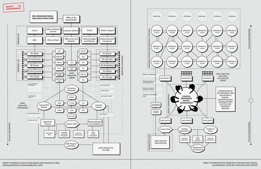
Making Data Infrastructure Visible
As sea levels rise, toxicants are leached into soils, and environmental change increases, environmental data informs the spatial practice of retreat and design for climate. However, much of the environmental data we collect and use from organizations such as the EPA, while incredibly reliable, is difficult to access both intellectually and practically. This project imagines a new form of digital watershed governance that lays a grid for potential sensing stations across the territory to produce alternative forms of landscape sensing that support existing work on climate data. This grid of potential sites offers a suggestion for the collection of data as a political praxis to experience the granularity of climate change at the level of the neighborhood and watershed, rather than layers of geospatial data housed in the depths of government agencies’ websites.
Sensing data collected at sites in the grid activate with environmental pollution and are constructed by local environmental groups in need of greater monitoring, setting off a chain of new sensing towers as a plume of pollution grows. Yet, these sensing towers do not abandon traditional sensing altogether: sites include all the standard functions of EPA monitoring stations, but they also include large plantings aimed to bioindicate both contaminants and long-term environmental change. The data center, sited at the Wheelabrator landfill in Saugus, serves as a public data center that can be accessed as needed in an otherwise dead landscape. The data center supports the data collected through sensing stations, while serving as a public utility to generate capital and infrastructural means to contain contaminants that may leach from the landfill itself as sea level rises.


A waste-to-energy ash monofill landfill located in Rumney Marsh – between Revere, Saugus, and Lynn in Massachusetts – is the proposed location for the center of a public monitoring network.
The surrounding context of the site is at severe risk of flooding, a problem that could lead to the leaching of toxins into the protected salt marsh surrounding the landfill. The reporting agencies for water and air monitors are often distant from the monitors’ location, physically alienating data analysis from locals.
Site 1: Public Data Center
The public data center serves as the center of governance for the watershed’s stations. The site harnesses existing water pumping infrastructure that is part of the waste-to-energy systems to keep the inundating marsh afloat, but also to treat the water so it can be used as cooling water for the data center. Despite having very different infrastructural and productive purposes, data centers and landfills have similar requirements, which supports a fruitful reciprocity between the two programs.
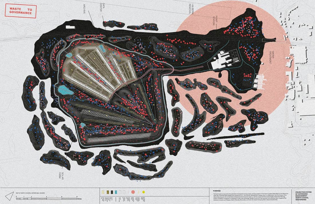
Site plan of the landfill as it becomes inundated by sea level rise. The data center is added in the corner of the landfill that is currently active. A former berm in the salt marsh is moved and reconstituted as additional flood barriers to protect the infrastructure of the data center.
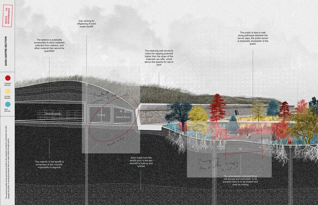
Retaining walls contain and heighten the berms, and valleys use plantings to filter and indicate toxicity levels in water flowing back into pumps for water treatment.
Site 2: Lynn Triangle Waterfront
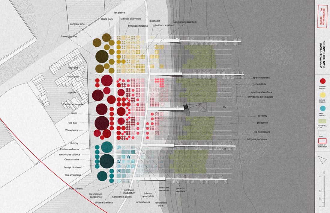
Planting plan for the waterfront, using plants found in the region in the 19th century, contemporary plants, and plants found in Florida’s climate as a means to indicate climate change on a long timescale.
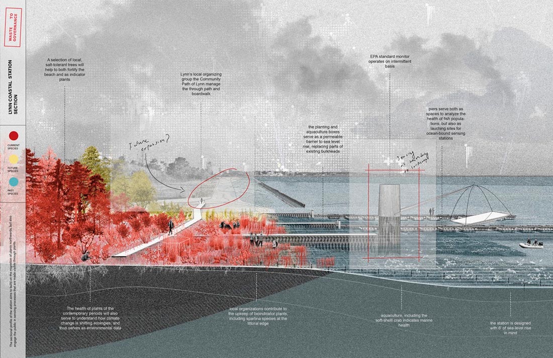
The planting of the waterfront serves to replace aging bulkheads with a planted wetland to ease flood risk.

Located adjacent to an elementary school, the urban park aims to indicate saltwater intrusion as flooding in Lynn worsens over time, among other climatic changes. The sloping site uses the varying root depth of plants to work as indicators in an inland setting.