


A first-of-its-kind map reveals inequalities in access to groceries across 24 hours, as stores shutter down while people continue to work.
Food inaccessibility is a critical issue for night workers. A 2024 Living Wage Foundation survey, for example, found that more than half of London’s night workers struggle to find healthy food during or after their shifts. Yet, to date, there has been little geospatial or quantitative evidence to show how this issue unfolds across the city and through the night.
To address this gap, researchers from the Data After Dark research collaboration have created a new map of London to show where and when the lack of access to food is most acute for people who work in the city between 6pm and 6am. This first ever map of London’s night-time food deserts is possible thanks to a combination of mobile phone-derived footfall data (meaning the number of people who pass through or enter a specific place), public transport routes and schedules, and information on the locations and operating hours of food retail outlets.
The research reveals that during the day more than 92% of people working in London can access a grocery store within a 10-minute walk or public transport journey — after midnight, this proportion drops to fewer than 60%, leaving an estimated 150,000 people still working across many parts of the city without sufficient access to food. The map shows how, with each passing hour of darkness, access to food becomes more challenging for those across Greater London who work through the night.
Underlying the map are the locations and opening times of 8,337 supermarkets, convenience stores and grocers (supplied by Green Street via GeoDS ). Equipped with this data, hourly estimates of how long it would take to reach the nearest open outlet across the city were then produced. The richness of the opening times and the granularity of the travel-time estimates allowed to undertake the most comprehensive analysis of night-worker food retail accessibility in a major city anywhere in the world.

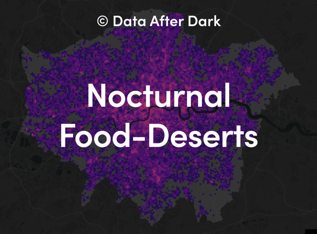
Mapping access to food retail outlets at night
The first step in understanding the geography of night-time food inaccessibility is to map travel-times to the nearest open food retail outlet across London. To capture fine-grained spatial variation, the analysis was conducted using a hexagonal grid, with each cell measuring 350 metres from edge to edge. Travel-times were calculated for every hour of a Friday night (using March 2024 data), spanning from 6pm to 6am the following morning. Travel-time combines the time spent walking and, where necessary, using public transport to reach the nearest open food retailer from the centre of each hexagonal cell.
The data shows how the food-desert gradually spreads across the city, as the night progresses:
6pm — Business as usual: At 6pm, the whole city has very good access to food. Availability mirrors day-time levels, with virtually all neighbourhoods within easy reach of an open store.
10pm — Still within reach: Up till 11pm, accessibility remains largely unchanged. Around 65% of presented hexagonal cells still have an open food outlet within a 10-minute walk or public transport journey.
11pm — The turning point: After 11pm, the landscape shifts dramatically. Disparities become particularly visible when many small-format supermarkets, such as Tesco Express, close for the night. While central London maintains relatively high levels of easy access throughout the night, travel-times in Outer London markedly increase.
After midnight — A fraction of the day: At 3am, only around 700 food retail stores remain open — less than 10% of the daytime supply — leaving large parts of the city with limited or no nearby options. The result is a widening gap between central and peripheral areas, with night-time workers and residents in outer boroughs facing longer and more complex journeys.

Yet accessibility alone does not reveal where, or when, demand is greatest. During the day, residential population data can serve as a reasonable proxy for need. At night, however, most people are inactive. To account for the presence of night workers, novel mobile phone-derived footfall data was incorporated as a demand layer. Although other groups may also require food access at night, night workers are the most consistently active population during these hours and are likely to benefit most from improvements.
Mapping the potential demand for food retail outlets at night
Single aggregate figures, such as the 1.32 million night workers estimated to work in London, mask important spatio-temporal variations that are pertinent to understanding demand. For example, the analysis for Friday reveals that worker numbers in London decline steadily through the evening and night — from an estimated 997,000 during 6–9pm window to 395,000 by 3–6am.
To capture where night work takes place, the analysis draws on anonymised and aggregated footfall data provided by BT Group through the Greater London Authority High Streets Data Service. The number of residents, workers and visitors in an area are estimated by inferring home and workplaces from each individual’s most visited locations over an eight-week period. To ensure privacy, the data are aggregated to 350m cells and three-hour intervals. Focusing only on detected workers within this dataset, values were averaged for each three-hour interval of the week (eg 6–9 pm on Fridays) across January 2024. This serves as a proxy for the spatio-temporal distribution of night workers in London.
The data shows how that demand for food retails persist throughout the night and how it is spread geographically across the city:
6–9 pm — Widespread activity: Work activity spans the entire city, with strong concentrations in inner boroughs and smaller hotspots in outer areas. These key locations include major office hubs (the City, Canary Wharf, Stratford), entertainment districts (West End, Mayfair), hospitals, transport nodes, town centres and Heathrow Airport.
Night progression — Declining activity: As the night advances, activity decreases across the city, starting in office areas between 9pm and midnight, and later in entertainment districts. Despite this, many locations remain active with workers throughout the night.
Persistent hotspots: Hospitals, certain town centres and Heathrow maintain high worker presence both before and after midnight, highlighting areas of sustained night-time activity.


Creating a dynamic location-based accessibility model
The dynamic accessibility model is developed by linking the accessibility data from this research with worker footfall. This enables analysis of the proportion of workers with access to an open food retail outlet within specified travel-time thresholds across the night.
High day-time and evening accessibility: Over 92% of detected workers can reach the nearest food retail outlet within a 10-minute walk or public transport journey during all surveyed day-time hours. This strong accessibility extends into the evening, between 6 pm and 9pm, showing continuity of access as the city transitions from day to night.

Night-time accessibility drops sharply: Between 10pm and 5am, however, access to food retail declines noticeably. By 10pm, 89% of workers can reach a store within 10 minutes, but this falls to 74% at 11pm and 59% by midnight, reflecting widespread store closures during hours when many workers are still active. After midnight, over 40% of workers — more than 150,000 people — no longer have a food outlet within 10-minute reach.

Insufficient accessibility metric: Practical tool for policymakers
While the dynamic accessibility model provides valuable city-wide insights, it does not explicitly identify which areas require the most urgent policy attention. To address this, the insufficient accessibility (IA) metric is introduced, based on the principle of ‘sufficientarianism’.
Using an X-minute travel-time threshold, the IA metric identifies areas where night workers are present but cannot reach a food outlet within that time. Each area is paired with the number of affected workers, allowing policymakers to target interventions based on both spatial and demographic relevance. Unlike typical accessibility maps that may highlight low-access areas with no actual demand (eg parks), the IA map prioritises areas where unmet need exists, putting people, not just infrastructure, at the centre of analysis. The threshold here is set to 10 minutes, but this can be adjusted to meet local priorities or planning standards.

Case study: Where in Woolwich is access lacking?

Woolwich, the main commercial and retail centre of the Royal Borough of Greenwich, exhibits consistently high night worker density, but according to the Green Street dataset lacks food retail access after midnight. Fast-food outlets, some open until 2am, remain the only available options. This gap is notable given that Woolwich has been designated as one of London’s three Night Time Enterprise Zones. The programme aims to extend opening hours and increase footfall through initiatives such as Woolwich Lates. However, most of these interventions are event-based and temporary in nature. As such, they do not provide a structural response to the persistent lack of late-night access to food retail.
Final thoughts
The need for tailored research approaches: The night is fundamentally different from the day, and it cannot be analysed using the same assumptions.
The findings underscore the importance of temporality in accessibility research. Beyond the expected day–night contrast, it is show that variation within night-time hours is far greater than within day-time hours. Day-time accessibility remains relatively stable, whereas night-time conditions fluctuate dramatically — accessibility at 9pm bears little resemblance to that at 3am. As a result, a single representative value may reasonably approximate day-time accessibility, but night-time accessibility cannot be meaningfully captured without accounting for temporal variation. This has implications for both researchers and policymakers, cautioning against reliance on headline figures — such as the 1.32 million night workers in London — that obscure these shifting realities.
A decision-support tool, not a perfect map: The analysis is based on an average Friday in 2024, so in a city as dynamic as London there would likely have been some changes as new stores open and others close, for example. Moreover, other important considerations in accessing food, such as the price, quality and affordability of the groceries on offer in the open outlets, or if there are alternative food options such as a work canteen, are not captured in the map. Local policymakers, and the people and businesses they support, are therefore best placed to interpret these findings in context.