The global trend of urbanization is not limited to shining downtown districts and masterplanned developments: of the roughly 4 billion people who live in cities worldwide [1], almost 1 billion reside in informal settlements constructed without official urban planning. [2] These settlements are built spontaneously and competitively, resulting in a complex urban morphology. People living in informal settlements are largely excluded from city infrastructure and services –exposing them to a variety of public health and security challenges – but they continue to absorb new generations of residents as the world’s exploding urban population outpaces the availability of official affordable housing. [3]
In Brazil, these informal settlements are known as favelas, and they crop up in the hills of big cities like Rio de Janeiro in dense, multilayered forms that contrast starkly with the planned neighborhoods next door. The very spatial complexity that makes them so intriguing also makes them largely impervious to remote sensing-based research: satellite imagery, Google Street View, and open-source mapping only offer a glimpse into their labyrinthine cityscapes.
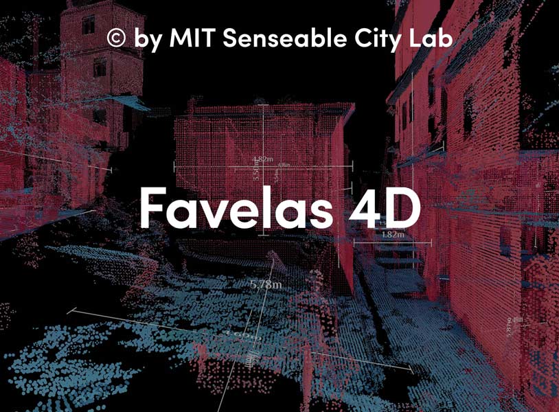
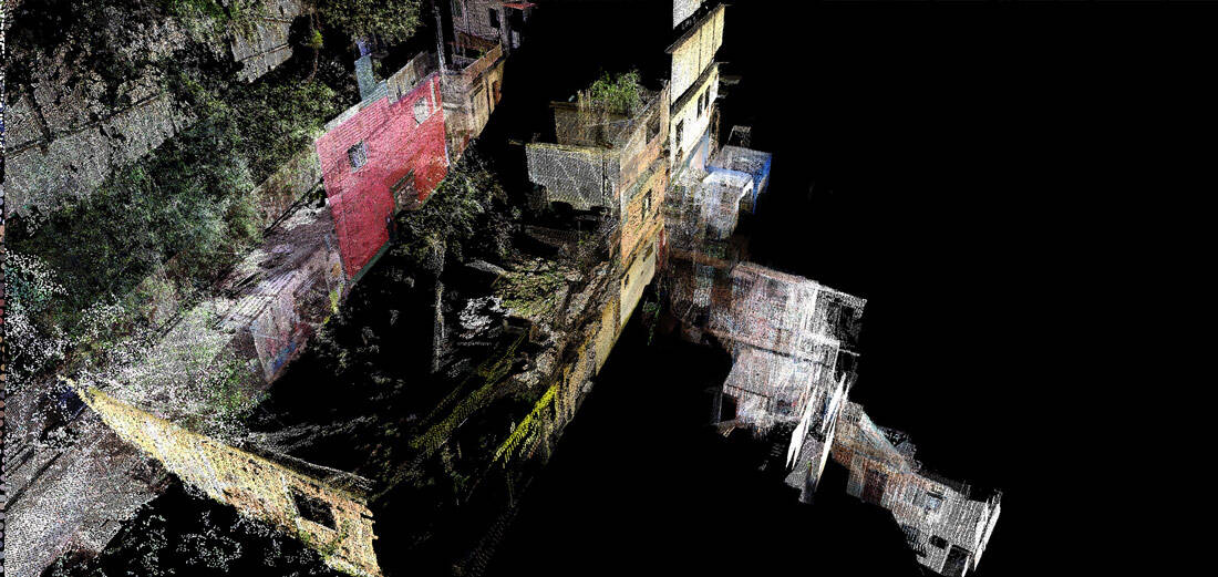
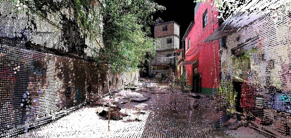
Favelas 4D, a project by MIT Senseable City Lab, in collaboration with Washington Fajardo, uses 3D laser scanning technology to analyze the morphology of Rocinha, the largest favela in Rio de Janeiro. Using detailed point cloud data from LiDAR (light detection and ranging) scans taken at street level in the favela, researchers are able to quantitatively characterize morphological variation in this complex built environment at very high resolution. LiDAR uses a laser pulse to measure distances, mapping minuscule points to locations in space in order to create a dataset that describes a 3D environment with incredible precision.
The fundamental advantage of LiDAR as a research medium is its precise representation of the form of the built environment. Form is a productive angle for the study of informal settlements because it reveals patterns in the unregulated construction of the favela, illuminating the tendencies of unfettered urban development and revealing actionable insights that can inform interventions and policies to improve the safety of these environments. Favelas struggle with property trading due to the lack of land tenure, landslide risks due to the unstable terrain they occupy, and water and air quality due to the limited infrastructure and services that reach them; all of these issues are implicated in the shape of the built environment. However, as MIT Senseable City Lab director and professor of the practice Carlo Ratti observes, “Despite their challenging circumstances, favela residents have developed ingenious and responsive ways to build their own urban systems. This bottom-up planning process and the complex architectural forms it produces can challenge the standard way of designing cities.” Favelas 4D examines urban form from a quantitative perspective, using data analysis techniques to describe and map the morphological dynamics at work in Rocinha.
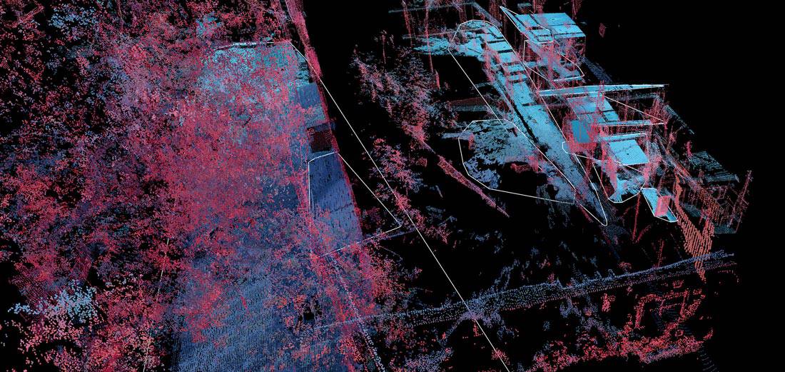
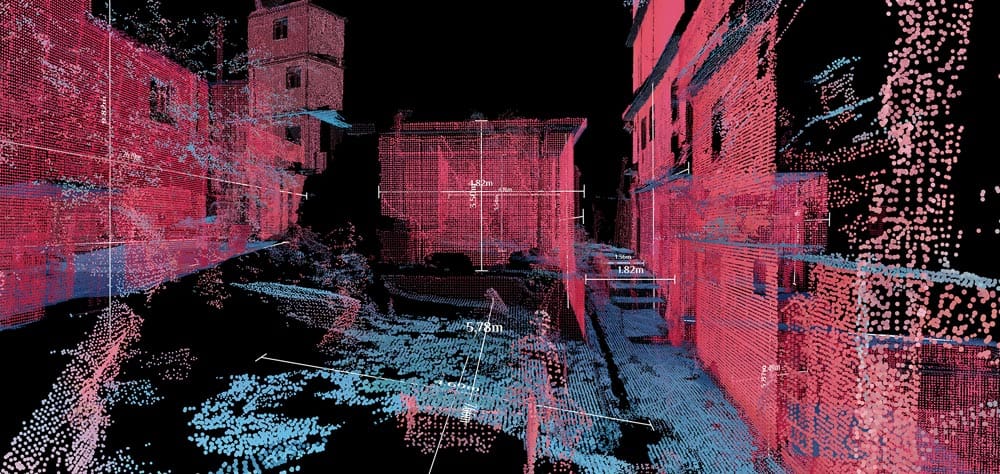
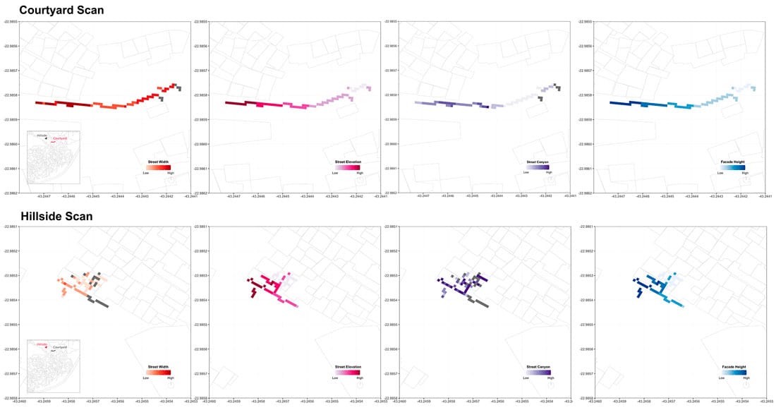
To analyze the LiDAR data, researchers at the Senseable City Lab have developed a scalable and automated process to measure the morphological qualities of streets in the favela. The analysis operates at two resolutions, including a global analysis focused on comparing different streets of the favela to one another, and a local analysis unpacking the variation of morphology within streets. Five morphological factors are considered: street width, street elevation, density of façades, variance in façade height, and street canyon (the ratio of façade height to street width). Using the results of the analysis, it is possible to map morphological information at a resolution of 0.5 meters directly onto the favela’s plan.
These maps of the two sample scanning areas reveal morphological features like pinching and widening of streets and clusters of tall buildings. They show the variable morphology of the scanning area used in this research, and they offer a glimpse of the type of valuable information that will be available when the whole favela is scanned. Washington Fajardo, City Planning Commissioner for Rio de Janeiro and collaborator on the project, is optimistic about its potential to inform future public works decisions. He explains that “the findings could also be used to develop planning strategies that make the formal city more inclusive to informal settlements, or to spark research into alternative ways of building that make urban environments more accommodating and affordable to their growing populations.” This analysis contributes to the improvement of favela conditions and also raises questions about development practices and methods of city-building overall. As informal settlements around the world continue to grow, researchers and planners must integrate them with visions of the global urban future, both by learning from their unique development patterns and by improving their access to the benefits of formalized urbanism. Favelas 4D contributes to this goal by mobilizing the unique capabilities of LiDAR data and the revelations of quantitative analysis, offering an example of how 3D morphological analysis can help us understand and shape the cities of tomorrow.