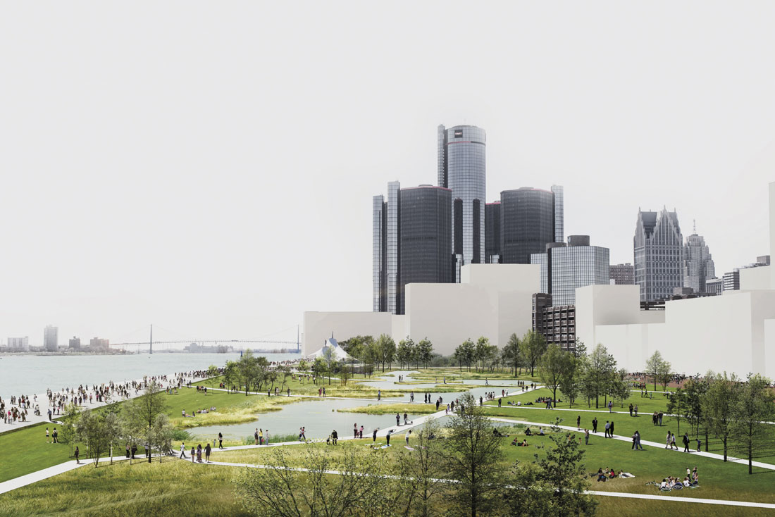
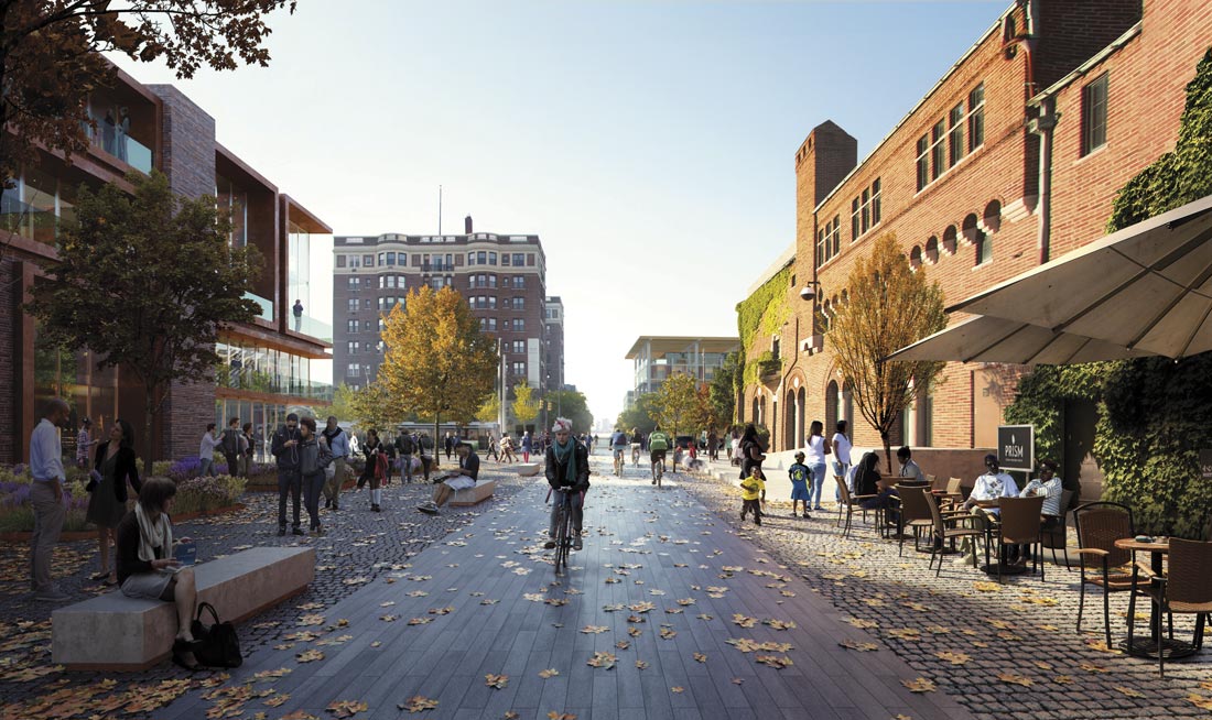
Building on a ten-year initiative led by the Detroit RiverFront Conservancy, in collaboration with the City of Detroit Planning & Development Department and the Detroit Economic Growth Corporation (DEGC), architects and urban planners Skidmore, Owings & Merrill LLP (SOM), developed a framework plan for Detroit’s East Riverfront District. The plan is designed to preserve more riverfront land for public use, generate greater community access to the Detroit River, and spur investment along the East Riverfront.
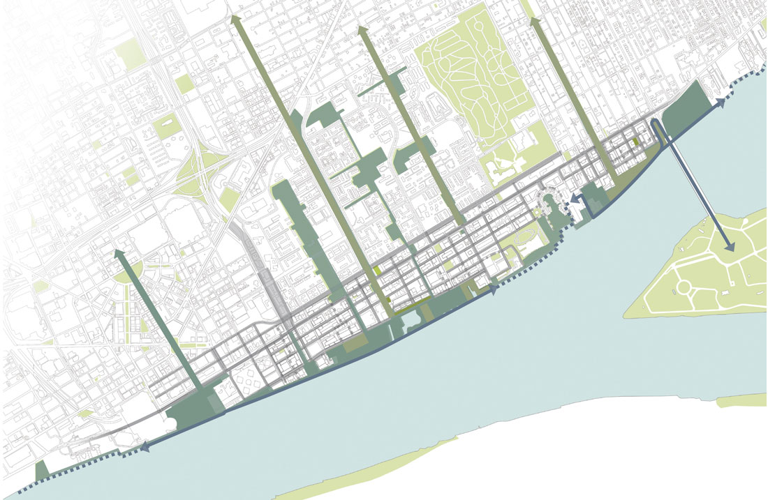
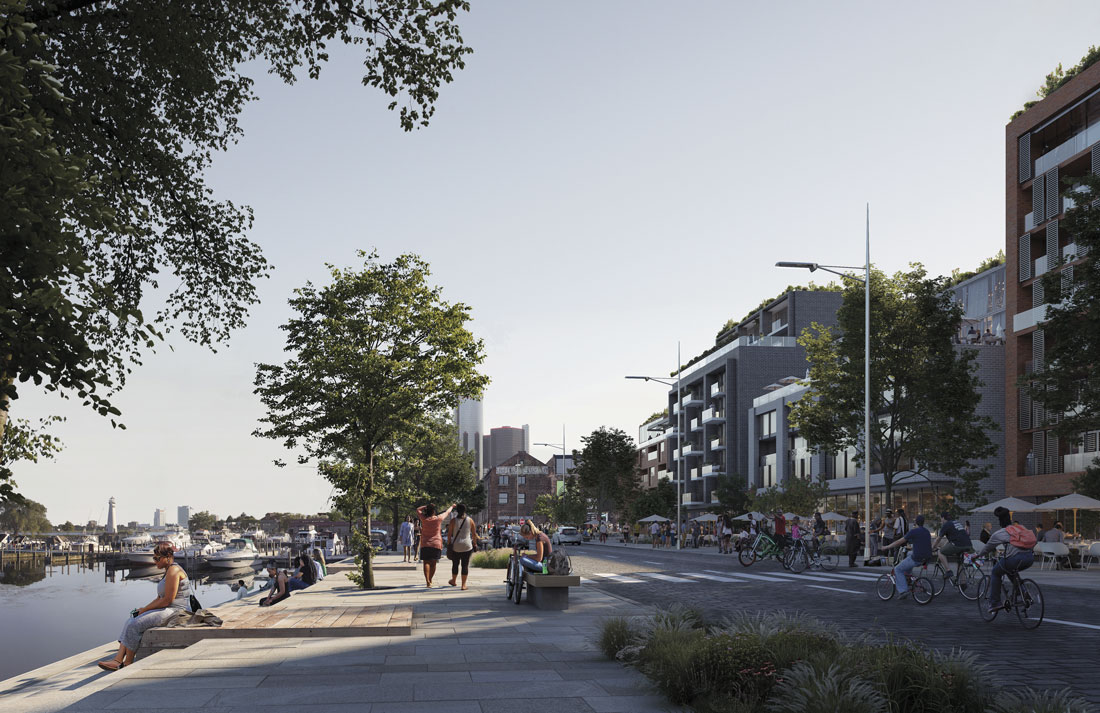
In 2017, DEGC made a Request for Proposals to envision an adaptive reuse of the historic structure, increasing density along the waterfront. The outcome strategic framework plan forges new connections between the East Riverfront and surrounding neighborhoods, expands green space, and makes pedestrian-friendly streetscape improvements. Realized after an intensive six-month program of community meetings–workshops, tours, and interviews–it is the result of a public-private collaboration between the City of Detroit and the Detroit RiverFront Conservancy. The principal mission of the non-profit organization, founded in 2003, is to develop public access to Detroit’s waterfront and serve as an anchor for economic development. It is responsible for raising the funds needed for construction, operation, on-time maintenance, security, and programming of public space.
The plan adds of eight acres of park space to the East Riverfront, envisions keeping significant portions of the waterfront free from private development in perpetuity, and confers a particular significance for short-time improvements in order to give the citizens safe access to the enhanced riverfront. Improvements on Jefferson Avenue would reduce vehicular accidents, improve walkability, and beautify the corridor; they are designed to support local businesses and facilitate waterfront access. The Beltline is a new greenway that will directly connect inland neighborhoods to the Detroit River; the existing Joseph Campau Greenway will receive new lighting, paving, and landscaping. The project is focused on four main aims: parks and green open spaces that are inclusive and accessible, safe and attractive greenways with sustainable streets for all residents, and facilitating local businesses and property development while preserving the heritage of the East Riverfront.
This requalification of the urban landscape also offers the possibility of regenerating natural habitat and offering new opportunities in terms of infrastructure, promenades, and management of natural components. Building a new East Riverfront with the citizen in mind is also a way to treat this wet area, supervising the water network and boosting citizens’ awareness of environmental issues. The project seeks to continue transforming the East Riverfront area from a blighted, industrial area, into a vibrant, public waterfront, accessible to all Detroit residents.


