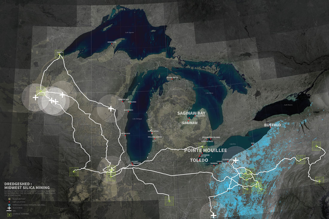
DregdeShed, US by Chris Bennet
Dredging is an excavation process carried out at least partially underwater, with the purpose of gathering up bottom material (sand, silt, sediment) and transporting it elsewhere.[1] In the case of port and harbor dredging, dredged material can seem endless. In the Great Lakes alone, 4 million cubic yards of material are dredged annually from its ports and harbors.[2] In another case of dredging, dredged sand is collected from near shore locations and pumped on shore for beach replenishment due to erosion. Miami, for instance, is currently depleting all of its near shore dependable sand sources creating a ‘sand war,’ positioning for control of a steady sand source to supply its beaches.[3] At its core dredging is a operation of movement, relocation, storage, and repetition. It is subtractive and additive at the same time. Dredging operates in conditions that are always changing by responding to natural and man made landscapes. Processes of dredging are recursive and the great irony of dredging is that dredging contribute to the acceleration of the very forces in which it is intended to counter.[4] DredgeShed seeks to explore and question these juxtapositions. This proposal proposes aerial documentation photography of sand mines, Confined Disposal Facilities (CDF’s), and sand dune mines in the Great Lakes megaregion to gather a comprehensive understanding of the relationships of these three typologies of sites and dimensions that surround dredging.


