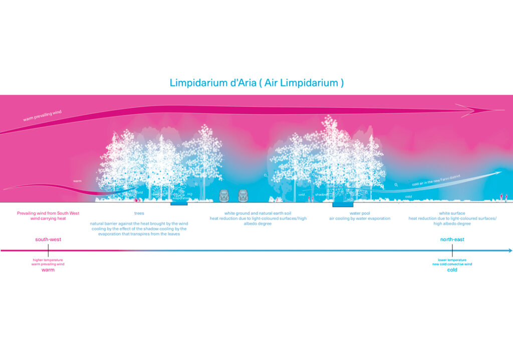
URBAN CONVECTION
In cities, the ground’s low albedo (solar ray reflection ratio) will transform solar rays into heat, creating what are called urban heat islands. One of the best ways to fight these heat islands is to prevent the air from heating up too much due to being still. The city must be ventilated, allow natural winds to pass through, to remove heat from the streets and dissipate the air. It is also possible to artificially create a hot spot (low albedo, little evaporation) and a cold spot (high albedo, high evaporation) which, thanks to their temperature difference, in a phenomenon similar to the sea breeze, will create a movement of air and prevent cities from overheating in summer. Creating a temperature difference between two urban poles sets the air in motion, which also enables breaking up and diluting the concentration of air pollutants in the city (and viruses), to avoid the accumulation of fine particles in streets or squares.
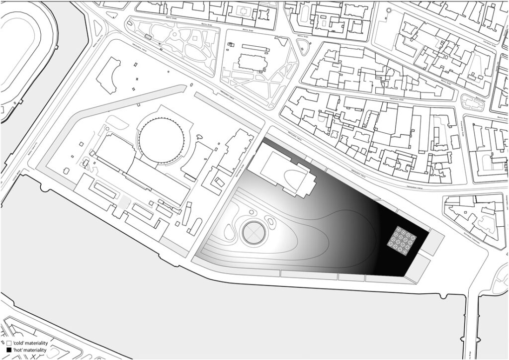
Urban heat island
Because of dark surfaces such as asphalted roads and pavements, and due to the absence of evaporation by plants or plant cover that, by changing from liquid to gas phase lower the temperature, the city overheats in summer. To cool it down, among other things, it must be ventilated, the air must circulate, to dilute the heat by convection, as if fanning it or as if blowing on a hot soup spoon to cool it.
Urban pollution
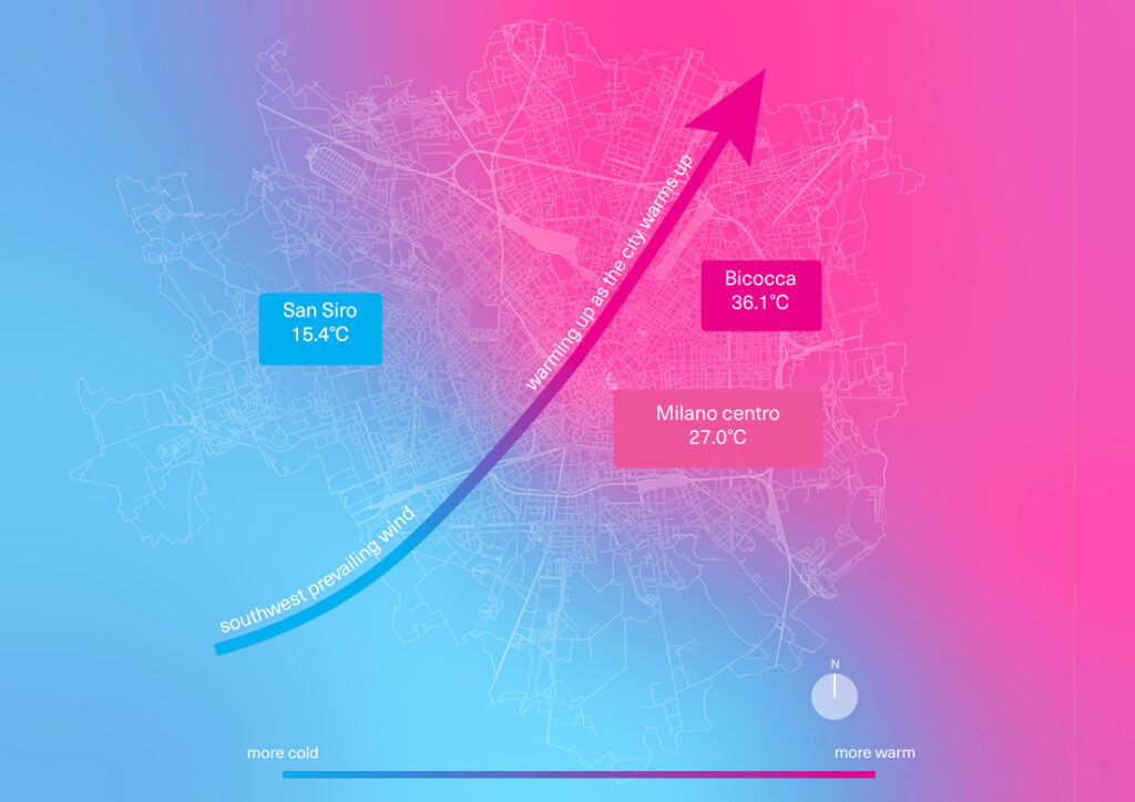
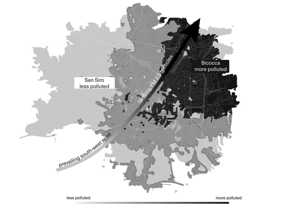
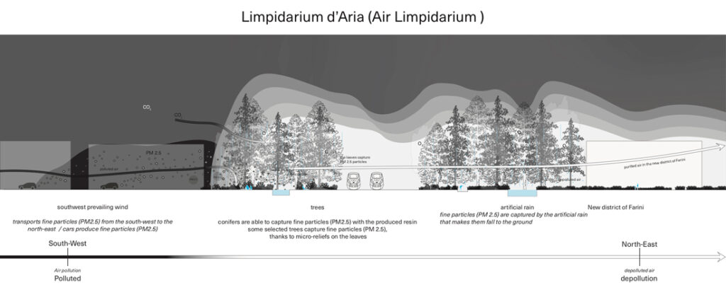
Air pollution in contemporary metropolitan areas, especially (carcinogenic) fine particulate matter PM 2.5 and PM 10, largely given off by combustion engines, is accumulating in cul-de-sacs. It is unequally distributed across the city, with scarce presence where fresh winds arrive (south-west in London, Paris or Milan, for example) and, conversely, accumulating in the north-east, where the wind ends up after having picked up all the pollutants of the city.
Cooling by convection
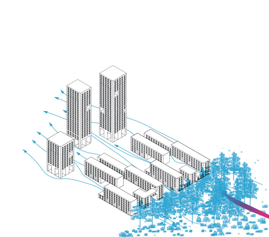
In order to cool urban islets, buildings should preferably be built parallel to the direction of the prevailing wind, allowing it to cross the islet without being halted or interrupted and to carry away the heat accumulated due to the low albedo dark mineral surfaces such as the bitumen of which the streets are made.
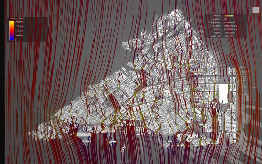
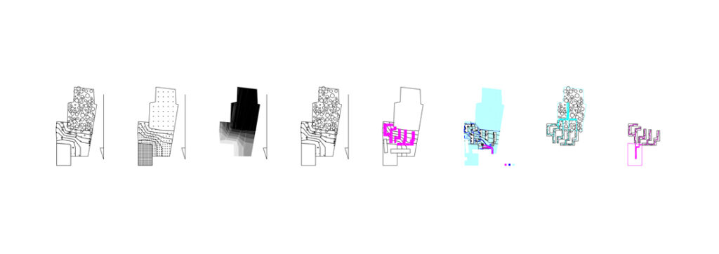
Computer modeling of flows
The new volumes of urban buildings (bottom left) are designed by the winds, allowing them to circulate between buildings and in the streets to remove excessive heat and air pollutants.
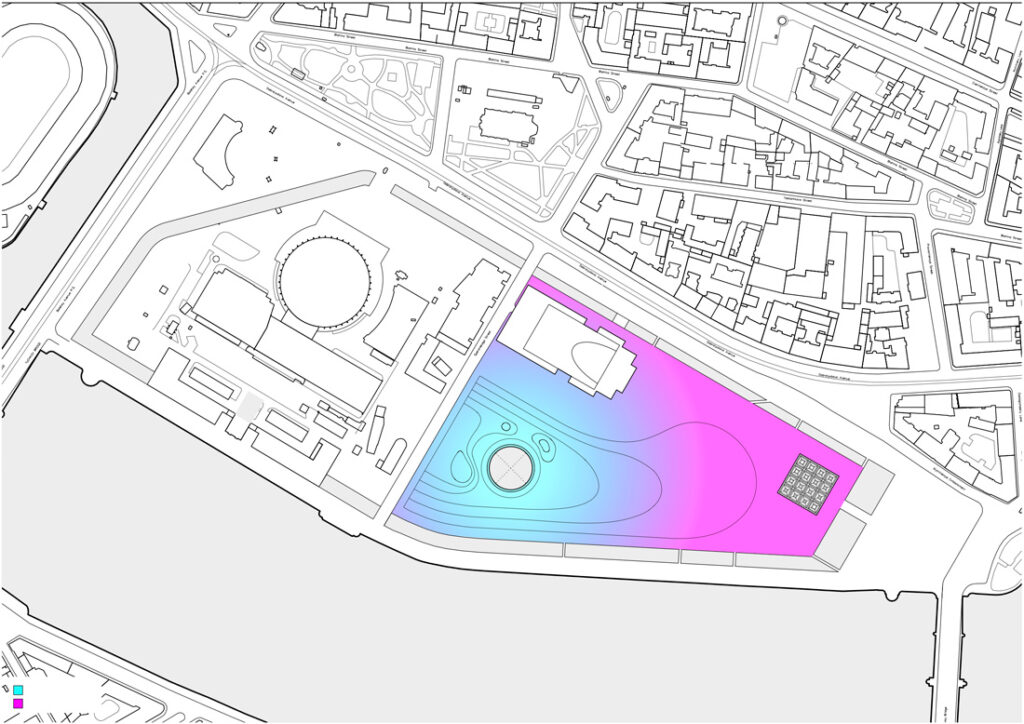
City breeze
By creating a thermodynamic imbalance thanks to a hot pole (built-up mineral masses) and a cold pole (vegetable park), the convective movement of the air is amplified and enables evacuating the heat from the streets by making it rise into the sky.
Building winds
A novel urban planning art may consist of creating city breezes to remove heat and pollution from the city into the sky.
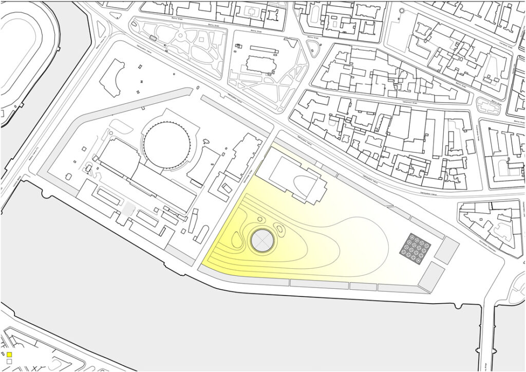
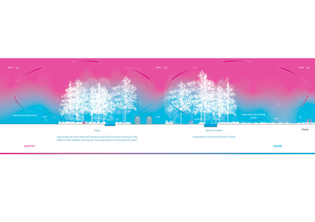
A breeze against pollution
A filtering zone of bushy coniferous trees as well as artificial rain (which causes the floating polluting fine particles to fall to the ground) make it possible to reduce air pollution, and then allow clean air to blow toward the new neighborhoods.
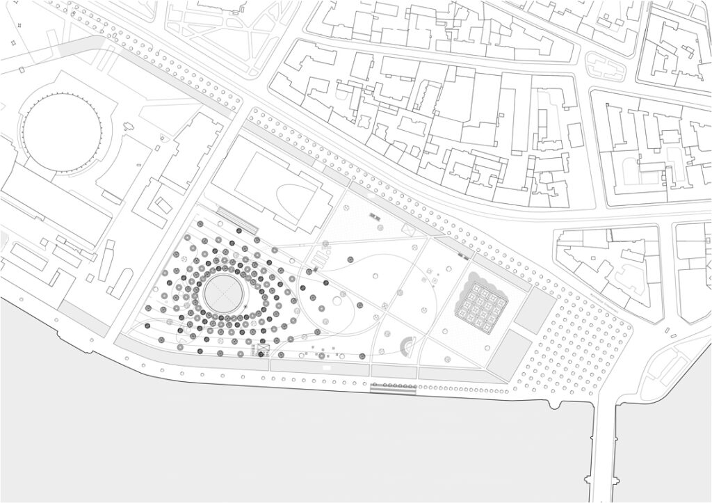
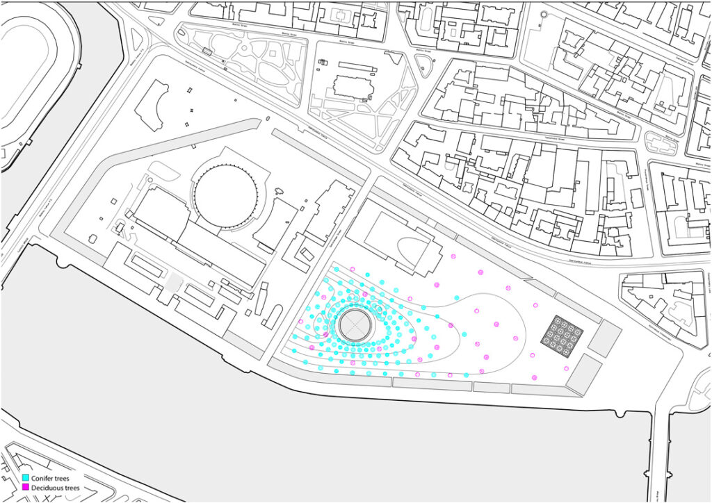
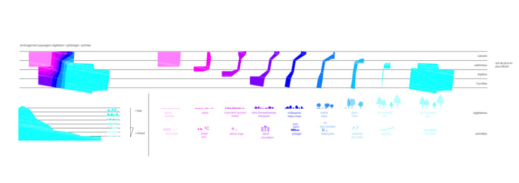
Gradation of urban atmospheres
The urban agenda of this project for a new residential district is to construct two squares at opposite ends of the site and to build betweenthem. The buildings are implemented between these two public spaces.
The corridors of buildings become ventilation ducts augmented to human scale, the ends of which, like nozzles connect to the public squares to draw the ambient air whose thermal quality will have been high at the mineral square to the north-west or lower in the forest to the south-east.
Urban thermal gradation
The district is polarized between two main public squares whose development is based on an initiative to enhance the air, its structuring, where housing is implemented between two poles of air, one hot and one cold. Between these two principal areas, 7 strips of landscape unfold stretching from north to south, which gradually, from west to east, take youfrom the mineral square in the northwest to the forest in the south-east, from hot to cold, from mineral to vegetation, with alternating strips of different geological and plant qualities, ranging from brownfield land, vegetable gardens, shrubs, fruit trees and forest with which uses are associated that take advantage of the landscape qualities and atmospheres of each of the strips: beach games, gardens, sport on mineral surfaces, games, jogging, walks in the meadows, tree houses.
Gradation of landscape atmospheres
The plan for the park establishes a climatic gradation between a cold pole (shady, high albedo, very wooded) suitable for taking shelter in summer, and a warm pole (open, little wooded, low albedo) in which to shelter in winter.