The US-Mexico borderlands can be defined by shifting and intensifying bands of ultraviolet radiation that impact bodies in asymmetrical ways, enact new forms of migration, and condition space and power relations. Operating within this framework, the national security apparatus has become expert at deploying tactical infrastructures that mitigate the impact of ultraviolet radiation on its agents in order to inspect and manage other bodies more efficiently. Border agents deploy, manage, and appropriate shade in the name of state security. While state agents and security space are increasingly protected from impacts of ultraviolet radiation, the borderland public and public space beyond the limits of security space are routinely exposed.
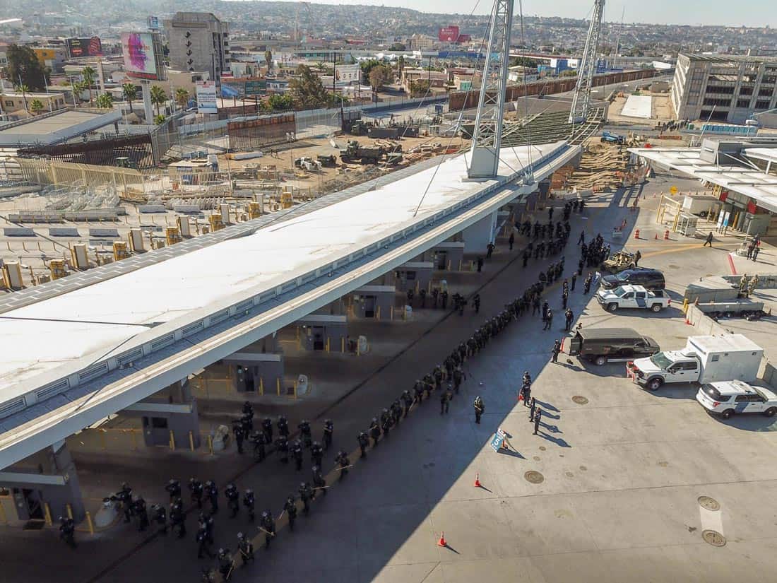
CBP Agents Amass in the Shadow of the San Ysidro Port of Entry (CBP, Public Domain)
Ultraviolet (UV) radiation is a result of the high sun exposure that routinely and relentlessly impacts border cities, landscapes, and populations. Latitudinal parallels are commonly used to approximate the boundaries of shared territories with common UV exposure.[1] But, in the borderland, these east-west transects hold a looser grip over the limits of the ultraviolet frontier. Shared ultraviolet territories appear to bend along the boundary, their geometry complicated by the strong form of the border. Inflected by changes in altitude, topography, and vegetation, maps showing distribution patterns of UV exposure risk in the region tightly parallel the meandering line of the international boundary. These maps position the border as an organizing feature in UV distribution while thickening and blurring the border line into a transnational border zone of shared atmospheric risk.[2]
Borderland UV Exposure Risk: Feb, Mar, Apr (NASA Earth Observatory, Public Domain)
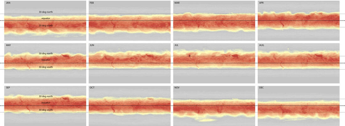
This ultraviolet border is unstable, conditional, ephemeral, volatile. It migrates with changes in solar exposure and atmospheric pollution throughout each day and throughout the year, contorting itself to the geography of the borderland. Climate change is mobilizing the ultraviolet border, expanding territories of ultraviolet radiation exposure risk to the north. The ultraviolet border correlates with a frontline in a widening global ultraviolet exposure gap, in which ultraviolet radiation will asymmetrically impact populations closer to the equator. Studies show that by 2100, UV radiation at tropical latitudes will continue to intensify, while mid- and polar latitudes will see decreasing amounts, exacerbating the inequity of exposure to already-vulnerable regions.[3]
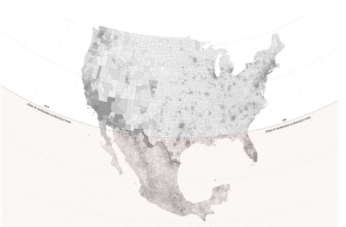
Zone of Increased Ultraviolet Risk; Background Image: US-Mexico International Migration based on US and Mexico Census Data, with dark orange showing percentage of population not born in the area (Courtesy the Authors)
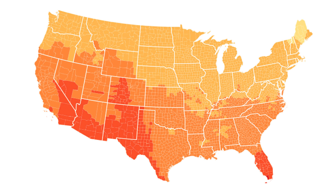
The US-Mexico borderlands fall closely to the 30th parallel north, which delimits a particularly relevant boundary with respect to human health impacts of ultraviolet exposure. According to research supported by the US Environmental Protection Agency (EPA),[4] populations living between 30° north latitude and 30° south latitude will see increased incidences of sunburns over the next thirty years, while populations living outside these boundaries will likely see reduced exposure. The 30th parallel is thus a charged exposure boundary, which happens to bisect the US-Mexico borderland near its geographic center, passing about 100 miles south of the El Paso/Ciudad Juárez metroplex. Roughly half the population of the metroplex region occupies the UV exposure zone of increased risk.
Global UV Index Visualization, with dangerous exposure levels at the center in red, and decreasing risks in yellow and grey. (Courtesy the Authors)
Taking into account the geographic distortions of UV exposure boundaries along the border, it follows that the entire borderland falls within the ultraviolet frontier. UV index maps show consistent exposure similarities throughout the borderland in a thickened band that follows the meandering line of the border, unconstrained by the abstract grid of the parallels, suggesting that the entirety of the borderland is subjected to increased risk.
The ultraviolet frontier is migrating, and with it, populations are newly and asymmetrically exposed. Domestic migration patterns in the US since 1981 show hundreds of thousands of people moving primarily to southern and western states, with the largest number focused on a few southern counties that represent some of the most quickly growing cities in the nation. Texas and California—two border states—saw some of the most in-migration in the last four decades.[5] As the frontier moves north, and as populations from northern latitudes migrate closer to the equator, they enter an unfamiliar ultraviolet regime and are subject to new risks, with higher incidences of melanoma than rates at their origin, along with other adverse health impacts.[6]
In addition to these southward flows, large populations from Central America are migrating northward to the borderland as well, due in part to the effects of climate change and shifts in UV exposure affecting agricultural production and livelihood at lower latitudes. As populations from southern latitudes move north, they face a different set of health challenges. With the reduction in UV exposure, they produce less Vitamin D, and are subject to increases in blood pressure and reduced auto-immune functions.[7] Conversely, migrant workers are more prone to disease due in part to increased UV exposure[8] when working long hours in the outdoors.
The most vulnerable populations in the ultraviolet frontier face devastating impacts. Migrants to Mexico and the US face prolonged sun and heat exposure on their journey north, with heat exposure a leading cause of death. Exposure is a continued threat even within US Customs and Border Protection (CBP) custody. The American Civil Liberties Union (ACLU) has reported the detention of “thousands of migrant families outdoors, without protection from … the sun,” and similar conditions have been widely reported in the press.[9] A Department of Homeland Security (DHS) Office of Inspector General (OIG) report revealed photos of an overcrowded El Paso facility showing dozens of families and individuals waiting for processing exposed in a sun-bathed parking lot, their numbers far exceeding the capacity of the two minimal shade structures provided.[10] Detained migrants in McAllen, denied sufficiently protective cover from the Texas sun while they awaited processing, have been forced to fashion makeshift awnings by stringing together rows of reflective blankets into a military-style tent.[11] The struggle to combat conditions of over-exposure continues beyond the borderland. The United Nations International Organization for Migration (IOM) and the United States Agency for International Development (USAID) are reportedly building sun protection for migrants returning to El Salvador after having been denied asylum.[12]
Shading the Security State
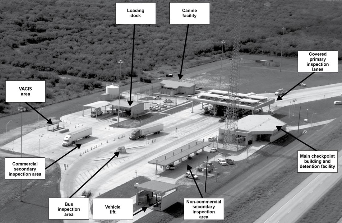
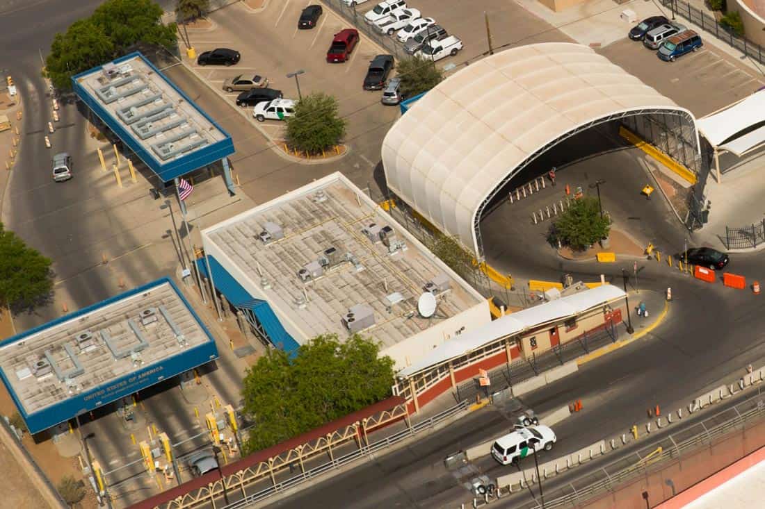
State security forces navigate the irradiated atmosphere of the borderland, brokering power relations by deploying and denying protection from the elements. Shade is at the service of the state, determining who and what is exposed. Covered positions are rare in the desert landscape, but quickly identified and exploited by border agents. Absent any dedicated structures, patrols will appropriate the shade provided by existing infrastructure to locate temporary checkpoints.[13] And where shade is unavailable, the state creates and shapes it to its purposes. Tactical inspection positions are routinely augmented with deployable fabric canopies and tents, extending the capability of security agents to occupy and surveil within the hostile desert environment.
Checkpoint Canopies and Operations (GAO Report 19-534, Public Domain)
Building on these tactical interventions, the federal border security apparatus has developed an appetite for shade in the borderland, and has continued to invest in more permanent, purpose-built structures to extend their cover and strengthen their position in the landscape, resulting in an extensive inventory of shade structures serving the security state. Shade structures at security checkpoints and ports of entry orchestrate a biopolitical choreography, mitigating the impact of solar exposure while facilitating the inspection of bodies and vehicles and smoothing the flow of transnational commerce.
Inspection Canopies, Stanton Street Port of Entry (CBP, Public Domain)
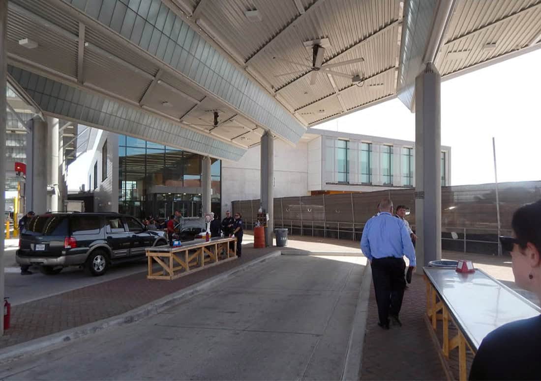
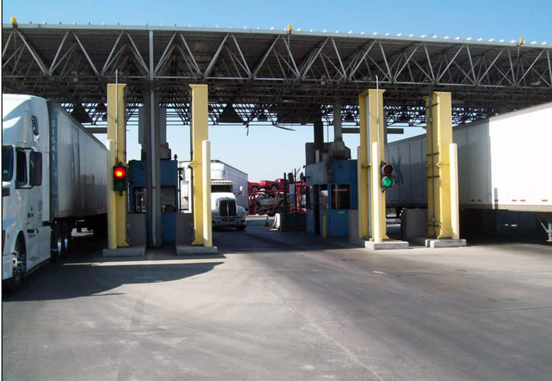
In contrast to the border wall and other vertical barriers which control the territory through rigid partitioning of the ground plane, the shaded space of national security is defined by floating horizontal planes which subtly shift the atmospheric conditions of the ground and support asymmetrical relationships between security forces and the public. Security canopies proliferate throughout the far reaches of the ultraviolet frontier.[14] Canopies cover conditioned and fortified inspection booths for security personnel, as well as open areas for agents to conduct vehicular or pedestrian inspection.[15]
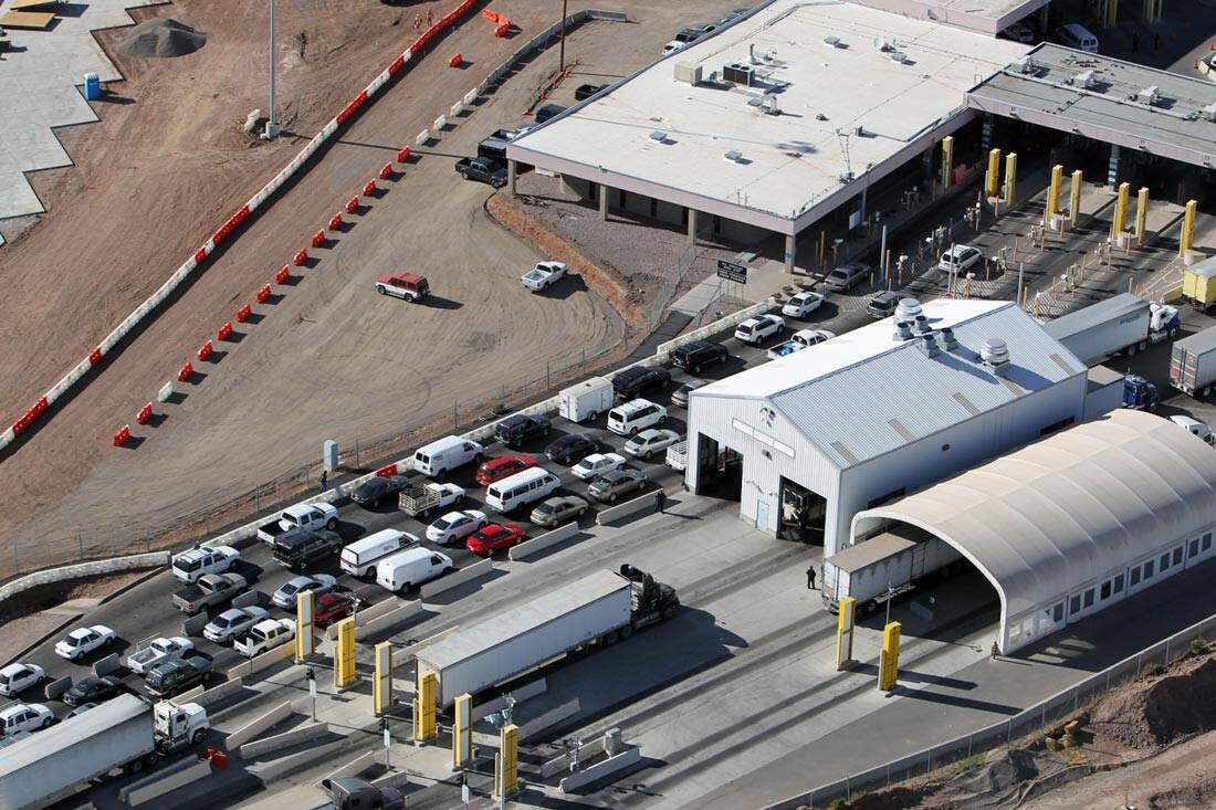
At international crossings and ports of entry, more complex arrangements of canopies orchestrate a series of interrogative spaces, coordinated to assist agents in identifying and isolating individuals and vehicles deemed suspect. From pre-screening areas to primary and secondary inspection areas, the scale and orientation of the canopies shift to facilitate specific types of human, canine, and technologically-enhanced searches.[16] Crossing the shade from one stage of inspection to the next signals a progressively more intense encounter with enforcement.
Security Canopy (GAO Report 19-534, Public Domain)
At a port of entry, shade is not a public amenity, but a national security concern. When screening technologies like license plate readers and radiation monitors are not protected by shade, they can overheat and fail to operate, drawing concern and additional government oversight.[17] The General Services Administration (GSA) publishes guidelines for how to classify and quantify these spaces, noting the canopies “perform the essential function of sheltering inspection-related activities.”[18] While canopies cover critical security functions, they also claim territory for the security state. The coverage of each canopy contributes to the total value and extent of GSA real estate. While uncovered booths are “measured and assigned” in the GSA inventory only to the extent of their walls, canopies are counted as real property based on the coverage of their drip lines, inflating the inventory by counting not only the booths they cover, but all exterior inspection activities shaded below.
GSA Public Buildings Service Design Guidelines specify and articulate the relationship between security and shade. As vehicle inspections at the southern border often face south, “canopies must protect inspectors from sun in their eyes,” with precise calibrations depending on “sun angles and the orientation of the booths.”[19] Additional shading is required below the canopy in west-facing orientations, and architect-engineers are required to conduct sun-angle studies to ensure performance.
Shade structures in the borderland can also conceal and enhance surveillance features. A non-descript canopy in Nogales, Arizona, in 2016 hosted an array of cameras testing next-gen facial recognition software.[20] The tech has since been deployed at Anzalduas, Texas, for a “voluntary biometric processing test” on the public that ran from 2018–2019.[21] The cameras themselves are shaded with a deep hood, and located under an inspection canopy, presumably to improve image capture by reducing effects of glare on vehicle windows.[22]
Security Canopy (GAO Report 19-534, Public Domain)
Emphasis is routinely placed on the ability of shade structures at ports and inspection areas to protect security officers, not the public. Thus, makeshift canopies are meant to “protect [CBP] officers from the elements,” assist with their “temperature regulation,” and are designed to provide “dogs, the handlers, and other agents shelter from the heat.” In early 2018, four structures added to Nogales Port of Entry were lauded for their ability to improve officers’ comfort while nothing that “nothing’s changing for the people that are coming across.”[23]
Canopy space, like security space itself, is seemingly insatiable, expanding as the security complex grows. A “pre-primary canopy” is currently in the works at Calexico, extending inspection coverage further to the edge of the port. Shifting canopies around is common practice. In Laredo, Texas, an eastern vehicular canopy was demolished and a new structure was built at a neighboring bridge in an effort to re-route SENTRI traffic and smooth commuter flows.[24] A similar canopy relocation was in the works in Columbus, New Mexico, in 2017.[25]
Shifts in overhead cover respond in near-real time to shifting needs of security and interstate trade. At the Paso del Norte International Bridge in El Paso, a makeshift canopy was erected beyond the limits of the pedestrian cover. Extending to the international boundary, it protected agents conducting irregular document checks and assisting in the number of “pushbacks” of asylum seekers, effectively denying them entry to the port beyond.[26]
The national security apparatus appropriates shade as needed. In March 2019, the untapped shade below the Paso del Norte International bridge was opportunistically exploited by CBP to set up a makeshift detention processing site, holding an unexpected migrant influx at the border.[27] The makeshift site became semi-permanent, and was in operation for several months before closing.
Compared to the use of shade to facilitate explicit port trade and security functions, the provision of public shade in security space is of secondary concern to the state. Shade is a daily necessity for commuters, and perennial matter of concern for human rights advocates working in the borderland. Border cities, especially in Mexican border towns, “lack a tradition of urban planning,”[28] which leaves pedestrian routes to and from crossings in substantial shade deficits. Areas around ports of entry are especially shade deficient. In 2008, the Border Network for Human Rights identified shade to be among the basic human services lacking at the nation’s land ports.[29] A resident of Presidio, Texas, petitioned to provide additional shade at the Presidio port of entry, as long lines of seasonal travelers were commonly waiting, exposed to the sun for hours.[30] The CBP responded that funds were not available and travelers had other options for places to wait.[31] Government audits routinely assess the need for more shade at crossings, and several sites have had pedestrian shade added over the last decade, including El Paso, Hidalgo, and Columbus, among others. [32] Where shaded pedestrian walkways have been planned and realized at ports of entry, they have largely been limited—targeted interventions to facilitate orderly arrivals, processing, and departure.
An Invisible/Insensible Threat
On the US-Mexico border, there is a contrast between shade surplus in security space and shade deficit in public space. Novel representational techniques can be used to investigate and highlight the unequal UV exposure within and around the borderspace, where inspection infrastructure is prioritized over the protection of the public—or detainees—and where control processes and commerce are facilitated over human care. Given that the impact of irradiation on the human body is invisible, the best way to expose this discrepancy is to rethink how maps and urban space are drawn and render it visible.
Recent scientific findings prove that UV damage does not, as is commonly assumed, correlate to the visible light spectrum and to shade, which contributes to a false sense of security in urban shade. As climate change continues to push the ultraviolet border across the US-Mexico border, local exposure inequalities will only increase. A means of uncovering, representing, and designing for the unseen dangers of irradiated shade is necessary.
The highly securitized El Paso-Ciudad Juárez metroplex is one of the largest binational urban environments in the Western Hemisphere, where physiological effects of solar radiation are relentlessly rendered upon vulnerable populations. The metroplex is host to some of the most-traveled international pedestrian bridges between the US and Mexico, connecting the adjacent downtown areas of the sister cities. Within the increasingly austere and securitized public spaces of the border zone, pedestrians are subjected to high levels of solar radiation on daily cross-border commutes. Shade, here more than anywhere, in a desert city subject to unparalleled geopolitical and environmental stresses, is an “index of inequality.”[33] Central American migrants, asylum seekers, and detainees have been kept under makeshift shade structures beneath bridges for days at a time and exposed to UV damage while waiting to cross the border.
Atmospheric scattering of UV wavelengths allows UV to enter even shaded conditions, rendering bodies in them susceptible to damage. Directional scattering at high angles of incidence, as well as multi-directional scattering at low angles, bounces ultraviolet waves throughout the borderland. The El Paso-Ciudad Juárez metroplex is highly susceptible to this kind of atmospheric scattering due to the high density of airborne particulate matter in the atmosphere from anthropogenic sources and airborne dust from the surrounding Chihuahuan Desert. The dust scatter creates diffuse conditions of sunlight and radiation. Even in shaded areas, “a large fraction of the diffuse UV radiation is always present.”[34] As climate change continues to cause desertification and climate migration, El Paso and Ciudad Juárez will continue to urbanize, further increasing levels of airborne particulate matter and pollutants.
Existing techniques to capture the effects of UV radiation on populations vary widely in scale and leave blind spots regarding its impact. The US Department of Agriculture (USDA) has run the UV-B Monitoring and Research Program (UVMRP) since 1992, using thirty-seven “climatologic” sites and three “long-term research sites.”[35] It monitors large areas and is geared mostly towards agricultural science research purposes. Researchers in the network study “crops, plants, animals, and ecosystems” with an eye toward how changing atmospheric radiation conditions drive changes in “terrestrial ecosystems.” Sensor locations throughout the country are deployed in order to be spatially diverse, and while they are mostly agricultural, “several urban sites are [also] included.”[36]
The UVMRP system is based on “North American ecoregions (ecologically and geographically defined areas).”[37] The Chihuahuan Desert Province is designated as USDA Eco Region 321, and has UVMRP stations in El Paso, Las Cruces (Jornada Experimental Range), and Panther Junction (K-Bar and Castolon Sites at Big Bend National Park). A few experimental sites have been deployed as part of the network internationally, including several sites in Mexico City at Universidad Tecnológica de Tecámac, Universidad Nacional Autónoma de México, and Instituto Mexicao del Petróleo. However, the El Paso-Ciudad Juárez region is under-represented in national UV index maps, which represent stations in Dallas and Houston, but none in the border region.[38] The region is typically mapped as having a higher UV index than the other Texas cities (despite sharing their latitudes), and shares more with the Albuquerque, New Mexico station to the north. The degree of natural shade and density of built environment—which contributes to shade—is much lower here than at equivalent latitudes, suggesting greater environmental risk in the border cities.
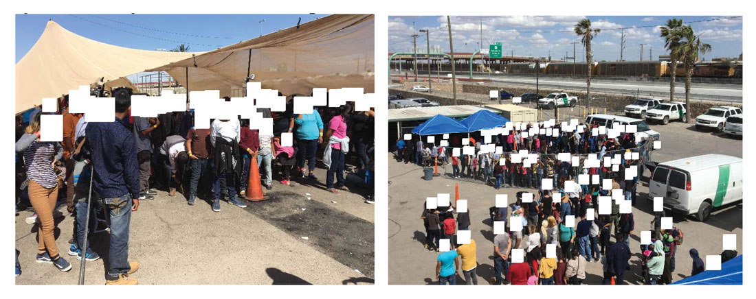
Migrant Processing Overflowing Shade (DHS/OIG, Public Domain)
Mapping Overexposure
Operating at the periphery of information, and contending with layers of jurisdictional silos, over the past year we have explored techniques to image and imagine UV radiation at various scales, from the territory to the city, in order to develop visualization and design tools that engage conditions of irradiated shade in the borderland. Additionally, to mitigate the limited availability of corresponding and correlated data across the national divide, the project uses remote sensing to bridge the data divide, albeit at coarse geospatial scales. By developing a land-use classification index, we can better understand the location of urbanized development and emission sources that contribute to atmospheric scatter. Using a false color image, we can further discern and catalog natural shade, vegetation, and urbanized land. Satellite images are used to measure the impact of irradiation to produce a land surface temperature map These images show cool mountain peaks and intense heat of the urban heat island within which populations seek shade. More specifically, the public space of the international border suffers from a shade deficit, especially near the international crossings, where urban density, building heights, and amount of street trees are low, despite the high volume of pedestrian traffic through the ports each day.
Closer inspection of the land surface temperature map reveals a number of hotspots that highlight locations where shade inequality is most extreme, with intense heat around the pedestrian approaches to the international bridges and neighborhoods in and around the border. The latter locations are where many border-crossers wait or meet their relatives. The approach to the Paso del Norte International Bridge, an area that sees high volumes of pedestrian traffic throughout the day, is a clear hotspot. Cross-border commuters face long, sun-exposed walks from the port of entry to public transit facilities blocks away. Taxi and private car pick up locations are south-facing without street trees, awnings, or canopies. In 2010, the Center for International Intelligent Transportation Research identified the need for a canopy connecting the covered bridge with these drop-offs, though the proposal has never been realized.[39] Pedestrian travel paths from ports of entry to denser urban fabric traverse parking lots and other port facilities, attenuating travel time and heat exposure. Some efforts including a plaza with light shade trees have been developed around the Stanton Street port of entry by the City of El Paso in 2012.
Re-presenting the Dangers of Shade
While increased shade in public spaces has been advocated as a strategy for “mitigation [of] climate change,” it is not a panacea to the threat.[40] Even in apparent shade, the body is still exposed to harmful ambient or scattered UVB radiation. This indirect radiation exposure is dependent on the amount of sky visible from the position of the observer.[41] Researchers have found that the overall size of a shade structure, as well as the design of openings along sides, can greatly impact the UPF (UV protection factor), leading some structures to provide inadequate protection.[42] Shade, therefore, is not the discrete condition captured in ubiquitous urban and architectural “sun” and “shadow studies,” which focus only on optical qualities of light and shadow; flattening the three-dimensional nature of radiation exposure and the ultraviolet spectrum. Safe shade is contingent on the nuances of the surrounding built environment, and designers must observe and respond to a wider context than current representational tools allow.
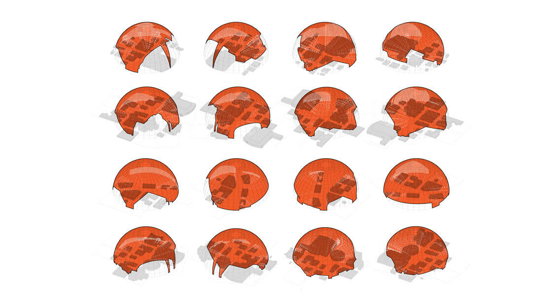
Standard approaches to representing solar exposure need to be turned inside-out to image the environment from the perspective of UV radiation. Drawing on evidence that the amount of UV radiation entering a shaded condition is directly proportional to the amount of visible sky seen from the shade, we have developed a technique for spherical projection which takes any point in the city, scans the surrounding cityscape, and masks any obstructions on a sky dome. The resultant drawings give a computable surface that yields not only a graphic representation of the areas of potential vulnerability, but other metrics as well, including the percentage of sky cover and other orientation vectors. This projection can be unrolled into a panorama-style drawing to better understand how the surrounding city offers protection against UV exposure, and to optimize ways in which to mask the sky dome, which becomes the representation of the optimized form of UVB protection.
This set of tools is just the beginning of developing an ability to address the biopolitics enmeshed in UV exposure and the provision of shade in the border region. While the federal government and CBP focus investment in shade structures that solely protect their agents and security equipment, the public spaces of migration and cross-border flows are increasingly exposed to high levels of UV radiation, leaving the borderland public on a dangerously irradiated ground.