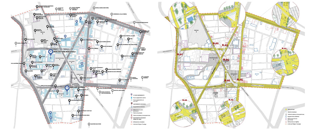
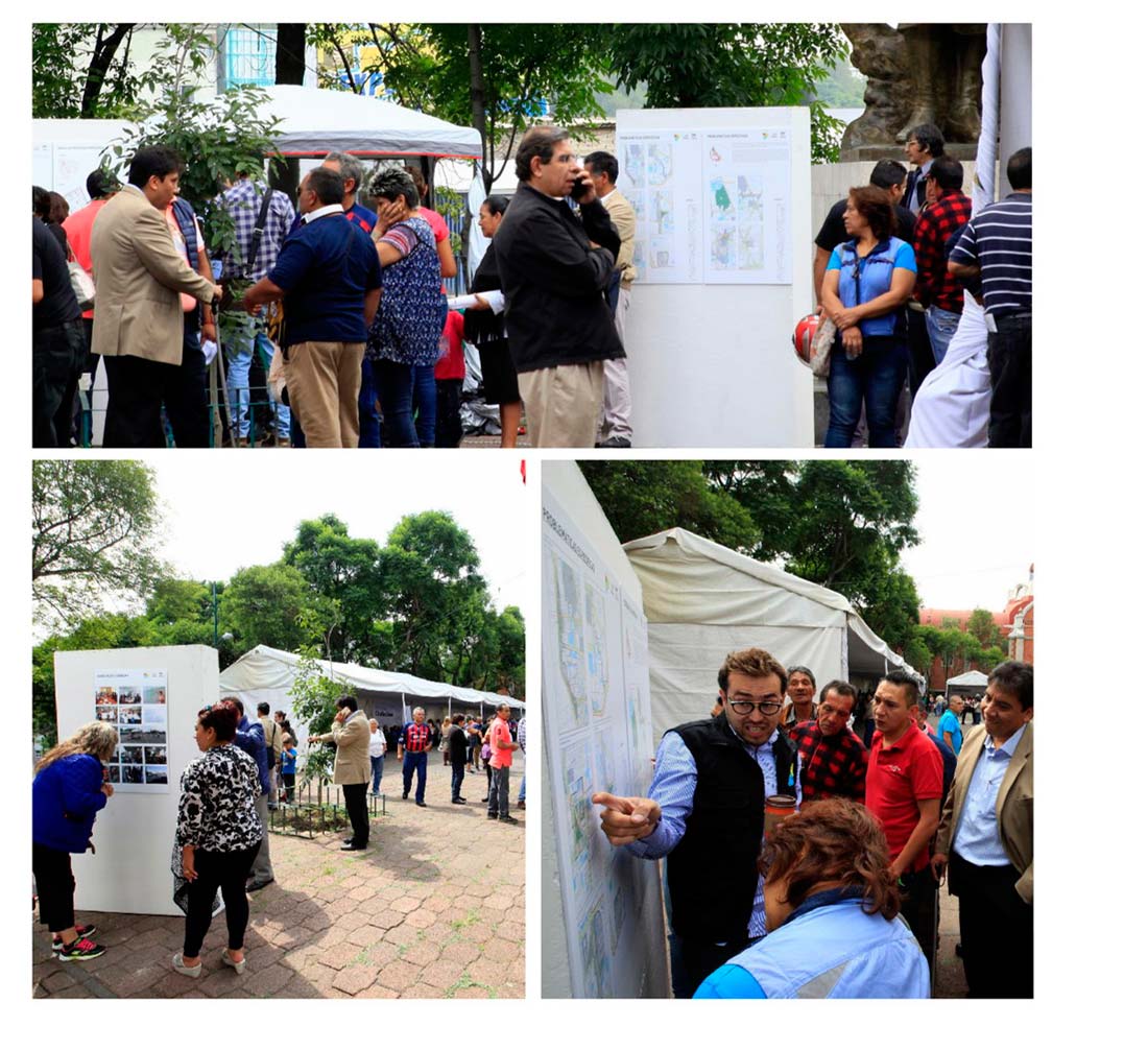
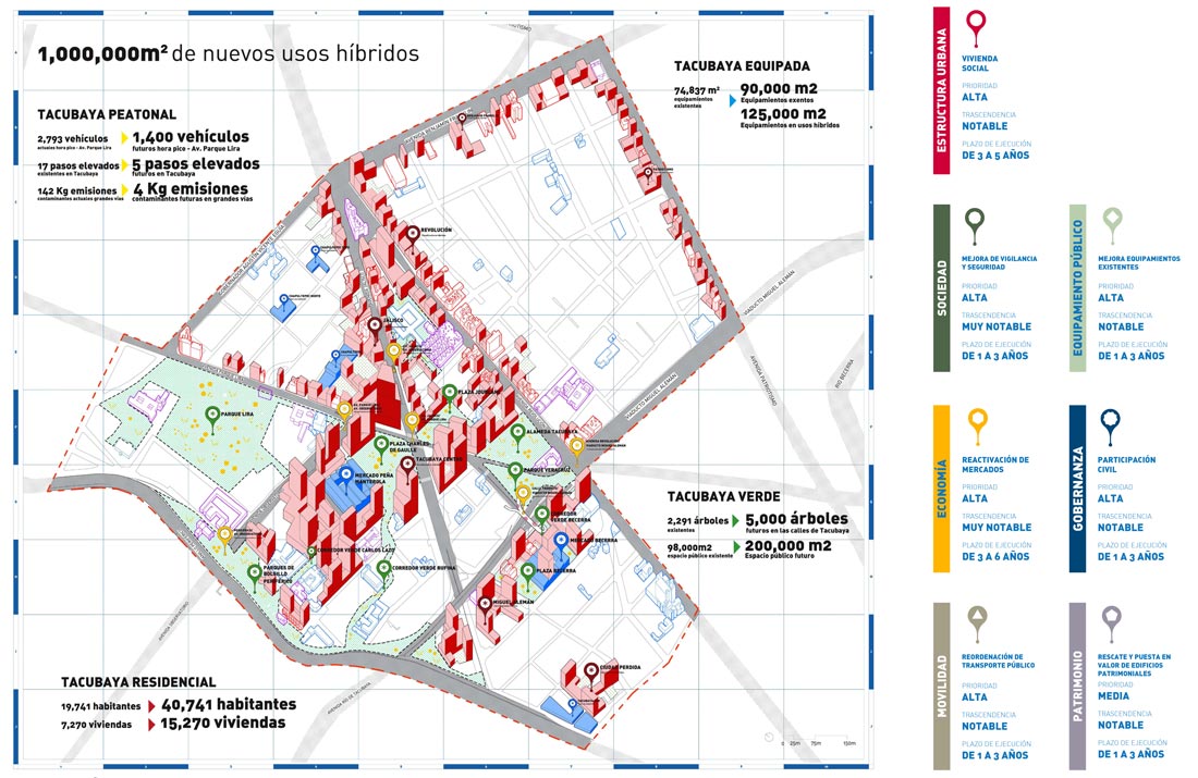
The Tacubaya Strategic Plan is developed in the area called “Polígono Parcial Tacubaya”, located on the south-east side of the Miguel Hidalgo delegation with an approximate area of 142 ha. Like any Strategic Plan, it also seeks to commit to a city model and demonstrate that the proposed actions refer back to a unitary framework that considers the city as a set of social, economic, cultural and urban equations, all affected by different variables such as the quality of public space, residential balance, sustainable mobility, self-autonomous infrastructures and services, added value of the patrimony, and governance adapted to the intentions expressed by the document. But there is more, because none of this will make sense if an essential voice is not given to the neighbors and social groups that meet in the work area: residents, market owners, public transport professionals, street sellers, etc. who have actively participated in the diagnostic and proposal processes of the strategic plan. The ultimate goal is the complete, coherent and cohesive re-qualification of a fragment of a city with its own personality, both before and after, which the plan aims to reinforce.
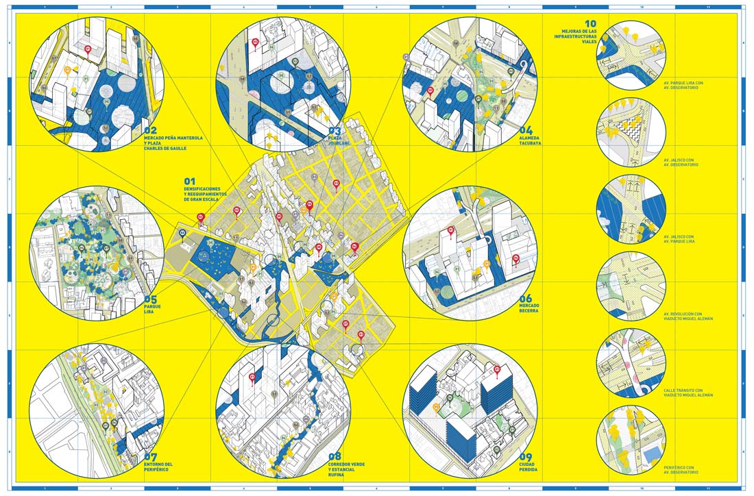
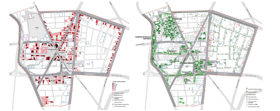
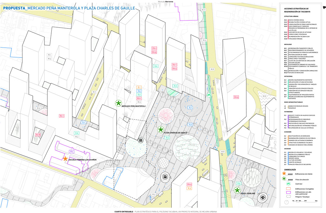
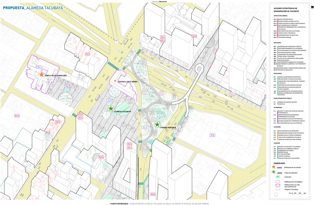
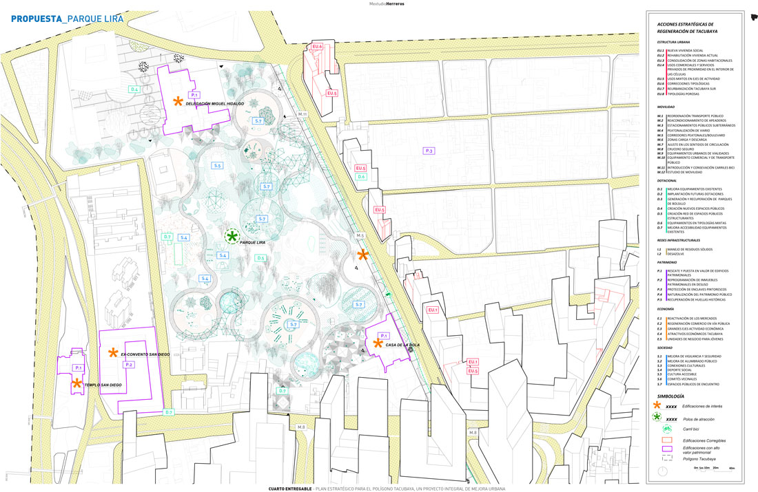
The Tacubaya Strategic Plan is therefore the road map that guides these transformations and, for that reason, it provides a chapter called ACTIONS that are proposed for the short, medium and long term. Although these actions are likely to develop independently in response to economic opportunities and availability, a coherence between them is attempted through their grouping into eight scenarios, which will be the new centers for collective life in the new Tacubaya. Each of them is understood as an ambitious project encompassing architecture, landscape, infrastructures and equipment whose realization we consider essential to mobilize the collective desires of a community that wants the best for its city.
These scenarios or sets of actions are the following:
– Lira Park
– Peña Manterola’s Market and Charles De Gaulle Square
– Joublanc Square
– Entorno del Periférico
– Green Corridor and Estancial Rufina
– Alameda Tacubaya
– Becerra’s Market
– Ciudad Perdida
These sets of actions are supported by two processes of extraordinary importance for the area:
The first reflects the position of the STRATEGIC PLAN vis-a-vis the System of Action for Cooperation of the Tacubaya Zone: the SAC TACUBAYA. Its premises, dimensions and basic principles, issued by the Ministry of Urban Development and Housing, are given by a process prior to the writing of STRATEGIC PLAN. Given this background, the Strategic Plan is bound to visualize the resulting city and propose the appropriate corrections within the limitations of the instruments at our disposal.
The second is essential and must be programmed: a reconsideration of the problems generated by an abundance of road infrastructure in the industrial area. This effort demands an ambitious redefinition of the road junctions that currently generate congestion points and segregate the city, with an eye to making mobility impossible for pedestrians and bike riders.