Recent examples of urban expansion in Melbourne’s northern growth corridor have cleared extensive areas of native grasslands despite that temperate grasslands are the most threatened ecosystem in Australia.[1] The area is characterised by large scale areas of plains grasslands and grassy woodlands, interspersed with agricultural land and volcanic hills from the top of Craigieburn to the south edge of Wallan, along Merri Creek north catchment area. This unbuilt project proposes a visionary alternative to low dense housing estates that are laid across the landscape of this area specifically,[2] and generally also found in peri-urban development sites on the fringe of Australian cities. It explores the possibility of development coexisting as part of a healthy ecosystem, integrating the new built spaces to a shared public ‘grassland common’ that is kept free from new footprint.
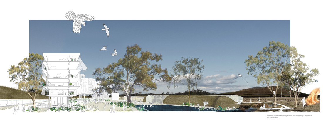
Section drawing of filament development backing onto the road and facing open space.
Development is often seen as incompatible with the natural environment which is usually cleared, flattened and destroyed during the development process. A policy called ‘offsetting’ allows for the conservation of another similar area of vegetation as a trade off for the one you want to clear and is often used to justify the clearing of land on our urban fringes of metropolitan areas as well as more remote bushland for agriculture.
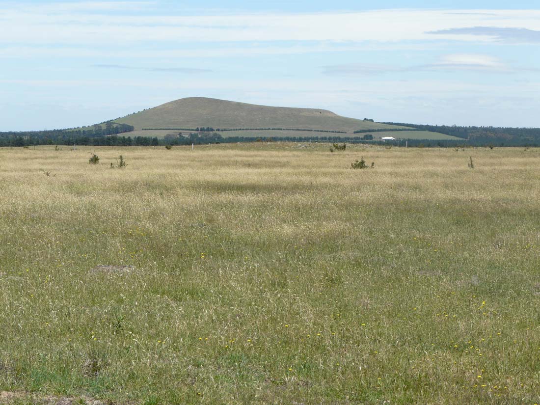
Bald Hill from the North © Brian Bainbridge
Principles explored in the design were: working with the ecological foundations of the site; recognition of natural systems and processes as primary conditioning factors of urban/architectural/landscape/infrastructural design; reduction of urban sprawl and consolidation of the urban footprint within contained areas that are inclusive of all infrastructural and ‘hard’ urban services to areas along existing main arteries; and cross-programming.
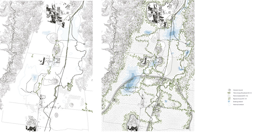
Historical and current vegetation mapping reveals a unique opportunity for the site to enhance ecological connectivity between important areas in the east and west. At a local scale, remnant patches of grasslands and grassy woodlands can be connected through habitat restoration, while more broadly, the site may also provide a green corridor between Kinglake and Mount Macedon, as Merri Creek provides an existing green connection between the established northern suburbs of Melbourne and the Great Dividing Range to the north.
The area is home to numerous native species, including the threatened Growling Grass Frog and iconic River Red Gum (Eucalyptus camaldulensis). The ecological values of the site are addressed by applying principles described as Biodiversity Sensitive Urban Design which aim to create urban environments that are a net positive for biodiversity, while also meeting needs of development.[3] Large, connected areas of plains grassland and plains grassy woodland provide important habitat for the Golden Sun Moth and Striped Legless Lizard, which are nationally threatened species. A series of well connected wetlands and large buffer zones between the Merri Creek and built areas will benefit the Growling Grass Frog and other endemic fauna species.
The dispersal of native species is facilitated by mitigating major barriers to movement, such as roads, in natural areas, and connecting high value remnants to the east and west. The minimisation of disturbance is achieved by the concentration of the built form and reduced noise from less reliance on roads. The minimal footprint also reduces the amount of runoff from the site, while the compact design of the built form accommodates the need for fire in the landscape facilitating natural processes.
Existing territorial plan showing sites ecology. / Proposed.
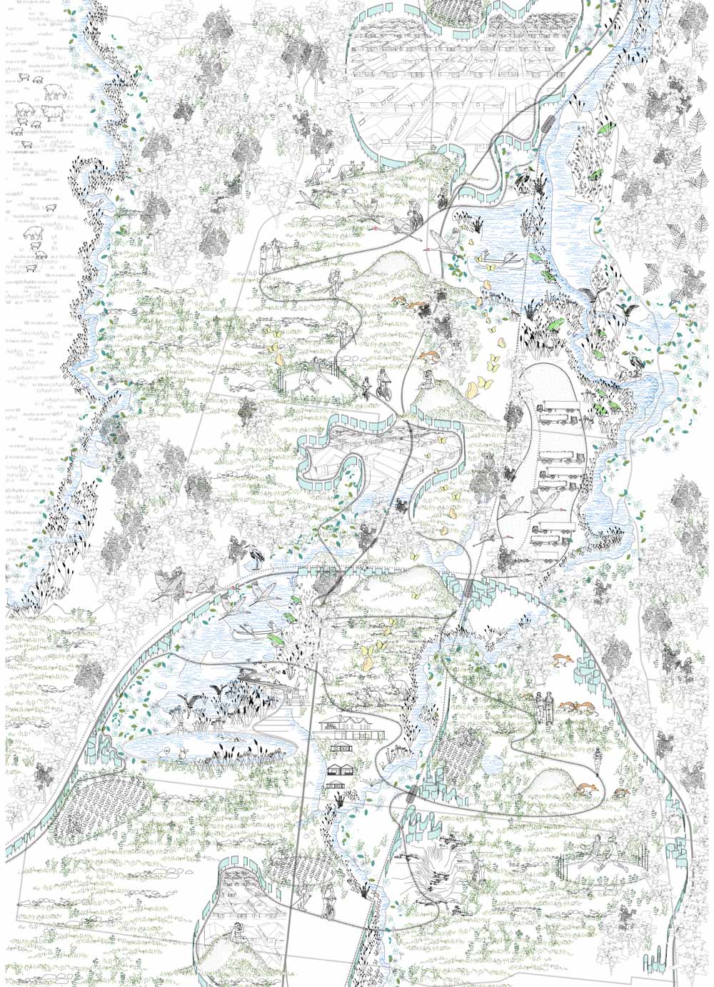
Imagined inhabitation.
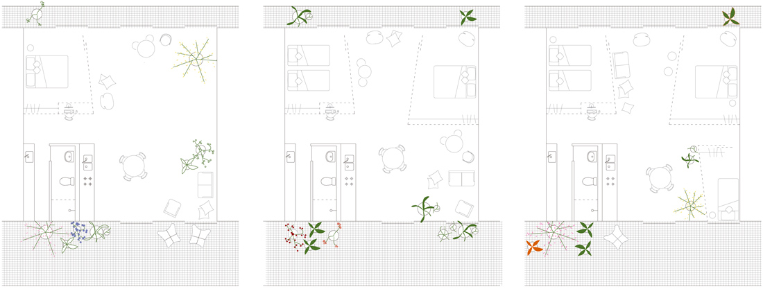
The urban and architectural resolutions of the approach are based on the following principles: new built volumes as ‘filaments’ along existing and/or planned infrastructures, benefiting from adjacency to services and circulation, as well as minimising and containing new footprint, with a narrow cross-section and raised from the ground; vegetated berms accommodating services – pipelines, ducts, private carparks – and buffering residential buildings from highway; new built semi-public areas relating to the public ‘grassland common’ by buffering, and yet embracing it rather than spreading into it, informed by a mix of integrated programs, from residential to work and community areas including spaces for socialisation, entertainment, commercial, educational, sport, institutional activities and green house farming; flexibility in apartment layout to enable space articulation and potential growth in stages within the original footprint – apartments can shift over time from one to two and three bedrooms.
Floor plan of filament hosing development showing internal modifications.
In determining development objectives for the site, guidance was taken from research reports at RMIT, which suggest that infill development in Melbourne’s existing suburbs could accommodated 41% of the projected growth area dwelling targets.[4] Approximately 20,000 new dwellings are accommodated in the urban filaments of this proposal – higher yield could be achieved by increasing density at key points along the filaments, such as service and transport hubs.